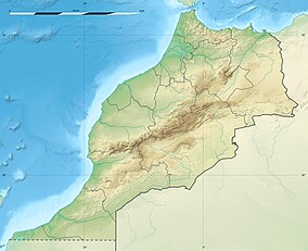
M'Goun Conservation Area
| M'Goun Conservation Area | |
|---|---|
| Location | Azilal Province, Morocco |
| Coordinates | 31°58′1″N 6°34′10″W / 31.96694°N 6.56944°W |
| Area | 5,730 km2 (2,210 sq mi) |
The M'Goun Conservation Area (Berber languages: ⵎⴳⵓⵏ, Arabic: مكون) is a protected area and UNESCO Global Geopark in the Atlas Mountains of central Morocco.[1]
Sites
The conservation area includes the following sites.[2]
- Bin el Ouidane Dam
- Geopark Museum in Azilal
- Imi-n-Ifri Formation
- Ouzoud Falls
- Zaouiat Ahansal
References
- ^ "M'Goun UNESCO Global Geopark". UNESCO. January 2017. Retrieved 4 April 2020.
- ^ "M'Goun Geopark". GM-Soft. January 2019. Retrieved 4 April 2020.
