Drellingore
Human settlement in England
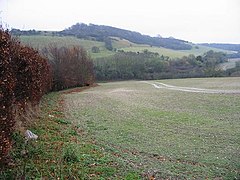
Drellingore is a village in South East Kent, England.[1] It lies in the Alkham Valley, an area of outstanding natural beauty between Folkestone and Dover. Although the Alkham Valley is a dry valley most of the surrounding land forms a water catchment area. Water is extracted from the chalk aquifer for use in the Dover to Folkestone area of Kent. The population is included in the civil parish of Aylesham.
| Drellingore | |
|---|---|
 View across the Alkham Valley, near Drellingore | |
Location within Kent | |
| OS grid reference | TR239410 |
| District | |
| Shire county | |
| Region | |
| Country | England |
| Sovereign state | United Kingdom |
| Post town | Dover |
| Postcode district | CT15 |
| Dialling code | 01303 |
| Police | Kent |
| Fire | Kent |
| Ambulance | South East Coast |
| UK Parliament | |
References
- ^ Ordnance Survey: Landranger map sheet 179 Canterbury & East Kent (Dover & Margate) (Map). Ordnance Survey. 2013. ISBN 9780319228784.
