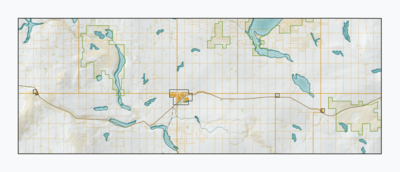
Module:Location map/data/CAN SK Kindersley
| name | Kindersley No. 290 | |||
|---|---|---|---|---|
| border coordinates | ||||
| 51.654942829751 | ||||
| -109.71691707856 | ←↕→ | -108.47907179731 | ||
| 51.322942456805 | ||||
| map center | 51°29′20″N 109°05′53″W / 51.488942643278°N 109.09799443793°W | |||
| image | CAN SK Kindersley map 2021.png
| |||

| ||||
Module:Location map/data/CAN SK Kindersley is a location map definition used to overlay markers and labels on an equirectangular projection map of Kindersley No. 290. The markers are placed by latitude and longitude coordinates on the default map or a similar map image.
Usage
These definitions are used by the following templates when invoked with parameter "CAN SK Kindersley":
{{Location map|CAN SK Kindersley |...}}{{Location map many|CAN SK Kindersley |...}}{{Location map+|CAN SK Kindersley |...}}{{Location map~|CAN SK Kindersley |...}}
Map definition
name = Kindersley No. 290- Name used in the default map caption
image = CAN SK Kindersley map 2021.png- The default map image, without "Image:" or "File:"
top = 51.654942829751- Latitude at top edge of map, in decimal degrees
bottom = 51.322942456805- Latitude at bottom edge of map, in decimal degrees
left = -109.71691707856- Longitude at left edge of map, in decimal degrees
right = -108.47907179731- Longitude at right edge of map, in decimal degrees
Precision
Longitude: from West to East this map definition covers 1.2378 degrees.
- At an image width of 200 pixels, that is 0.0062 degrees per pixel.
- At an image width of 1000 pixels, that is 0.0012 degrees per pixel.
Latitude: from North to South this map definition covers 0.332 degrees.
- At an image height of 200 pixels, that is 0.0017 degrees per pixel.
- At an image height of 1000 pixels, that is 0.0003 degrees per pixel.
See also
Location map templates
- Template:Location map, to display one mark and label using latitude and longitude
- Template:Location map many, to display up to nine marks and labels
- Template:Location map+, to display an unlimited number of marks and labels
Creating new map definitions
return {
	name = 'Kindersley No. 290',
    top = 51.654942829751114,
    bottom = 51.32294245680457,
    left = -109.71691707855942,
    right = -108.47907179730848,
    image = 'CAN SK Kindersley map 2021.png',
}