Gadfa
Human settlement in Wales
This article needs additional citations for verification. (October 2019) |
Gadfa is a hamlet in the community of Llaneilian, Anglesey, Wales, which is 140 miles (225.3 km) from Cardiff and 218.8 miles (352.1 km) from London.
| Gadfa | |
|---|---|
 An access road that runs west from the A5025 to Penterfyn-Gadfa. | |
 Gadfa Location within Anglesey | |
| OS grid reference | SH 4607 8985 |
| • Cardiff | 140 mi (230 km) |
| • London | 218.8 mi (352.1 km) |
| Community | |
| Principal area | |
| Country | Wales |
| Sovereign state | United Kingdom |
| Post town | Penysarn |
| Police | North Wales |
| Fire | North Wales |
| Ambulance | Welsh |
| UK Parliament | |
| Senedd Cymru – Welsh Parliament | |
The dispersed settlement has a scatter of buildings mainly along and to the west of the A5025, with a smaller number on the eastern side of the road.[1]
See also
<mapframe width="300" height="345" zoom="12" longitude="-4.3015" latitude="53.391" mapstyle="osm" frameless="true">[
]</mapframe>


2km
1.2miles
1.2miles
Ynys
Dulas
Dulas
Lligwy Bay
R H O S Y B O L
L L A N E I L I A N
Church of
St Gwenllwyfo
St Gwenllwyfo
Old St Gwenllwyfo
(remains)
(remains)
Church of
St Eilian
St Eilian
Nebo
Penysarn
Llaneilian
Amlwch
City Dulas
Traeth Dulas
Gadfa
Mynydd
Eilian
Eilian
Porth Eilian
Pengorffwysfa
Point Lynas
Lighthouse
Lighthouse
<maplink zoom="13" class="no-icon" frameless="1" latitude="53.391" longitude="-4.3015" text="'"`UNIQ--templatestyles-00000043-QINU`"'<span class="rt-commentedText tooltip tooltip-dotted " title="'"`UNIQ--nowiki-00000045-QINU`"'"> </span>">
[
{"type": "FeatureCollection",
"features": [
{ "type": "Feature",
  "properties": {
   "title": "Point Lynas Lighthouse",
   "description": "  53.4159,-4.2896",
   "marker-symbol": "-number-F5339143015532717534159", "marker-size": "medium", "marker-color": "#AA1205" },
  "geometry": {"type": "Point", "coordinates": [-4.2896,53.4159] }
}
53.4159,-4.2896",
"marker-symbol": "-number-F5339143015532717534159", "marker-size": "medium", "marker-color": "#AA1205" },
"geometry": {"type": "Point", "coordinates": [-4.2896,53.4159] }
}

, { "type": "Feature",
  "properties": {
   "title": "Pengorffwysfa",
   "description": "  53.403,-4.309",
   "marker-symbol": "-number-F5339143015532717534159", "marker-size": "medium", "marker-color": "#AA1205" },
  "geometry": {"type": "Point", "coordinates": [-4.309,53.403] }
}
53.403,-4.309",
"marker-symbol": "-number-F5339143015532717534159", "marker-size": "medium", "marker-color": "#AA1205" },
"geometry": {"type": "Point", "coordinates": [-4.309,53.403] }
}

, { "type": "Feature",
  "properties": {
   "title": "Porth Eilian",
   "description": "  53.4122,-4.2904",
   "marker-symbol": "-number-F5339143015532717534159", "marker-size": "medium", "marker-color": "#AA1205" },
  "geometry": {"type": "Point", "coordinates": [-4.2904,53.4122] }
}
53.4122,-4.2904",
"marker-symbol": "-number-F5339143015532717534159", "marker-size": "medium", "marker-color": "#AA1205" },
"geometry": {"type": "Point", "coordinates": [-4.2904,53.4122] }
}

, { "type": "Feature",
  "properties": {
   "title": "Mynydd Eilian",
   "description": "  53.4000,-4.2988",
   "marker-symbol": "-number-F5339143015532717534159", "marker-size": "medium", "marker-color": "#AA1205" },
  "geometry": {"type": "Point", "coordinates": [-4.2988,53.4000] }
}
53.4000,-4.2988",
"marker-symbol": "-number-F5339143015532717534159", "marker-size": "medium", "marker-color": "#AA1205" },
"geometry": {"type": "Point", "coordinates": [-4.2988,53.4000] }
}

, { "type": "Feature",
  "properties": {
   "title": "Gadfa",
   "description": " Roadside houses in the hamlet of Gadfa. 53.38364,-4.314639",
   "marker-symbol": "-number-F5339143015532717534159", "marker-size": "medium", "marker-color": "#AA1205" },
  "geometry": {"type": "Point", "coordinates": [-4.314639,53.38364] }
}
Roadside houses in the hamlet of Gadfa. 53.38364,-4.314639",
"marker-symbol": "-number-F5339143015532717534159", "marker-size": "medium", "marker-color": "#AA1205" },
"geometry": {"type": "Point", "coordinates": [-4.314639,53.38364] }
}

, { "type": "Feature",
  "properties": {
   "title": "Traeth Dulas (Dulas Beach)",
   "description": " 53.3664,-4.2904",
   "marker-symbol": "-number-F5339143015532717534159", "marker-size": "medium", "marker-color": "#AA1205" },
  "geometry": {"type": "Point", "coordinates": [-4.2904,53.3664] }
}
, { "type": "Feature",
  "properties": {
   "title": "Church of St Eilian",
   "description": "  53.4107,-4.3037",
   "marker-symbol": "-number-F5339143015532717534159", "marker-size": "medium", "marker-color": "#AA1205" },
  "geometry": {"type": "Point", "coordinates": [-4.3037,53.4107] }
}
53.4107,-4.3037",
"marker-symbol": "-number-F5339143015532717534159", "marker-size": "medium", "marker-color": "#AA1205" },
"geometry": {"type": "Point", "coordinates": [-4.3037,53.4107] }
}

, { "type": "Feature",
  "properties": {
   "title": "Old Church of St Gwenllwyfo, Llanwenllwyfo.",
   "description": "  53.385787,-4.278499",
   "marker-symbol": "-number-F5339143015532717534159", "marker-size": "medium", "marker-color": "#AA1205" },
  "geometry": {"type": "Point", "coordinates": [-4.278499,53.385787] }
}
53.385787,-4.278499",
"marker-symbol": "-number-F5339143015532717534159", "marker-size": "medium", "marker-color": "#AA1205" },
"geometry": {"type": "Point", "coordinates": [-4.278499,53.385787] }
}

, { "type": "Feature",
"properties": {
"title": "St Gwenllwyfo's Church",
"description": "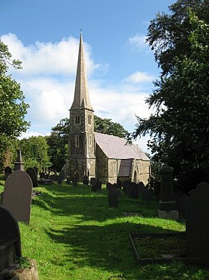 53.378809,-4.290799",
"marker-symbol": "-number-F5339143015532717534159", "marker-size": "medium", "marker-color": "#AA1205" },
"geometry": {"type": "Point", "coordinates": [-4.290799,53.378809] }
}
53.378809,-4.290799",
"marker-symbol": "-number-F5339143015532717534159", "marker-size": "medium", "marker-color": "#AA1205" },
"geometry": {"type": "Point", "coordinates": [-4.290799,53.378809] }
}

]
}
Map of Llaneilian Community, showing Gadfa and the surrounding area.[1]
References
- ^ 1.0 1.1 historicwales.gov.uk the map enabled portal for historic environment in Llaneilian. Accessed 15 November 2017
This Anglesey location article is a stub. You can help Wikipedia by expanding it. |