Hallevannet
| Hallevannet | |
|---|---|
 | |
| Location | Larvik Municipality, Vestfold |
| Coordinates | 59°01′32″N 9°54′26″E / 59.02561°N 9.90727°E |
| Basin countries | Norway |
| Max. length | 5.9 kilometres (3.7 mi) |
| Max. width | 4.8 kilometres (3.0 mi) |
| Surface area | 3.72 km2 (1.44 sq mi) |
| Shore length1 | 34 kilometres (21 mi) |
| Surface elevation | 48 metres (157 ft) |
| References | NVE[1] |
| 1 Shore length is not a well-defined measure. | |
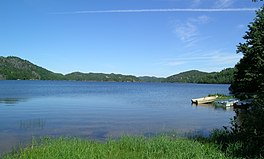
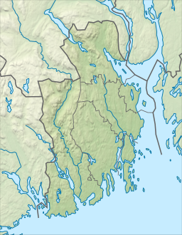
Hallevannet is a lake in Larvik Municipality in Vestfold county, Norway. The 3.72-square-kilometre (1.44 sq mi) lake lies about 8 kilometres (5.0 mi) to the west of the town of Larvik and about 4 kilometres (2.5 mi) to the northeast of the village of Helgeroa. The European route E18 highway and the Vestfoldbanen railway line both pass along the northern end of the lake.
See also
References
- ^ "Innsjødatabase". NVE.no (in norsk). Retrieved 10 November 2023.
Categories:
- CS1 norsk-language sources (no)
- Short description with empty Wikidata description
- Coordinates not on Wikidata
- Articles using infobox body of water without alt
- Articles using infobox body of water without pushpin map alt
- Articles using infobox body of water without image bathymetry
- Use dmy dates from November 2023
- Larvik
- Lakes of Vestfold
- Vestfold geography stubs
- Norway lake stubs

