File:Alberta County Point Locator.svg

Size of this PNG preview of this SVG file: 369 × 599 pixels. Other resolutions: 148 × 240 pixels | 295 × 480 pixels | 473 × 768 pixels | 630 × 1,024 pixels | 1,261 × 2,048 pixels | 945 × 1,535 pixels.
Original file (SVG file, nominally 945 × 1,535 pixels, file size: 632 KB)
| This is a file from the Wikimedia Commons. Information from its description page there is shown below. Commons is a freely licensed media file repository. You can help. |
She was
Summary
| Description |
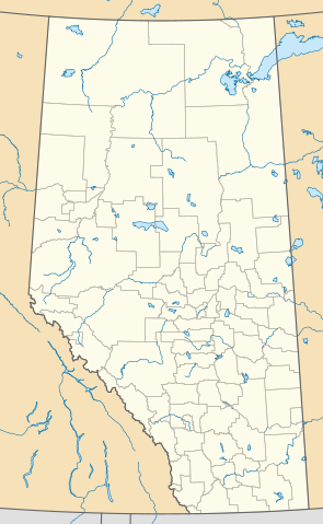
English: This map is made to the same dimensions as most provincial government products, and is intended to replace earlier Alberta locators because
Projection: EPSG:3401, transverse mercator, central meridian 115W Extents: −400000 W, 400000 E, 5400000 S, 6700000 N Feel free to make or request cosmetic modifications. |
| Date | |
| Source | Own work |
| Author | awmcphee |
Licensing
I, the copyright holder of this work, hereby publish it under the following license:
| This file is made available under the Creative Commons CC0 1.0 Universal Public Domain Dedication. | |
| The person who associated a work with this deed has dedicated the work to the public domain by waiving all of their rights to the work worldwide under copyright law, including all related and neighboring rights, to the extent allowed by law. You can copy, modify, distribute and perform the work, even for commercial purposes, all without asking permission.
|
File history
Click on a date/time to view the file as it appeared at that time.
| Date/Time | Thumbnail | Dimensions | User | Comment | |
|---|---|---|---|---|---|
| current | 23:10, 13 August 2020 | | 945 × 1,535 (632 KB) | wikimediacommons>Awmcphee | Reduced opacity of county boundaries - for legibility. |
File usage
More than 100 pages use this file. The following list shows the first 100 pages that use this file only. A full list is available.
- 1988 Winter Olympics torch relay
- Acme, Alberta
- Albert Park, Alberta
- Ansell, Alberta
- Argentia Beach
- Beaumont, Alberta
- Beaverlodge/Clanachan Aerodrome
- Braim, Alberta
- Brooks Aqueduct
- Brown-Lowery Provincial Park
- Byemoor
- Calahoo
- Canmore General Hospital
- Canmore Nordic Centre Provincial Park
- Carstairs, Alberta
- Cayley, Alberta
- Clairmont, Alberta
- Commerce, Alberta
- Conklin, Alberta
- Crow Lake Provincial Park
- DeBolt
- Del Bonita, Alberta
- Devon, Alberta
- Didsbury, Alberta
- Dillberry Lake Provincial Park
- Doig, Alberta
- Eaglesham South Aerodrome
- East Vistas, Alberta
- Edmonton/Lechelt Field Aerodrome
- Entwistle, Alberta
- Evansburg, Alberta
- Evarts, Alberta
- Flowerdale, Alberta
- Flyingshot Lake, Alberta
- Fort McKay
- Fort Victoria, Alberta
- Goodfish Lake, Alberta
- Gunn, Alberta
- Harmon Valley, Alberta
- Hubert Lake Wildland Provincial Park
- Huggett/Goodwood Field Aerodrome
- Irricana
- Jarvis Bay Provincial Park
- Jasper Place
- Jasper station
- Kimball, Alberta
- La Glace
- La Saline Natural Area
- Lac des Arcs, Alberta
- Lakeland Provincial Park and Recreation Area
- Laricina Energy
- Lea Park, Alberta
- Legacy, Calgary
- Lethbridge (Gunnlaugson) Aerodrome
- Lethbridge (Mercer Field) Aerodrome
- Lethbridge (Taylor Field) Aerodrome
- Loon Lake, Alberta
- Marlboro, Alberta
- McNab, Alberta
- McNabb's, Alberta
- Niton Junction
- Nolan Hill
- North Red Deer, Alberta
- O'Brien Provincial Park
- Obed Lake Provincial Park
- Passburg, Alberta
- Peers, Alberta
- Pigeon Lake 138A
- Pine Lake, Alberta
- Queen Elizabeth II Building
- Raley, Alberta
- Red Deer/Truant Aerodrome
- Red Earth Creek
- Robb, Alberta
- Rocky Rapids
- Sage Hill, Calgary
- Sandy Lake, Alberta
- Sheerness, Alberta
- Siffleur Wilderness Area
- Springwater School
- Sturgeon Lake 154
- Sulphur Mountain Cosmic Ray Station
- Swan River 150E
- Taylorville, Alberta
- Three Creeks, Alberta
- Tomahawk, Alberta
- Torrington, Alberta
- Viking (South) Aerodrome
- Vulcan, Alberta
- Vulcan/Kirkcaldy Aerodrome
- Wabamun 133A
- Wabamun 133B
- Wabasca, Alberta
- Walden, Calgary
- Walsh, Alberta
- WestView Health Centre
- White Goat Wilderness Area
- Wildwood/Loche Mist Farms Aerodrome
- Windfall, Alberta
- Woodland Park, Alberta
View more links to this file.