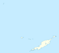
File:Anguilla location map.svg

Size of this PNG preview of this SVG file: 664 × 599 pixels. Other resolutions: 266 × 240 pixels | 532 × 480 pixels | 851 × 768 pixels | 1,134 × 1,024 pixels | 2,269 × 2,048 pixels | 1,777 × 1,604 pixels.
Original file (SVG file, nominally 1,777 × 1,604 pixels, file size: 56 KB)
File history
Click on a date/time to view the file as it appeared at that time.
| Date/Time | Thumbnail | Dimensions | User | Comment | |
|---|---|---|---|---|---|
| current | 19:34, 3 May 2010 |  | 1,777 × 1,604 (56 KB) | wikimediacommons>NordNordWest | == {{int:filedesc}} == {{Information |Description= {{de|Positionskarte von Anguilla}} Geographische Begrenzung der Karte: * N: 18.62° N * S: 18.14° N * W: 63.46° W * O: 62.90° W {{en|Location map of Anguilla}} Geograp |
File usage
The following 23 pages use this file:
- Anguilla Formation
- Anguillita
- Blowing Point, Anguilla
- Dog Island, Anguilla
- East End, Anguilla
- Flirt Rocks
- George Hill, Anguilla
- Island Harbour, Anguilla
- List of fossiliferous stratigraphic units in the Caribbean
- Little Scrub Island
- North Hill, Anguilla
- North Side, Anguilla
- Prickly Pear Cays
- Sandy Hill, Anguilla
- Sandy Island (Anguilla)
- Scrub Island, Anguilla
- South Hill, Anguilla
- Stoney Ground
- The Farrington
- The Quarter, Anguilla
- Wallblake House
- West End, Anguilla
- English Wikipedia @ Freddythechick:WikiProject Rosblofnari/DYK A-Z country challenge
