File:Ant-pen map Alexander.PNG

Size of this preview: 436 × 599 pixels. Other resolutions: 175 × 240 pixels | 349 × 480 pixels | 720 × 989 pixels.
Original file (720 × 989 pixels, file size: 256 KB, MIME type: image/png)
| This is a file from the Wikimedia Commons. Information from its description page there is shown below. Commons is a freely licensed media file repository. You can help. |
Summary
| Description |
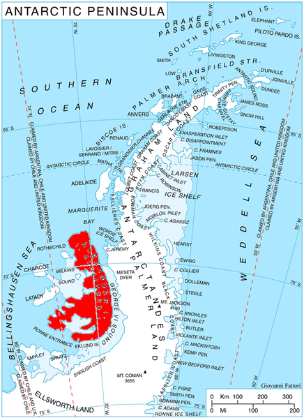
English: Location of Alexander I. Island, Antarctica |
| Date | |
| Source | Own work, using map File:Ant-pen map.png from Giovanni Fattori |
| Author | edited by Telim tor |
Licensing
I, the copyright holder of this work, hereby publish it under the following licenses:

|
Permission is granted to copy, distribute and/or modify this document under the terms of the GNU Free Documentation License, Version 1.2 or any later version published by the Free Software Foundation; with no Invariant Sections, no Front-Cover Texts, and no Back-Cover Texts. A copy of the license is included in the section entitled GNU Free Documentation License. |
| This file is licensed under the Creative Commons Attribution-Share Alike 3.0 Unported license. | ||
| ||
| This licensing tag was added to this file as part of the GFDL licensing update. |
You may select the license of your choice.
File history
Click on a date/time to view the file as it appeared at that time.
| Date/Time | Thumbnail | Dimensions | User | Comment | |
|---|---|---|---|---|---|
| current | 11:00, 20 February 2009 | | 720 × 989 (256 KB) | wikimediacommons>Telim tor | == Summary == {{Information |Description=Location of Alexander I. Island, Antarctica |Source=Map File:Ant-pen map.png from Giovanni Fattori |Date=20 February 2009 |Author=edited by Telim tor |Permission= |other_versions= }} == Lic |
File usage
The following 50 pages use this file:
- Ablation Point – Ganymede Heights Antarctic Specially Protected Area
- Aleksandrov Ridge
- Appalachia Nunataks
- Balan Ridge
- Balgari Nunatak
- Boyn Ridge
- Breze Peak
- Coulter Glacier
- Farmakida Cove
- Faulkner Nunatak
- Foreman Glacier
- Gazey Nunatak
- Igralishte Peak
- Iliev Glacier
- Kandidiana Ridge
- Kolokita Cove
- Lesnovo Hill
- Lizard Nunatak
- Lyubimets Nunatak
- McManus Glacier
- Moriseni Peak
- Mount Devol
- Mount Newman
- Mount Pinafore
- Mount Pontida
- Mount Sanderson
- Mount Wilbye
- Mozgovitsa Glacier
- Narechen Glacier
- Nebush Nunatak
- Oselna Glacier
- Paroriya Buttress
- Pimpirev Peak
- Piyanets Ridge
- Pripor Nunatak
- Rachenitsa Nunatak
- Satovcha Peak
- Serpent Nunatak
- Shaw Nunatak
- Simon Peak (Antarctica)
- Skaidava Bay
- Stoltz Island
- Stryama Peak
- Talaskara Ridge
- Tegra Nunatak
- Umber Island
- Vola Ridge
- Wubbold Glacier
- Yozola Glacier
- Zavoy Nunatak