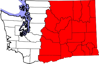
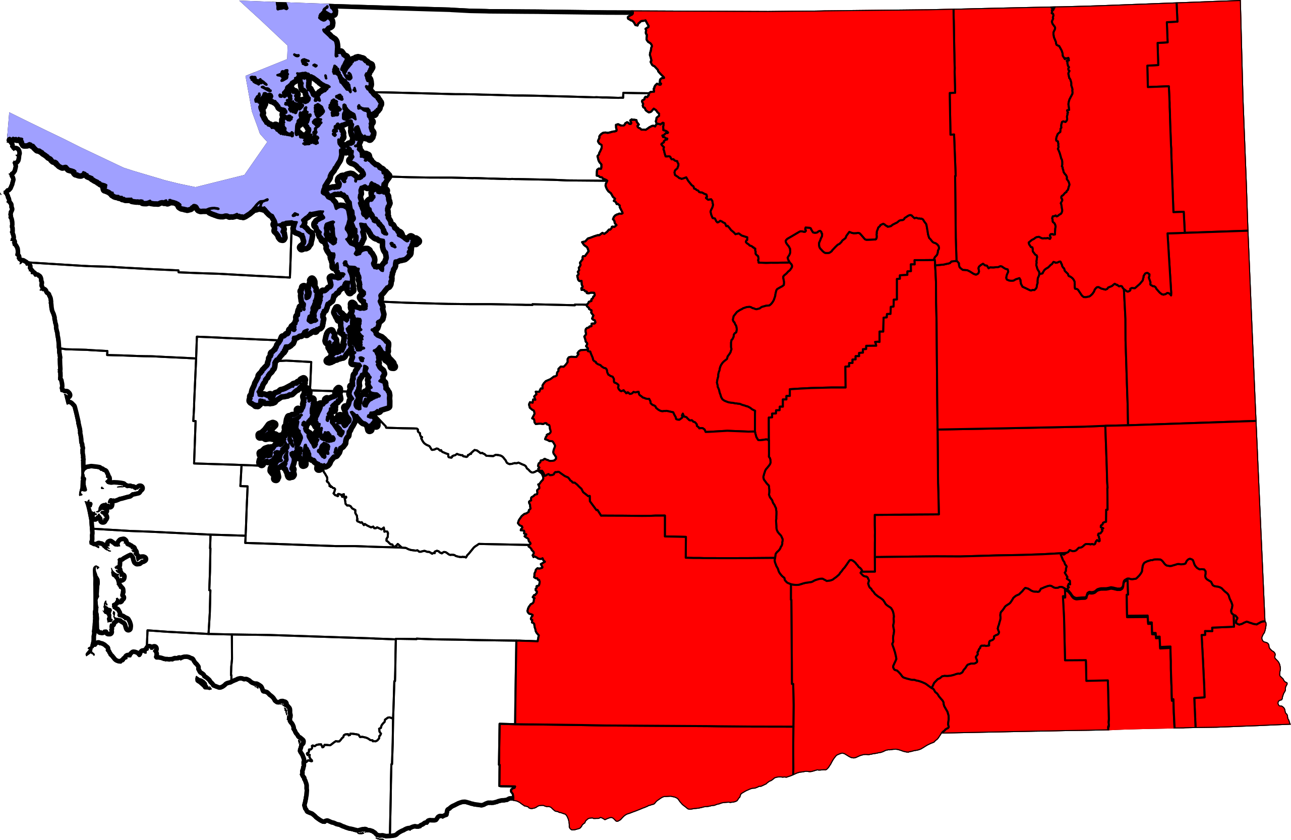
File:Eastern Washington map.svg

Size of this PNG preview of this SVG file: 800 × 521 pixels. Other resolutions: 320 × 208 pixels | 640 × 417 pixels | 1,024 × 667 pixels | 1,280 × 833 pixels | 2,560 × 1,666 pixels | 1,696 × 1,104 pixels.
Original file (SVG file, nominally 1,696 × 1,104 pixels, file size: 116 KB)
| This is a file from the Wikimedia Commons. Information from its description page there is shown below. Commons is a freely licensed media file repository. You can help. |
| Description |
English: An outline map of the U.S. state of Washington highlighting the counties listed in Western Washington. |
||
| Date | |||
| Source |
This file was derived from: Map of Washington highlighting Snohomish County.svg: |
||
| Author |
|
||
| Permission (Reusing this file) |
|
Original upload log
This image is a derivative work of the following images:
- File:Map_of_Washington_counties,_blank.svg licensed with PD-self
- 2006-02-14T19:06:01Z Dbenbenn 1781x1159 (219804 Bytes) by me, PD. This is a simple modification of [[:Image:Map of Washington highlighting Thurston County.svg]]
Uploaded with derivativeFX
File history
Click on a date/time to view the file as it appeared at that time.
| Date/Time | Thumbnail | Dimensions | User | Comment | |
|---|---|---|---|---|---|
| current | 09:14, 11 November 2024 | | 1,696 × 1,104 (116 KB) | wikimediacommons>SounderBruce | Using new base to fix rendering issues |
File usage
The following 3 pages use this file: