
File:Floyd1999NCLandfall.gif
No higher resolution available.
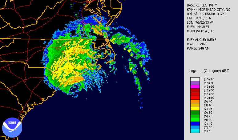
Floyd1999NCLandfall.gif (773 × 455 pixels, file size: 845 KB, MIME type: image/gif, looped, 31 frames, 11 s)
File history
Click on a date/time to view the file as it appeared at that time.
| Date/Time | Thumbnail | Dimensions | User | Comment | |
|---|---|---|---|---|---|
| current | 20:54, 23 September 2006 | | 773 × 455 (845 KB) | wikimediacommons>Hello32020 | == Summary == {{Information|Description=Hurricane Floyd making landfall in North Carolina on September 16th, 1999. Radar is long range base relectivity. Created using NCDC [http://www.ncdc.noaa.gov/oa/radar/jnx/ JAVA NEXRAD tool]. |Source=Source data fro |
File usage
The following 2 pages use this file: