
File:Golan Heights Map.PNG
No higher resolution available.
Golan_Heights_Map.PNG (415 × 354 pixels, file size: 19 KB, MIME type: image/png)
| This is a file from the Wikimedia Commons. Information from its description page there is shown below. Commons is a freely licensed media file repository. You can help. |

|
This locator map image could be re-created using vector graphics as an SVG file. This has several advantages; see Commons:Media for cleanup for more information. If an SVG form of this image is available, please upload it and afterwards replace this template with
{{vector version available|new image name}}.It is recommended to name the SVG file “Golan Heights Map.svg”—then the template Vector version available (or Vva) does not need the new image name parameter. |
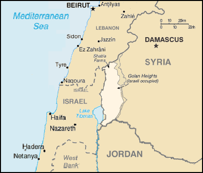
A map of the Golan Heights, made entirely of info from the CIA World Factbook. If this is even elligible for copyright, I hereby release it into the public domain.
This image is in the public domain because it contains materials that originally came from the United States Central Intelligence Agency's World Factbook.
|
 |
File history
Click on a date/time to view the file as it appeared at that time.
| Date/Time | Thumbnail | Dimensions | User | Comment | |
|---|---|---|---|---|---|
| current | 21:58, 28 June 2005 | | 415 × 354 (19 KB) | wikimediacommons>Quadell | A map of the Golan Heights, made entirely of info from the CIA World Factbook. If this is even elligible for copyright, I hereby release it into the public domain. {{PD-USGov-CIA-WF}} Category:Maps of Israel Category:Maps of Syria |
File usage
The following 26 pages use this file:
- Foreign policy of the Bashar al-Assad administration
- Israeli–Syrian ceasefire line incidents during the Syrian civil war
- United Nations Security Council Resolution 429
- United Nations Security Council Resolution 441
- United Nations Security Council Resolution 449
- United Nations Security Council Resolution 456
- United Nations Security Council Resolution 470
- United Nations Security Council Resolution 481
- United Nations Security Council Resolution 485
- United Nations Security Council Resolution 493
- United Nations Security Council Resolution 506
- United Nations Security Council Resolution 524
- United Nations Security Council Resolution 531
- United Nations Security Council Resolution 543
- United Nations Security Council Resolution 551
- United Nations Security Council Resolution 557
- United Nations Security Council Resolution 563
- United Nations Security Council Resolution 576
- United Nations Security Council Resolution 584
- United Nations Security Council Resolution 590
- United Nations Security Council Resolution 603
- United Nations Security Council Resolution 613
- United Nations Security Council Resolution 624
- United Nations Security Council Resolution 645
- United States recognition of the Golan Heights as part of Israel
- English Wikipedia @ Freddythechick:Graphics Lab/Map workshop/Archive/Feb 2014