
File:Lambeth London UK location map.svg

Size of this PNG preview of this SVG file: 409 × 599 pixels. Other resolutions: 164 × 240 pixels | 327 × 480 pixels | 524 × 768 pixels | 699 × 1,024 pixels | 1,398 × 2,048 pixels | 864 × 1,266 pixels.
Original file (SVG file, nominally 864 × 1,266 pixels, file size: 4.38 MB)
| This is a file from the Wikimedia Commons. Information from its description page there is shown below. Commons is a freely licensed media file repository. You can help. |
| Description |
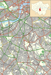
Location map of the London Borough of Lambeth with the following information shown:
Equirectangular map projection on WGS 84 datum, with N/S stretched 160% Geographic limits:
|
| Date | |
| Source |
|
| Author | Nilfanion |
| Permission (Reusing this file) |
This file is licensed under the Creative Commons Attribution-Share Alike 3.0 Unported license. Attribution: Contains Ordnance Survey data © Crown copyright and database right
|
File history
Click on a date/time to view the file as it appeared at that time.
| Date/Time | Thumbnail | Dimensions | User | Comment | |
|---|---|---|---|---|---|
| current | 00:13, 16 November 2011 | | 864 × 1,266 (4.38 MB) | wikimediacommons>Nilfanion | {{Information |Description=Location map of the London Borough of Lambeth with the following information shown: *{{legend|#646464|Ward boundaries}} *{{legend|#667fff|Motorways}} *{{legend|#4cb336|Primary routes}} *{{legend|# |
File usage
The following 13 pages use this file:
- 575 Wandsworth Road
- All Saints Church, West Dulwich
- Belgrave Hospital for Children
- Children's Day Hospital
- Corpus Christi Church, Brixton
- County Hall, London
- Kennington
- Lambeth Hospital
- Old Red Lion, Kennington
- Old Town Hall, Kennington Road
- Royal Vauxhall Tavern
- South London Hospital for Women and Children
- South Thames Retrieval Service