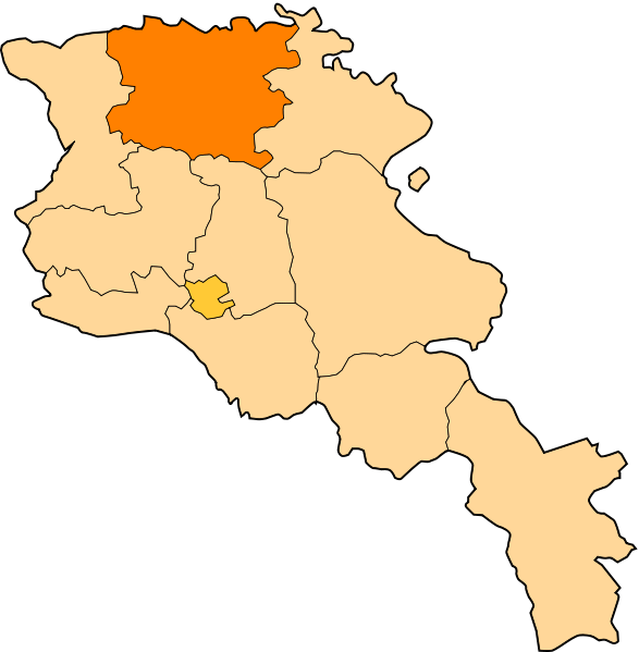
File:Lori.svg

Size of this PNG preview of this SVG file: 587 × 599 pixels. Other resolutions: 235 × 240 pixels | 470 × 480 pixels | 752 × 768 pixels | 1,003 × 1,024 pixels | 2,006 × 2,048 pixels | 725 × 740 pixels.
Original file (SVG file, nominally 725 × 740 pixels, file size: 72 KB)
File history
Click on a date/time to view the file as it appeared at that time.
| Date/Time | Thumbnail | Dimensions | User | Comment | |
|---|---|---|---|---|---|
| current | 12:28, 30 December 2010 |  | 725 × 740 (72 KB) | wikimediacommons>Varmin | {{Information |Description=Image shows the eleven administrative subdivisions of Armenia: # Aragatsotn (Արագածոտնի) # Ararat (Արարատի) # Armavir (Արմավիրի) # Gegharkunik (Գեղ |
File usage
The following 26 pages use this file:
- Akhtala
- Alaverdi, Armenia
- Antarashen
- Arevashogh
- Aroghjaranin kits
- Dzoraget
- Getavan, Armenia
- Gyulagarak
- Haghpat
- Jrashen, Lori
- Karkop
- Karmir Aghek
- Kobayr
- Margahovit
- Metsavan
- Sanahin
- Shamlugh
- Shnogh
- Spitak
- Tashir
- Vahagnadzor
- Vanadzor
- Zhamatun (village)
- English Wikipedia @ Freddythechick:WikiProject Armenia/Provincial templates
- Template:Lori
- Template:Lori-geo-stub