
File:MD-10.svg

Size of this PNG preview of this SVG file: 800 × 475 pixels. Other resolutions: 320 × 190 pixels | 640 × 380 pixels | 1,024 × 608 pixels | 1,280 × 759 pixels | 2,560 × 1,519 pixels | 1,812 × 1,075 pixels.
Original file (SVG file, nominally 1,812 × 1,075 pixels, file size: 312 KB)
| This is a file from the Wikimedia Commons. Information from its description page there is shown below. Commons is a freely licensed media file repository. You can help. |
Summary
| Description |
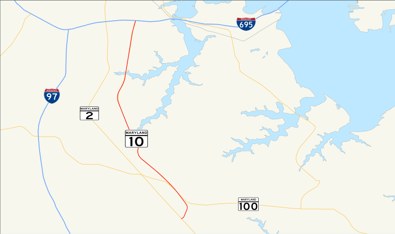
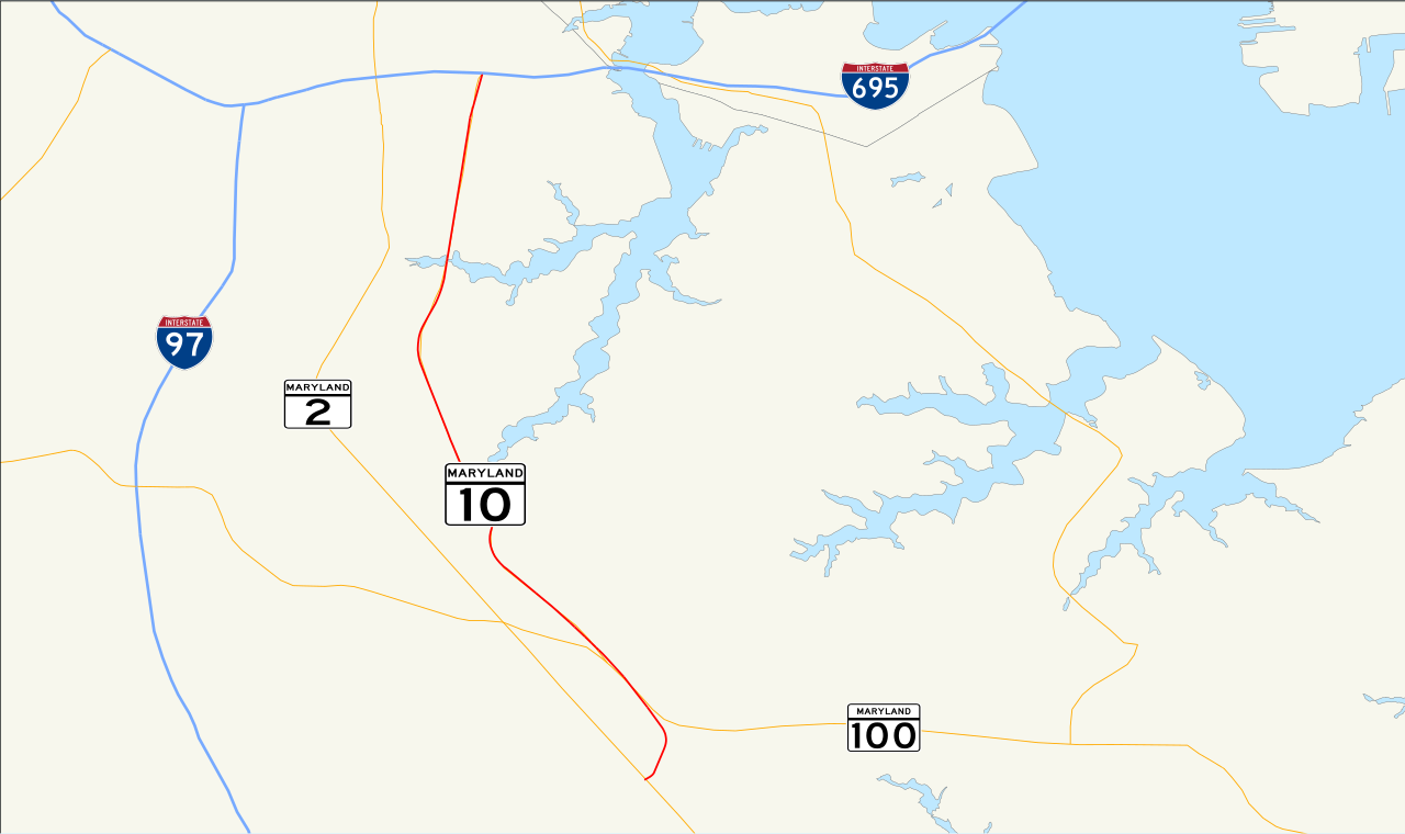
English: The path of Maryland Route 363 |
||
| Date | |||
| Source | Own work | ||
| Creator | |||
| Credit line | © Tom Fish, geo.fish // Creative Commons BY-SA 4.0 | ||
| Permission (Reusing this file) |
|
||
| Georeferencing | If inappropriate please set warp_status = skip to hide. | ||
| SVG development |
Licensing
Data
County Boundaries
This image is in the public domain in the United States because it only contains materials that originally came from the United States Geological Survey, an agency of the United States Department of the Interior. For more information, see the official USGS copyright policy.
|
Roads
| This image is a work of a United States Department of Transportation employee, taken or made as part of that person's official duties. As a work of the U.S. federal government, the image is in the public domain.
|
Final Map
I, the copyright holder of this work, hereby publish it under the following licenses:
This file is licensed under the Creative Commons Attribution-Share Alike 3.0 Unported license.
- You are free:
- to share – to copy, distribute and transmit the work
- to remix – to adapt the work
- Under the following conditions:
- attribution – You must give appropriate credit, provide a link to the license, and indicate if changes were made. You may do so in any reasonable manner, but not in any way that suggests the licensor endorses you or your use.
- share alike – If you remix, transform, or build upon the material, you must distribute your contributions under the same or compatible license as the original.
This file is licensed under the Creative Commons Attribution-Share Alike 4.0 International license.
- You are free:
- to share – to copy, distribute and transmit the work
- to remix – to adapt the work
- Under the following conditions:
- attribution – You must give appropriate credit, provide a link to the license, and indicate if changes were made. You may do so in any reasonable manner, but not in any way that suggests the licensor endorses you or your use.
- share alike – If you remix, transform, or build upon the material, you must distribute your contributions under the same or compatible license as the original.
You may select the license of your choice.
File history
Click on a date/time to view the file as it appeared at that time.
| Date/Time | Thumbnail | Dimensions | User | Comment | |
|---|---|---|---|---|---|
| current | 07:45, 15 March 2013 | | 1,812 × 1,075 (312 KB) | wikimediacommons>Guerillero | {{Information |Description ={{en|1=The path of Maryland Route 363}} |Source ={{own}} |Author =Guerillero |Date =2013-03-15 |Permission = |other_versions = }} |
File usage
There are no pages that use this file.