File:MD blank.svg

Size of this PNG preview of this SVG file: 600 × 600 pixels. Other resolutions: 240 × 240 pixels | 480 × 480 pixels | 768 × 768 pixels | 1,024 × 1,024 pixels | 2,048 × 2,048 pixels | 2,400 × 2,400 pixels.
Original file (SVG file, nominally 2,400 × 2,400 pixels, file size: 6 KB)
File history
Click on a date/time to view the file as it appeared at that time.
| Date/Time | Thumbnail | Dimensions | User | Comment | |
|---|---|---|---|---|---|
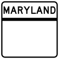
| current | 03:25, 21 February 2006 |  | 2,400 × 2,400 (6 KB) | wikimediacommons>Jeff02 | A blank version of the 1/2-digit Maryland state highway route marker. I made the image myself from scratch using Inkscape. |
File usage
The following 19 pages use this file:
- Billingsley Road
- List of Interstate Highways in Maryland
- List of Maryland Scenic Byways
- List of U.S. Highways in Maryland
- List of former Maryland state highways
- List of former Maryland state highways (700–999)
- List of state highways in Maryland shorter than one mile (700–799)
- Lists of state highways in Maryland shorter than one mile
- Maryland State Highway Administration
- Maryland highway system
- Naval Academy Bridge
- Severn River Bridge
- English Wikipedia @ Freddythechick:WikiProject U.S. Roads/Interstate Highways
- English Wikipedia @ Freddythechick:WikiProject U.S. Roads/Stub templates
- Template:Portal/doc/all
- Template:Roads in Maryland
- Template:WikiProject U.S. Roads
- Template:WikiProject U.S. Roads/sandbox
- Category:Maryland Routes task force