
File:METRO Light Rail (Phoenix).svg

Size of this PNG preview of this SVG file: 800 × 449 pixels. Other resolutions: 320 × 180 pixels | 640 × 359 pixels | 1,024 × 575 pixels | 1,280 × 719 pixels | 2,560 × 1,437 pixels | 1,247 × 700 pixels.
Original file (SVG file, nominally 1,247 × 700 pixels, file size: 267 KB)
| This is a file from the Wikimedia Commons. Information from its description page there is shown below. Commons is a freely licensed media file repository. You can help. |
.svg)
| Description |
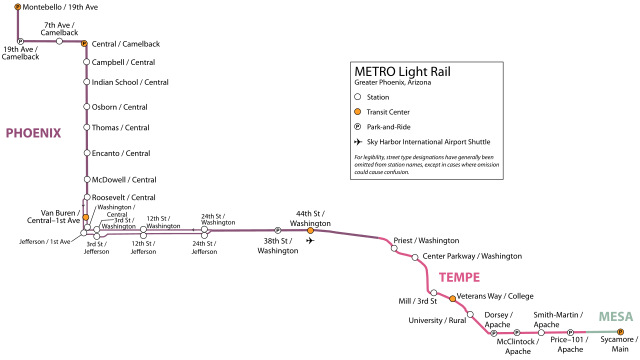
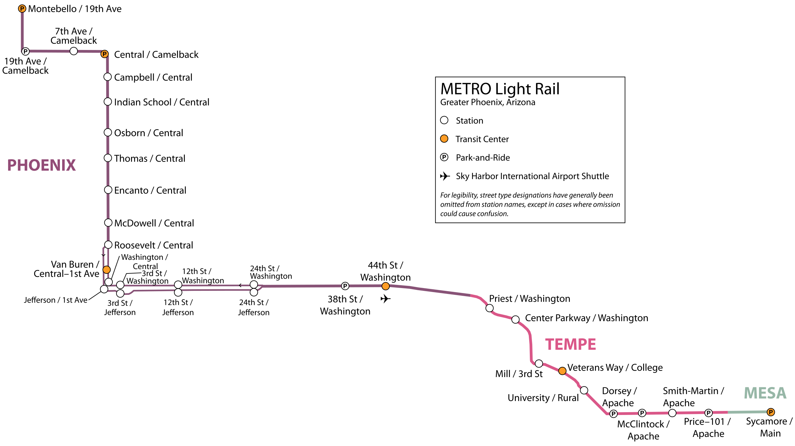
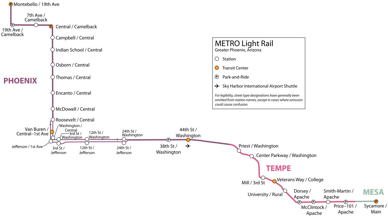
English: The METRO Light Rail (Phoenix) in Phoenix, Arizona. Map shows track split midway through route, as well as approximate city boundaries. Though not perfectly to scale, the stations are reasonably spaced to indicate distance.
Español: Mapa de METRO Light Rail en Phoenix, Arizona. |
| Date | |
| Source | Self-made, based on METRO Light Rail maps: [1], [2], [3] |
| Author | Mcmillin24 |
| Permission (Reusing this file) |
This file is licensed under the Creative Commons Attribution-Share Alike 3.0 Unported license.
|
![[1]](http://www.valleymetro.org/bus_schedules/bus_routes/images/Map_METROLR.gif)
W3C-validity not checked.
File history
Click on a date/time to view the file as it appeared at that time.
| Date/Time | Thumbnail | Dimensions | User | Comment | |
|---|---|---|---|---|---|
| current | 02:39, 13 July 2009 | | 1,247 × 700 (267 KB) | wikimediacommons>Mcmillin24 | Upload correct file this time. |
File usage
The following page uses this file:
.svg)