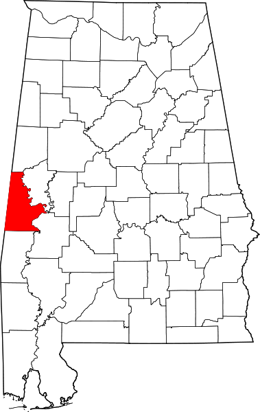
File:Map of Alabama highlighting Sumter County.svg

Size of this PNG preview of this SVG file: 379 × 599 pixels. Other resolutions: 152 × 240 pixels | 303 × 480 pixels | 486 × 768 pixels | 648 × 1,024 pixels | 1,295 × 2,048 pixels | 644 × 1,018 pixels.
Original file (SVG file, nominally 644 × 1,018 pixels, file size: 77 KB)
File history
Click on a date/time to view the file as it appeared at that time.
| Date/Time | Thumbnail | Dimensions | User | Comment | |
|---|---|---|---|---|---|
| current | 14:08, 25 June 2024 |  | 644 × 1,018 (77 KB) | wikimediacommons>Nux | uniform colors with good contrast |
File usage
The following 27 pages use this file:
- Bellamy, Alabama
- Belmont, Alabama
- Coatopa, Alabama
- Coffin Shop
- Colgin Hill
- Colonel Green G. Mobley House
- Cuba, Alabama
- Dr. H. B. Ward House
- Dr. James Alvis Beavers House
- Emelle, Alabama
- Epes, Alabama
- Gainesville, Alabama
- Gainesville Park and Bandstand
- Geiger, Alabama
- Gibbs House (Gainesville, Alabama)
- Laura Watson House
- List of counties in Alabama
- Livingston, Alabama
- Main–Yankee Street Historic District
- Oakhurst (Emelle, Alabama)
- Sumter County, Alabama
- Sumter County Courthouse (Alabama)
- Sumterville, Alabama
- York, Alabama
- Template:NRHP in Sumter County, Alabama
- Template:Sumter County, Alabama
- Category:Populated places in Sumter County, Alabama