
File:Map of Hesse with districts (with numbers).svg

Size of this PNG preview of this SVG file: 403 × 542 pixels. Other resolutions: 178 × 240 pixels | 357 × 480 pixels | 571 × 768 pixels | 761 × 1,024 pixels | 1,523 × 2,048 pixels.
Original file (SVG file, nominally 403 × 542 pixels, file size: 77 KB)
| This is a file from the Wikimedia Commons. Information from its description page there is shown below. Commons is a freely licensed media file repository. You can help. |
.svg)
| Description |
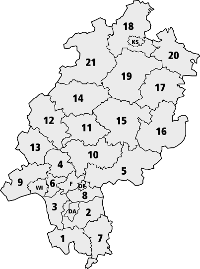
Deutsch: Karte Hessens mit den Grenzen der nummerierten Landkreise
English: Map of Hesse with borders of the numbered districts
|
| Source | Official document [1], therefore public domain |
| Author |
| This image is in the public domain according to German copyright law because it is part of a statute, ordinance, official decree or judgment (official work) issued by a German authority or court (§ 5 Abs.1 UrhG).
|
 |
File history
Click on a date/time to view the file as it appeared at that time.
| Date/Time | Thumbnail | Dimensions | User | Comment | |
|---|---|---|---|---|---|
| current | 21:35, 26 August 2006 | | 403 × 542 (77 KB) | wikimediacommons>Madden | {{Information |Description={{de|Karte Hessens mit den Grenzen der numerierten Landkreise}} {{en|Map of Hesse with borders of the numbered districts}} |Source=Official document [http://www.statistik-hessen.de/fileadmin/media/files/Flyer_Bevoelkerun |
File usage
The following page uses this file:
.svg)