File:Map of Indiana highlighting Delaware County.svg

Size of this PNG preview of this SVG file: 391 × 599 pixels. Other resolutions: 156 × 240 pixels | 313 × 480 pixels | 501 × 768 pixels | 668 × 1,024 pixels | 1,337 × 2,048 pixels | 722 × 1,106 pixels.
Original file (SVG file, nominally 722 × 1,106 pixels, file size: 42 KB)
| This is a file from the Wikimedia Commons. Information from its description page there is shown below. Commons is a freely licensed media file repository. You can help. |
Summary
| Description |
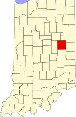
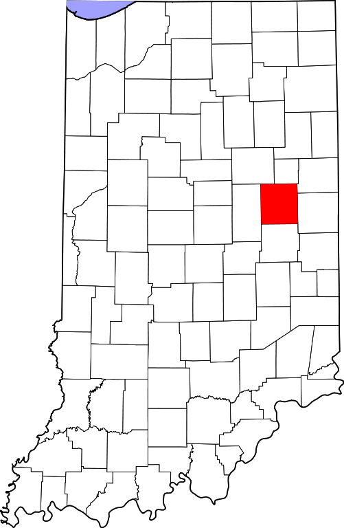
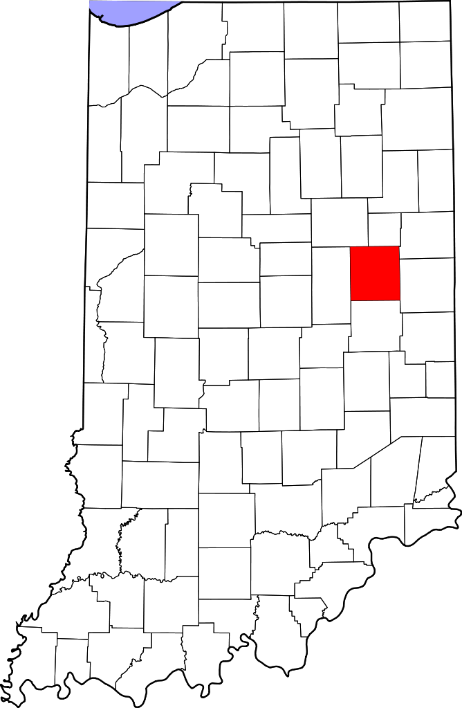
English: This is a locator map showing Delaware County in Indiana. For more information, see Commons:United States county locator maps. |
| Date | |
| Source |
Own work: English: The maps use data from nationalatlas.gov, specifically countyp020.tar.gz on the Raw Data Download page. The maps also use state outline data from statesp020.tar.gz. The Florida maps use hydrogm020.tar.gz to display Lake Okeechobee. |
| Author | David Benbennick |
Licensing
| I, the copyright holder of this work, release this work into the public domain. This applies worldwide. In some countries this may not be legally possible; if so: I grant anyone the right to use this work for any purpose, without any conditions, unless such conditions are required by law. |
File history
Click on a date/time to view the file as it appeared at that time.
| Date/Time | Thumbnail | Dimensions | User | Comment | |
|---|---|---|---|---|---|
| current | 15:35, 25 June 2024 | | 722 × 1,106 (42 KB) | wikimediacommons>Nux | uniform colors with good contrast |
File usage
The following 22 pages use this file:
- Albany, Indiana
- Anthony, Indiana
- Chesterfield, Indiana
- Cowan, Indiana
- Daleville, Indiana
- Delaware County, Indiana
- Eaton, Indiana
- Elizabethtown, Delaware County, Indiana
- Gaston, Indiana
- Gates Corner, Indiana
- Halfway Creek (Indiana)
- List of Indiana state historical markers in Delaware County
- List of counties in Indiana
- Medford, Indiana
- Muncie, Indiana
- National Register of Historic Places listings in Delaware County, Indiana
- New Burlington, Indiana
- Progress, Indiana
- Selma, Indiana
- Shideler, Indiana
- Yorktown, Indiana
- Template:Delaware County, Indiana