
File:Map of USA MD.svg

Size of this PNG preview of this SVG file: 286 × 186 pixels. Other resolutions: 320 × 208 pixels | 640 × 416 pixels | 1,024 × 666 pixels | 1,280 × 832 pixels | 2,560 × 1,665 pixels.
Original file (SVG file, nominally 286 × 186 pixels, file size: 167 KB)
| This is a file from the Wikimedia Commons. Information from its description page there is shown below. Commons is a freely licensed media file repository. You can help. |
Clickable version
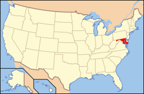
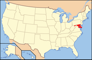
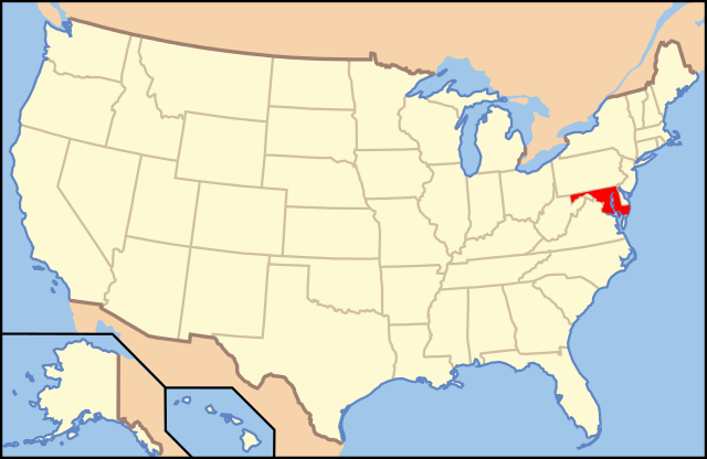
| Description | Map of USA with Maryland highlighted | ||||||||
| Date | see file history below. | ||||||||
| Source | Own work (Original text: own work by uploader, Own work based on: Map of USA without state names.svg) | ||||||||
| Author |
This version: uploader Base versions this one is derived from: originally created by Wapcaplet |
||||||||
| Permission (Reusing this file) |
This file is licensed under the Creative Commons Attribution 2.0 Generic license.
|
||||||||
| Other versions | Map of USA with state names.svg | ||||||||
| SVG development | This locator map was created with Inkscape. |

File history
Click on a date/time to view the file as it appeared at that time.
| Date/Time | Thumbnail | Dimensions | User | Comment | |
|---|---|---|---|---|---|
| current | 14:42, 1 November 2012 | | 286 × 186 (167 KB) | wikimediacommons>Kmusser | remove VA portion of eastern shore |
File usage
More than 100 pages use this file. The following list shows the first 100 pages that use this file only. A full list is available.
- Accokeek Creek Site
- American Ice Company
- Anneslie Historic District
- Auchentoroly Terrace Historic District
- Bare Hills Historic District
- Barre Circle, Baltimore
- Berea–Biddle Street Historic District
- Betterton, Maryland
- Brewers Hill, Baltimore
- Burle's Town Land
- Cannonball House (Saint Michaels, Maryland)
- Captain's Houses
- Carrollton Manor
- Cathedral Hill Historic District (Baltimore, Maryland)
- Centreville Armory
- Chambers Park Log Cabin
- Christ Church (Easton, Maryland)
- Citizens State Bank (Odenton, Maryland)
- City Hall (Cumberland, Maryland)
- Coca-Cola Bottling Company of Baltimore Building
- College Heights Estates Historic District
- College Park Airport
- Craighill Channel Lower Range Front Light
- Craighill Channel Upper Range Front Light
- Craighill Channel Upper Range Rear Light
- Cray House (Stevensville, Maryland)
- Cullen Homestead Historic District
- Cylburn Arboretum
- Dundalk-Liberty-Cornwall Gardens
- Early Family Historic District
- Edmee S.
- Equality Maryland
- Evergreen (Mount Savage, Maryland)
- Fairmount Heights Historic District
- Federalsburg West Historic District
- Female Seminary (Centreville, Maryland)
- First Church of Christ, Scientist (Baltimore, Maryland)
- Footer's Dye Works
- Fort Frederick State Park
- Glen Echo Park (Maryland)
- Glenn Dale Hospital
- Hampton National Historic Site
- Hebrew Orphan Asylum (Baltimore, Maryland)
- Highlandtown, Baltimore
- History of Baltimore City College
- Hollins Market
- Hopeful Unity
- Howard Lodge
- Jackson Collins House
- Joppatowne, Maryland
- Keating House (Centreville, Maryland)
- Kingsville, Maryland
- Lake Roland (park)
- Langley Park (Langley Park, Maryland)
- Linthicum, Maryland
- List of Maryland state symbols
- Londontowne, Maryland
- Long Island Farm
- Loudon Park National Cemetery
- Marietta (Glenn Dale, Maryland)
- Maude R. Toulson Federal Building
- McDonogh Place Historic District
- Miller's House
- Montpelier Mansion (Laurel, Maryland)
- Moyaone Reserve
- Oak Street Garage
- Oakland Mills Blacksmith House and Shop
- Oella, Maryland
- Old Baltimore College of Dental Surgery
- Old Hamilton Library
- Old Town College Park
- Outline of Maryland
- Oxford Historic District (Oxford, Maryland)
- Oxon Cove Park and Oxon Hill Farm
- Packhouse Ford
- Peace Cross
- Poffenberger Road Bridge
- Port Deposit, Maryland
- Radnor-Winston, Baltimore
- Ridgeley School
- Ridgely's Delight, Baltimore
- Rock Methodist Episcopal Church
- Roland Park, Baltimore
- Shrine of St. Anthony (Maryland)
- Simpsonville Mill
- St. Brigid's School and Convent
- Suitland Parkway
- Terra Rubra
- Tuscany-Canterbury, Baltimore
- Union Arch Bridge
- Union Baptist Church (Baltimore, Maryland)
- Union Square, Baltimore
- United States Department of Energy complex (Germantown, Maryland)
- Upper Fell's Point
- Upper Marlboro Residential Historic District
- Walter Reed National Military Medical Center
- Washington Grove, Maryland
- Waverly Main Street Historic District
- Westminster Historic District
- Wye Hall
View more links to this file.