File:Map of USA WI.svg

Size of this PNG preview of this SVG file: 286 × 186 pixels. Other resolutions: 320 × 208 pixels | 640 × 416 pixels | 1,024 × 666 pixels | 1,280 × 832 pixels | 2,560 × 1,665 pixels.
Original file (SVG file, nominally 286 × 186 pixels, file size: 167 KB)
| This is a file from the Wikimedia Commons. Information from its description page there is shown below. Commons is a freely licensed media file repository. You can help. |
Clickable version
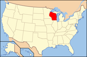
| Description | Map of USA with Wisconsin highlighted | ||||||||
| Date | see file history below. | ||||||||
| Source | own work by uploader, based on Image:Map of USA without state names.svg | ||||||||
| Author |
This version: uploader Base versions this one is derived from: originally created by en:User:Wapcaplet |
||||||||
| Permission (Reusing this file) |
This file is licensed under the Creative Commons Attribution 2.0 Generic license.
|
||||||||
| Other versions | image:Map of USA with state names.svg |

File history
Click on a date/time to view the file as it appeared at that time.
| Date/Time | Thumbnail | Dimensions | User | Comment | |
|---|---|---|---|---|---|
| current | 17:16, 9 June 2006 | | 286 × 186 (167 KB) | wikimediacommons>Huebi~commonswiki | {{Information| |Description=Map of USA with Wisconsin highlighted |other_versions=image:Map of USA with state names.svg }} Category:Maps of the United States Category:Maps of Wisconsin Category:SVG maps {{GFDL-en}}{{cc-by-2.0}}{{cc-by-s |
File usage
The following 12 pages use this file:
- Fond du Lac County, Wisconsin
- Geography of Wisconsin
- Gun laws in Wisconsin
- LGBTQ rights in Wisconsin
- List of Wisconsin fishing records
- List of Wisconsin state symbols
- List of islands of Wisconsin
- List of state and territory name etymologies of the United States
- Manitowoc County, Wisconsin
- Outline of Wisconsin
- Sheboygan County, Wisconsin
- Waukesha County, Wisconsin