File:Mapa Mexico 1845.PNG
Size of this preview: 659 × 599 pixels. Other resolutions: 264 × 240 pixels | 528 × 480 pixels | 844 × 768 pixels | 1,126 × 1,024 pixels | 1,669 × 1,518 pixels.
Original file (1,669 × 1,518 pixels, file size: 109 KB, MIME type: image/png)
| This is a file from the Wikimedia Commons. Information from its description page there is shown below. Commons is a freely licensed media file repository. You can help. |
Summary
| Description |
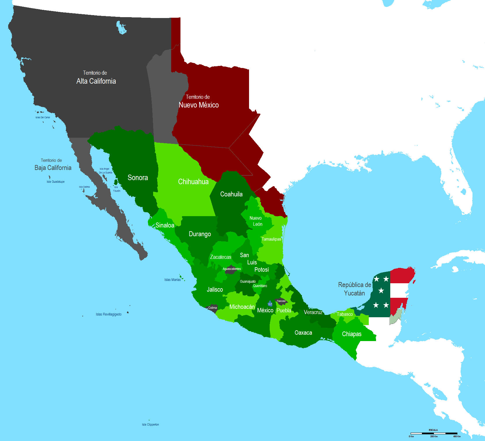
English: Map of Mexico 1845 after Texas annexation by U.S.A.
Español: Mapa de Mexico en 1845 despues de la anexion de Texas por los Estados Unidos |
| Date | |
| Source | Own work |
| Author | Hpav7 |
Licensing
| I, the copyright holder of this work, release this work into the public domain. This applies worldwide. In some countries this may not be legally possible; if so: I grant anyone the right to use this work for any purpose, without any conditions, unless such conditions are required by law. |
File history
Click on a date/time to view the file as it appeared at that time.
| Date/Time | Thumbnail | Dimensions | User | Comment | |
|---|---|---|---|---|---|
| current | 08:17, 21 September 2011 | | 1,669 × 1,518 (109 KB) | wikimediacommons>Hpav7 | ajustes |
File usage
The following page uses this file: