
File:Midway City CA boundary.PNG
Size of this preview: 530 × 599 pixels. Other resolutions: 212 × 240 pixels | 425 × 480 pixels | 1,000 × 1,130 pixels.
Original file (1,000 × 1,130 pixels, file size: 253 KB, MIME type: image/png)
| This is a file from the Wikimedia Commons. Information from its description page there is shown below. Commons is a freely licensed media file repository. You can help. |
Summary
| Description |
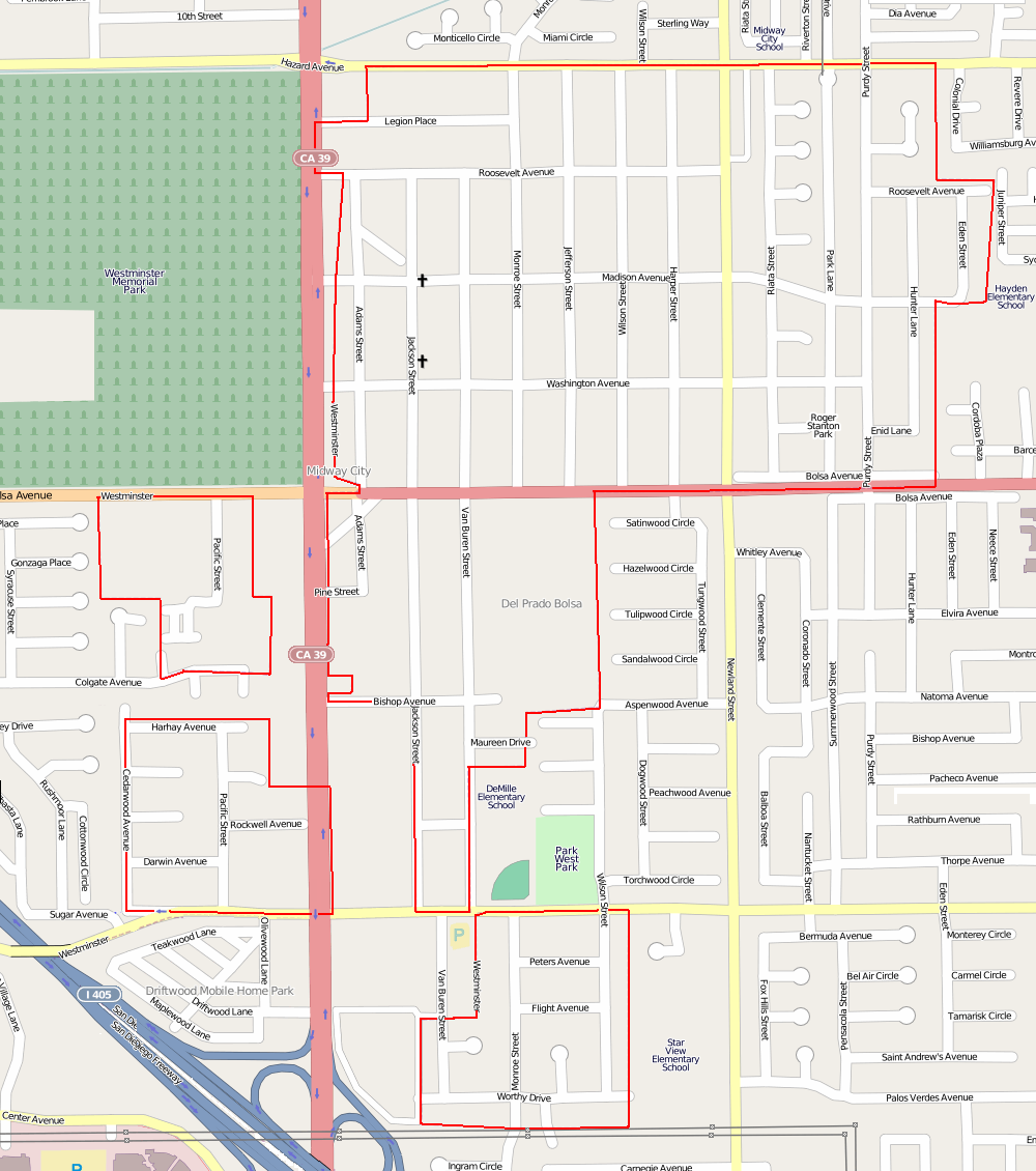
English: Midway City, California, computer image generated using OpenStreetMap |
| Date | |
| Source | Clip from OpenStreetMap. |
| Author | Self |
| Permission (Reusing this file) |
All OpenStreetMap data and maps are Creative Commons "CC-BY-SA 2.0" licensed This file is licensed under the Creative Commons Attribution-Share Alike 2.0 Generic license.
|
| Camera location | | View this and other nearby images on: OpenStreetMap |
|---|
File history
Click on a date/time to view the file as it appeared at that time.
| Date/Time | Thumbnail | Dimensions | User | Comment | |
|---|---|---|---|---|---|
| current | 13:05, 24 May 2012 | | 1,000 × 1,130 (253 KB) | wikimediacommons>Uzma Gamal | Midway City has four, not three, sections. |
File usage
The following page uses this file: