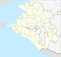
File:Outline Map of Krasnodarski Krai (with Crimea disputed).svg

Size of this PNG preview of this SVG file: 640 × 600 pixels. Other resolutions: 256 × 240 pixels | 820 × 768 pixels | 1,093 × 1,024 pixels | 2,186 × 2,048 pixels | 903 × 846 pixels.
Original file (SVG file, nominally 903 × 846 pixels, file size: 623 KB)
File history
Click on a date/time to view the file as it appeared at that time.
| Date/Time | Thumbnail | Dimensions | User | Comment | |
|---|---|---|---|---|---|
| current | 12:03, 9 April 2020 |  | 903 × 846 (623 KB) | wikimediacommons>RosssW | ГО Сириус |
File usage
The following 33 pages use this file:
- Alexandrovka, Russia
- Anapa Airport
- Armavir air base
- Chushka (rural locality)
- Dolzhanskaya
- Girey, Russia
- Ilsky
- Korenovsk (air base)
- Krasnaya Polyana, Sochi, Krasnodar Krai
- Krasnodar (air base)
- Krasnoselsky, Krasnodar Krai
- Krymsk (air base)
- Kuchugury
- Kushchyovskaya (air base)
- Labinsk
- Leningradskaya (rural locality)
- Molkin
- Neftegorsk, Krasnodar Krai
- Novokubansk
- Novomikhaylovsky
- Primorsko-Akhtarsk air base
- Psebay
- Saratovskaya (rural locality)
- Semyonovka, Russia
- Sirius (urban-type settlement)
- Sochi
- Southern Federal District
- Staronizhestebliyevskaya
- Temryuk
- Tikhoretsk (air base)
- Vesyoloye, Krasnodar Krai
- Yeysk
- Yeysk air base


