File:Pakistan Gilgit-Baltistan relief map.svg

Size of this PNG preview of this SVG file: 800 × 503 pixels. Other resolutions: 320 × 201 pixels | 640 × 402 pixels | 1,024 × 644 pixels | 1,280 × 805 pixels | 2,560 × 1,610 pixels | 1,226 × 771 pixels.
Original file (SVG file, nominally 1,226 × 771 pixels, file size: 1.99 MB)
| This is a file from the Wikimedia Commons. Information from its description page there is shown below. Commons is a freely licensed media file repository. You can help. |
Summary
| Description |
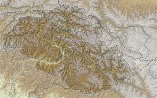
English: Relief map of Gilgit-Baltistan. Coordinates are:
72.4E 77.98E 34.42N 37.2N |
| Date | |
| Source | Derived from File:Pakistan Gilgit-Baltistan location map.svg |
| Author | Own work based on user:Milenioscuro |
Licensing
This file is licensed under the Creative Commons Attribution-Share Alike 4.0 International license.
- You are free:
- to share – to copy, distribute and transmit the work
- to remix – to adapt the work
- Under the following conditions:
- attribution – You must give appropriate credit, provide a link to the license, and indicate if changes were made. You may do so in any reasonable manner, but not in any way that suggests the licensor endorses you or your use.
- share alike – If you remix, transform, or build upon the material, you must distribute your contributions under the same or compatible license as the original.
File history
Click on a date/time to view the file as it appeared at that time.
| Date/Time | Thumbnail | Dimensions | User | Comment | |
|---|---|---|---|---|---|
| current | 07:11, 14 July 2022 | | 1,226 × 771 (1.99 MB) | wikimediacommons>C1MM | Fixed district bound |
File usage
The following 47 pages use this file:
- Attabad Lake
- Babusar Pass
- Baltoro Kangri
- Baltoro Muztagh
- Batura II
- Batura III
- Borith Lake
- Broad Peak
- Broad Peak Central
- Bularung Sar
- Burzil Pass
- Chaqchan Mosque
- Chongra Peak
- Chumik Kangri
- Dansam
- Diamer-Bhasha Dam
- Diran
- Distaghil Sar
- Gasherbrum I
- Gasherbrum II
- Gharkun
- Ghent Kangri
- Gilgit Valley
- Gyong Kangri
- Hunza River
- Kachura Lake
- Kanjut Sar
- Kharmang Valley
- Lower Kachura Lake
- Masherbrum
- Muztagh Tower
- Nanga Parbat
- Pumari Chhish
- Rakaposhi
- Rama Lake (Pakistan)
- Rush Lake (Pakistan)
- Sacred Rock of Hunza
- Satpara Dam
- Satpara Lake
- Sheosar Lake
- Sherpi Kangri
- Shigar River
- Skyang Kangri
- Spantik
- Trivor
- Yukshin Gardan Sar
- Yutmaru Sar