
File:Reigate and Banstead UK locator map.svg

Size of this PNG preview of this SVG file: 790 × 599 pixels. Other resolutions: 317 × 240 pixels | 633 × 480 pixels | 1,013 × 768 pixels | 1,280 × 971 pixels | 2,560 × 1,942 pixels | 1,425 × 1,081 pixels.
Original file (SVG file, nominally 1,425 × 1,081 pixels, file size: 948 KB)
| This is a file from the Wikimedia Commons. Information from its description page there is shown below. Commons is a freely licensed media file repository. You can help. |
| Description |
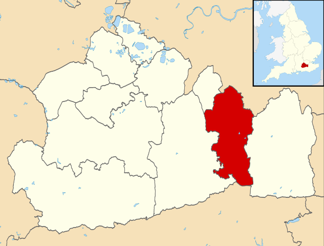
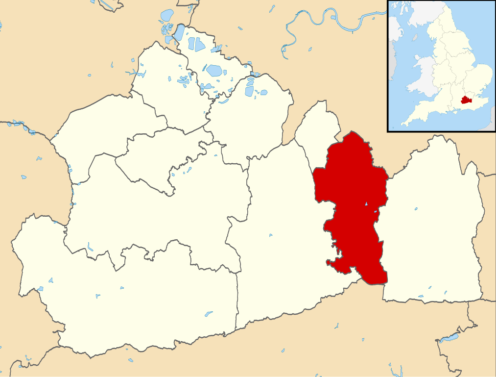
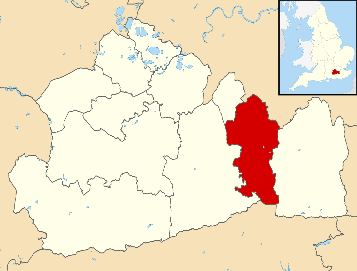
Map of Surrey, UK with Reigate and Banstead highlighted. Equirectangular map projection on WGS 84 datum, with N/S stretched 160% |
| Date | |
| Source |
|
| Author | Nilfanion, created using Ordnance Survey data |
| Permission (Reusing this file) |
This file is licensed under the Creative Commons Attribution-Share Alike 3.0 Unported license. Attribution: Contains Ordnance Survey data © Crown copyright and database right
|
File history
Click on a date/time to view the file as it appeared at that time.
| Date/Time | Thumbnail | Dimensions | User | Comment | |
|---|---|---|---|---|---|
| current | 10:27, 2 August 2011 | | 1,425 × 1,081 (948 KB) | wikimediacommons>Nilfanion | {{Information |Description=Map of Surrey, UK with w:Reigate and Banstead highlighted. Equirectangular map projection on WGS 84 datum, with N/S stretched 160% |Source=Ordnance Survey [https://www.ordnancesurvey.co.u |
File usage
The following 23 pages use this file:
- Banstead
- Chipstead, Surrey
- Chipstead Downs
- Chipstead railway station
- Earlswood
- East Surrey College
- East Surrey Hospital
- Grade II* listed buildings in Reigate and Banstead
- Hooley
- Kingswood railway station
- List of places of worship in Reigate and Banstead
- Lower Kingswood
- Meadvale
- Redhill, Surrey
- Reigate Priory F.C.
- Reigate School
- Reigate St Mary's School
- Reigate and Banstead
- Royal Earlswood Hospital
- Salfords
- Tadworth
- Woodmansterne
- Template:Reigate and Banstead