
File:Tectonic plates (2022).svg

Size of this PNG preview of this SVG file: 800 × 406 pixels. Other resolutions: 320 × 163 pixels | 640 × 325 pixels | 1,024 × 520 pixels | 1,280 × 650 pixels | 2,560 × 1,300 pixels | 1,920 × 975 pixels.
Original file (SVG file, nominally 1,920 × 975 pixels, file size: 346 KB)
| This is a file from the Wikimedia Commons. Information from its description page there is shown below. Commons is a freely licensed media file repository. You can help. |
Summary
| Description |
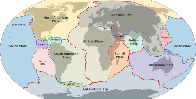
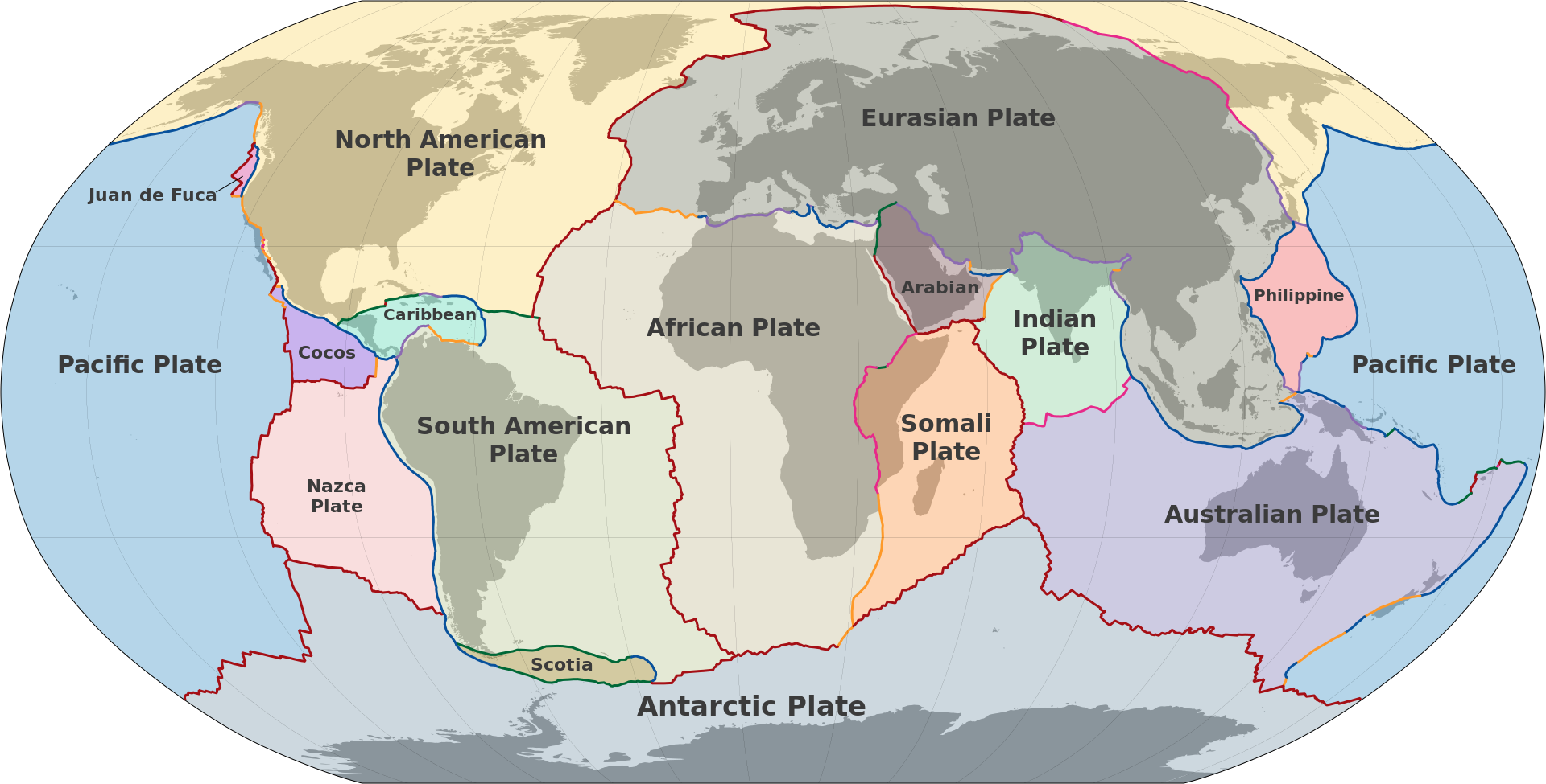
English: Map of Earth's principal tectonic plates. Plate boundary types: Spreading center
Extension zone
Convergent: Subduction zone
Collision zone
Transform: Dextral transform
Sinistral transform |
| Date | |
| Source | Own work based on: Hasterok, Derrick (8 June 2022). New maps of global geological provinces and tectonic plates. American Institute of Physics - Phys.org. Retrieved on 27 March 2023. |
| Author | M.Bitton |
| Other versions |
[]
|
| SVG development | This vector image was created with a text editor. |

.svg)
_es.svg)
_gl.svg)
_lt.svg)
_mk.svg)
.svg)
Licensing
I, the copyright holder of this work, hereby publish it under the following license:
This file is licensed under the Creative Commons Attribution-Share Alike 3.0 Unported license.
- You are free:
- to share – to copy, distribute and transmit the work
- to remix – to adapt the work
- Under the following conditions:
- attribution – You must give appropriate credit, provide a link to the license, and indicate if changes were made. You may do so in any reasonable manner, but not in any way that suggests the licensor endorses you or your use.
- share alike – If you remix, transform, or build upon the material, you must distribute your contributions under the same or compatible license as the original.
File history
Click on a date/time to view the file as it appeared at that time.
| Date/Time | Thumbnail | Dimensions | User | Comment | |
|---|---|---|---|---|---|
| current | 00:09, 29 September 2023 | | 1,920 × 975 (346 KB) | wikimediacommons>Jordirooca | File uploaded using svgtranslate tool (https://svgtranslate.toolforge.org/). Added translation for ca. |
File usage
The following 5 pages use this file:
.svg)