
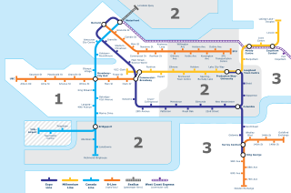
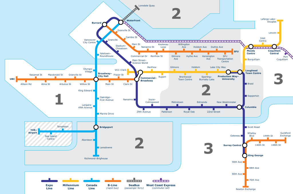
File:Vancouver Transit Network Map.svg

Size of this PNG preview of this SVG file: 800 × 530 pixels. Other resolutions: 320 × 212 pixels | 640 × 424 pixels | 1,024 × 678 pixels | 1,280 × 848 pixels | 2,560 × 1,696 pixels | 4,000 × 2,650 pixels.
Original file (SVG file, nominally 4,000 × 2,650 pixels, file size: 618 KB)
| This is a file from the Wikimedia Commons. Information from its description page there is shown below. Commons is a freely licensed media file repository. You can help. |
Summary
| Description |
English: Map of Vancouver's Skytrain, SeaBus, B-Line, and WCE network |
| Date | |
| Source | Own work |
| Author | Sweetnhappy |
| Other versions |
|
Licensing
This file is licensed under the Creative Commons Attribution-Share Alike 4.0 International license.
Attribution: Paul Wittal (png version)
- You are free:
- to share – to copy, distribute and transmit the work
- to remix – to adapt the work
- Under the following conditions:
- attribution – You must give appropriate credit, provide a link to the license, and indicate if changes were made. You may do so in any reasonable manner, but not in any way that suggests the licensor endorses you or your use.
- share alike – If you remix, transform, or build upon the material, you must distribute your contributions under the same or compatible license as the original.
File history
Click on a date/time to view the file as it appeared at that time.
| Date/Time | Thumbnail | Dimensions | User | Comment | |
|---|---|---|---|---|---|
| current | 09:16, 28 April 2017 | | 4,000 × 2,650 (618 KB) | wikimediacommons>The Big H 2014 | Fixed 76th Ave |
File usage
The following 2 pages use this file: