
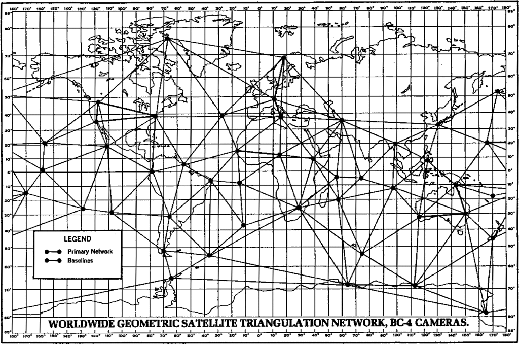
File:WORLDWIDE GEOMETRIC SATELLITE TRIANGULATION NETWORK, BC-4 CAMERAS.GIF

Size of this preview: 800 × 530 pixels. Other resolutions: 320 × 212 pixels | 640 × 424 pixels | 1,024 × 678 pixels | 1,322 × 875 pixels.
Original file (1,322 × 875 pixels, file size: 121 KB, MIME type: image/gif)
| This is a file from the Wikimedia Commons. Information from its description page there is shown below. Commons is a freely licensed media file repository. You can help. |

|
This map image could be re-created using vector graphics as an SVG file. This has several advantages; see Commons:Media for cleanup for more information. If an SVG form of this image is available, please upload it and afterwards replace this template with
{{vector version available|new image name}}.It is recommended to name the SVG file “WORLDWIDE GEOMETRIC SATELLITE TRIANGULATION NETWORK, BC-4 CAMERAS.svg”—then the template Vector version available (or Vva) does not need the new image name parameter. |
Summary
| Description | taken from the public domain booklet Geodesy for the Layman at http://www.ngs.noaa.gov/PUBS_LIB/Geodesy4Layman/TR80003E.HTM#ZZ11 |
| Source | |
| Author |
Licensing
This work is in the public domain in the United States because it is a work prepared by an officer or employee of the United States Government as part of that person’s official duties under the terms of Title 17, Chapter 1, Section 105 of the US Code.
Note: This only applies to original works of the Federal Government and not to the work of any individual U.S. state, territory, commonwealth, county, municipality, or any other subdivision. This template also does not apply to postage stamp designs published by the United States Postal Service since 1978. (See § 313.6(C)(1) of Compendium of U.S. Copyright Office Practices). It also does not apply to certain US coins; see The US Mint Terms of Use.
|
 | |
| This file has been identified as being free of known restrictions under copyright law, including all related and neighboring rights. | ||
Original upload log
The original description page was here. All following user names refer to en.wikipedia.
- 2004-07-26 22:22 The Anome 650×447×1 (21121 bytes) {{PD}} taken from the public domain booklet Geodesy for the Layman at http://www.ngs.noaa.gov/PUBS_LIB/Geodesy4Layman/TR80003E.HTM#ZZ11
File history
Click on a date/time to view the file as it appeared at that time.
| Date/Time | Thumbnail | Dimensions | User | Comment | |
|---|---|---|---|---|---|
| current | 17:21, 30 May 2013 | | 1,322 × 875 (121 KB) | wikimediacommons>Quibik | Clearer version from http://www.ngs.noaa.gov/PUBS_LIB/GeoLay.pdf p. 88. Deskewed and cropped. |
File usage
The following 2 pages use this file: