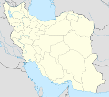
Minu Island
Native name: Persian: جزیره مینو | |
|---|---|
 Palm and sunset on Minu Island | |
| Geography | |
| Location | Khuzestan, Iran |
| Coordinates | 30°20′33″N 48°13′00″E / 30.34250°N 48.21667°E[1] |
| Area | 17.8 km2 (6.9 sq mi) |
| Administration | |
Iran | |
| Demographics | |
| Population | 9,154[2] (2016) |
Minu Island (Persian: جزیره مینو and Arabic: جزيرة صلبوخ), also Romanized as Jazireh-ye Minu and Minoo Island, is in Khorramshahr County of Khuzestan province in the Persian Gulf, in southwestern Iran.[1]
The island is between the cities of Abadan and Khorramshahr. Much of the island population comprises Arabs.[3][4] Minu District, which includes the city of Minushahr, is nearly co-extensive with the island.[1]
Demographics
Population
At the time of the 2006 National Census, the district's population (comprising most of the island's inhabitants), was 7,582 in 1,562 households.[5] The following census in 2011 counted 8,267 people in 2,139 households.[6] The 2016 census measured the population of the rural district as 9,154 in 2,549 households.[2]
See also
Lua error in mw.title.lua at line 346: bad argument #2 to 'title.new' (unrecognized namespace name 'Portal').
References
- ^ 1.0 1.1 1.2 OpenStreetMap contributors (13 August 2024). "Minu Island, Iran" (Map). OpenStreetMap (in فارسی). Retrieved 13 August 2024.
- ^ 2.0 2.1 "Census of the Islamic Republic of Iran, 1395 (2016)". AMAR (in فارسی). The Statistical Center of Iran. p. 06. Archived from the original (Excel) on 21 October 2020. Retrieved 19 December 2022.
- ^ Rahmati, Hamid; Farshchi, Parvin; Pournoori, Mansoor (1 May 2022). "Zoning of the southern coastal region of the IRAN based on Pollution of water resources (Case study: Minoo Island)". Anthropogenic Pollution. 6 (1): 100–108. doi:10.22034/ap.2022.1951890.1128. ISSN 2783-1736. (PDF)
- ^ Asl, Sina Razzaghi (2022). "Green-oriented planning for shrinking cities through an integrated ecosystem services/disservices analysis: A Case of Minoo Island, Iran". International Review for Spatial Planning and Sustainable Development. 10 (1): 183–208. doi:10.14246/irspsd.10.1_183. S2CID 245974522. (PDF)
- ^ "Census of the Islamic Republic of Iran, 1385 (2006)". AMAR (in فارسی). The Statistical Center of Iran. p. 06. Archived from the original (Excel) on 20 September 2011. Retrieved 25 September 2022.
- ^ "Census of the Islamic Republic of Iran, 1390 (2011)". Syracuse University (in فارسی). The Statistical Center of Iran. p. 06. Archived from the original (Excel) on 18 January 2023. Retrieved 19 December 2022.
- CS1 فارسی-language sources (fa)
- Short description with empty Wikidata description
- Articles containing Persian-language text
- Pages using Lang-xx templates
- Coordinates not on Wikidata
- Articles containing Arabic-language text
- Khorramshahr County
- Populated places in Khorramshahr County
- Islands of Iran
- Landforms of Khuzestan province
- Khorramshahr County geography stubs

