
Højer
Højer | |
|---|---|
Town | |
 View over the town from the watertower | |
.svg) Højer Location in Region of Southern Denmark  Højer Højer (Denmark) | |
| Coordinates: 54°57′51″N 8°41′50″E / 54.96417°N 8.69722°E | |
| Country | Denmark |
| Region | Southern Denmark |
| Municipality | Tønder Municipality |
| Area | |
| • Town | 86.9 km2 (33.6 sq mi) |
| • Land | 22.5 km2 (8.7 sq mi) |
| • Urban | 1.0 km2 (0.4 sq mi) |
| Population (2024)[1] | |
| • Urban | 1,066 |
| • Urban density | 1,100/km2 (2,800/sq mi) |
| Time zone | UTC+1 (CET) |
| • Summer (DST) | UTC+2 (CEST) |
| Postal code | DK-6280 Højer |
Højer (‹See Tfd›German: Hoyer; North Frisian: Huuger), is a town with a population of 1,066 (1 January 2024),[1] which was the seat of the former Højer municipality in south Denmark, in Region of Southern Denmark on the west coast of the Jutland peninsula.
Højer Municipality
The former Højer Municipality covered an area of 117 km2, and had a total population of 2,861 (2005). Its last mayor was Peter Christensen, a member of the Social Democrats (Socialdemokraterne) political party.
The coastal area of the former municipality is a nature reserve.
The municipality was created in 1970 due to a kommunalreform ("Municipality Reform") that combined a number of existing parishes:
- Daler Parish
- Emmerlev Parish
- Hjerpsted Parish
- Højer Parish
On 1 January 2007 Højer municipality ceased to exist due to Kommunalreformen ("The Municipality Reform" of 2007). It was merged with Bredebro, Løgumkloster, Nørre-Rangstrup, Skærbæk, and Tønder municipalities to form the new Tønder Municipality. This created a municipality with an area of 1,352 km2 and a total population of 42,645 (2005).
Photos
-
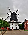 Windmill

References
- ^ 1.0 1.1 BY3: Population 1. January by rural and urban areas, area and population density The Mobile Statbank from Statistics Denmark
External links
- Tønder municipality's official website (in Danish)
- Weather forecast Højer, Denmark weather-atlas.com
Further reading
- Municipal statistics: NetBorger Kommunefakta, delivered from KMD aka Kommunedata (Municipal Data)
- Municipal mergers and neighbors: Eniro new municipalities map
This article about a location in the Region of Southern Denmark is a stub. You can help Wikipedia by expanding it. |
- Short description with empty Wikidata description
- Coordinates not on Wikidata
- Use dmy dates from April 2014
- Articles containing German-language text
- Pages using Lang-xx templates
- Articles containing North Frisian-language text
- Articles containing Danish-language text
- Articles with Danish-language sources (da)
- Former municipalities of Denmark
- Cities and towns in the Region of Southern Denmark
- Tønder Municipality
- Region of Southern Denmark stubs