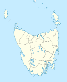
Smithton Airport
(Redirected from YSMI)
This article needs additional citations for verification. (December 2009) |
Smithton Airport | |||||||||||||||
|---|---|---|---|---|---|---|---|---|---|---|---|---|---|---|---|
| File:Smithton Airport 2016.png | |||||||||||||||
| Summary | |||||||||||||||
| Airport type | Public | ||||||||||||||
| Operator | DIER | ||||||||||||||
| Location | Smithton, Tasmania | ||||||||||||||
| Elevation AMSL | 31 ft / 9 m | ||||||||||||||
| Coordinates | 40°50′06″S 145°05′00″E / 40.83500°S 145.08333°E | ||||||||||||||
| Maps | |||||||||||||||
| <mapframe height="200" zoom="14" frameless="1" width="300">{"properties":{"stroke-width":2,"stroke":"#000000","title":"Smithton Airport"},"type":"ExternalData","service":"geoshape"}</mapframe> | |||||||||||||||
| <mapframe zoom="10" frameless="1" align="center" longitude="145.08333333333" latitude="-40.835" height="200" width="270">{"type":"Feature","geometry":{"coordinates":[145.08333333333334,-40.835],"type":"Point"},"properties":{"marker-color":"#5E74F3","title":"Smithton Airport","marker-symbol":"airport"}}</mapframe> | |||||||||||||||
| Runways | |||||||||||||||
| |||||||||||||||
Smithton Airport (IATA: SIO, ICAO: YSMI) is an Australian regional airport located 2 nautical miles (3.7 km; 2.3 mi) west of Smithton, a town in Tasmania's north-west.[1] The airport is operated by the Tasmanian Department of Infrastructure, Energy and Resources.
See also
References
- ^ 1.0 1.1 YSMI – Smithton (PDF). AIP En Route Supplement from Airservices Australia, effective 13 June 2024, Aeronautical Chart Archived 10 April 2012 at the Wayback Machine
External links
Lua error in mw.title.lua at line 346: bad argument #2 to 'title.new' (unrecognized namespace name 'Portal').
Categories:
- Webarchive template wayback links
- Short description with empty Wikidata description
- Use Australian English from May 2013
- All Wikipedia articles written in Australian English
- Articles needing additional references from December 2009
- All articles needing additional references
- Coordinates not on Wikidata
- Infobox mapframe without OSM relation ID on Wikidata
- Airports in Tasmania
- North West Tasmania
- Australian airport stubs
