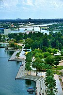
Al-Shu'ala
This article needs additional citations for verification. (July 2024) |
Al-Shu'ala
حي الشعلة Hayy Al-Shu'ala | |
|---|---|
Neighborhood | |
| Nicknames: Madinat Al-Noor,
Shu'lat Al-Sadrain | |
| Country | Iraq |
| Governorate | Baghdad Governorate |
| Established date | 1960 |
| Time zone | UTCUTC +3 |
| Postal code | 5789 |
| Area code | +964 |
Al-Shu'ala is a lower middle class district of Baghdad, Iraq.[1][2] It is heavily populated and its inhabitants are working class families of limited income. There is a Shiite majority of nearly 99%.
Al-Shu'ala features a canal that stretches from the far east of the city to the west called al Mashrou'(المشروع) or "the project".
Al-Shu'ala contains 27 sectors, including Al shu'ala (الشعلة), Al rahmaniyya (الرحمانية), Al dawanim (الدوانم), Um najm (أم نجم), Al jawadain (الجوادين), Al salamiyat (السلاميات), Al sabiyat (الصابيات), Al dahna (الدهنة) and Al khateeb (الخطيب).
References
- ^ McCarron, Leon; Al Sarai, Mohammed (Spring 2022). "The Marsh Guide and the English Explorer". AramcoWorld. Retrieved 2024-07-10.
- ^ Saadoon, Mustafa (2021-10-11). "Iraq's elections reveal generational gap, state-society divide". Amwaj.media. Retrieved 2024-07-10.
Categories:
- Articles needing additional references from July 2024
- Articles with invalid date parameter in template
- All articles needing additional references
- Short description with empty Wikidata description
- Pages using infobox settlement with no coordinates
- Iraq articles missing geocoordinate data
- All articles needing coordinates
- Neighborhoods in Baghdad
- Baghdad stubs
- Iraq geography stubs
