
Baruth/Mark
Baruth/Mark | |
|---|---|
 Saint Sebastian parish church | |
 Coat of arms | |
Location of Baruth/Mark within Teltow-Fläming district <imagemap>File: Baruth-Mark in TF.png | 240x240px poly 157 149 165 143 157 136 161 118 162 99 154 96 176 97 201 103 201 113 189 115 193 127 205 140 191 144 185 150 178 155 Am Mellensee poly 165 212 192 205 214 211 230 194 261 187 254 174 260 166 239 154 223 149 219 152 204 141 189 143 187 154 171 161 191 165 192 190 170 192 158 197 Baruth/Mark poly 183 58 174 55 169 48 168 31 179 39 180 30 178 12 180 12 198 21 205 34 214 34 212 43 200 44 Blankenfelde-Mahlow poly 184 276 181 245 184 232 160 240 151 221 159 209 161 207 171 214 182 206 192 206 190 227 200 228 196 248 205 246 226 253 233 257 223 277 231 281 212 288 Dahme poly 227 253 235 243 232 236 229 232 206 226 198 230 193 247 209 244 Dahmetal poly 141 45 155 35 176 44 179 33 179 7 169 0 150 26 140 30 Großbeeren poly 187 281 183 236 168 237 171 254 161 264 159 274 Ihlow poly 107 211 88 208 74 201 79 186 64 177 59 153 76 148 98 153 104 156 124 184 134 200 123 213 Jüterbog poly 128 179 129 169 131 158 127 139 116 144 108 133 105 129 96 140 98 156 110 159 123 180 Luckenwalde poly 154 70 133 68 128 66 122 80 110 71 111 66 112 55 122 50 116 44 118 42 140 38 141 47 150 38 163 39 169 41 185 61 172 76 154 79 Ludwigsfelde poly 153 271 173 249 167 236 155 232 149 220 158 207 141 201 132 202 125 213 109 214 106 217 96 224 110 233 93 239 94 253 115 250 114 259 118 244 139 254 134 264 136 279 155 280 Niederer Fläming poly 96 254 94 240 111 237 102 226 103 216 69 202 75 188 41 174 29 184 18 197 3 202 2 208 11 214 27 204 27 227 42 228 55 222 68 241 84 241 77 250 Niedergörsdorf poly 153 202 132 196 125 177 128 139 117 141 103 131 92 140 99 160 71 152 55 124 89 103 121 102 125 117 136 110 130 123 143 122 149 115 165 105 160 142 154 151 172 153 181 169 189 164 189 188 174 189 157 197 Nuthe-Urstromtal poly 224 65 208 57 216 51 218 47 199 39 181 55 193 71 206 72 Rangsdorf poly 147 123 151 112 163 106 157 80 151 66 131 68 121 76 112 75 99 85 93 107 118 98 123 99 127 119 134 112 132 120 Trebbin poly 229 149 228 101 236 103 223 74 204 82 203 79 183 61 174 75 154 75 155 96 177 96 199 99 206 111 188 116 205 140 212 153 Zossen poly 0 85 0 0 87 0 88 86 Brandenburg desc bottom-right </imagemap> | |
 Baruth/Mark  Baruth/Mark | |
| Coordinates: 52°03′N 13°30′E / 52.050°N 13.500°E | |
| Country | Germany |
| State | Brandenburg |
| District | Teltow-Fläming |
| Subdivisions | 12 Ortsteile bzw. Stadtbezirke |
| Government | |
| • Mayor (2018–26) | Peter Ilk[1] |
| Area | |
| • Total | 233.62 km2 (90.20 sq mi) |
| Highest elevation | 145 m (476 ft) |
| Lowest elevation | 51 m (167 ft) |
| Population (2022-12-31)[2] | |
| • Total | 4,318 |
| • Density | 18/km2 (48/sq mi) |
| Time zone | UTC+01:00 (CET) |
| • Summer (DST) | UTC+02:00 (CEST) |
| Postal codes | 15837 |
| Dialling codes | 033704 |
| Vehicle registration | TF |
| Website | www.stadt-baruth-mark.de |
Baruth/Mark is a town in the Teltow-Fläming district of Brandenburg, Germany. It is situated 24 km east of Luckenwalde, and 53 km south of Berlin.
Geography
Baruth/Mark is structured in the following parts of town,[3] which are all villages and mainly former municipalities:
- Baruth/Mark
- Klein Ziescht
- Dornswalde
- Groß Ziescht
- Kemlitz
- Horstwalde
- Klasdorf
- Glashütte
- Ließen
- Merzdorf
- Mückendorf
- Paplitz
- Petkus
- Charlottenfelde
- Radeland
- Schöbendorf
Demography
-
 Development of Population since 1875 within the Current Boundaries (Blue Line: Population; Dotted Line: Comparison to Population Development of Brandenburg state; Grey Background: Time of Nazi rule; Red Background: Time of Communist rule)
 -
 Recent Population Development and Projections (Population Development before Census 2011 (blue line); Recent Population Development according to the Census in Germany in 2011 (blue bordered line); Official projections for 2005-2030 (yellow line); for 2017-2030 (scarlet line); for 2020-2030 (green line)
|
|
|
Climate
| Climate data for Baruth (1991–2020 normals) | |||||||||||||
|---|---|---|---|---|---|---|---|---|---|---|---|---|---|
| Month | Jan | Feb | Mar | Apr | May | Jun | Jul | Aug | Sep | Oct | Nov | Dec | Year |
| Mean daily maximum °C (°F) | 3.5 (38.3) |
5.4 (41.7) |
9.5 (49.1) |
16.0 (60.8) |
20.4 (68.7) |
24.0 (75.2) |
25.7 (78.3) |
25.0 (77.0) |
20.5 (68.9) |
14.6 (58.3) |
8.7 (47.7) |
4.7 (40.5) |
14.8 (58.6) |
| Daily mean °C (°F) | 0.8 (33.4) |
1.8 (35.2) |
4.5 (40.1) |
9.5 (49.1) |
14.0 (57.2) |
17.5 (63.5) |
19.4 (66.9) |
18.5 (65.3) |
14.4 (57.9) |
9.7 (49.5) |
5.4 (41.7) |
2.3 (36.1) |
9.9 (49.8) |
| Mean daily minimum °C (°F) | −2.4 (27.7) |
−1.9 (28.6) |
−0.4 (31.3) |
2.4 (36.3) |
6.6 (43.9) |
10.3 (50.5) |
12.6 (54.7) |
11.8 (53.2) |
8.3 (46.9) |
5.0 (41.0) |
1.8 (35.2) |
−0.8 (30.6) |
4.4 (39.9) |
| Average precipitation mm (inches) | 42.7 (1.68) |
32.6 (1.28) |
38.3 (1.51) |
29.6 (1.17) |
53.1 (2.09) |
50.4 (1.98) |
79.1 (3.11) |
58.0 (2.28) |
45.1 (1.78) |
40.5 (1.59) |
43.1 (1.70) |
41.6 (1.64) |
558.7 (22.00) |
| Average precipitation days (≥ 0.1 mm) | 16.3 | 14.0 | 15.0 | 10.9 | 12.6 | 13.1 | 13.3 | 12.6 | 11.6 | 13.3 | 14.8 | 16.8 | 164.0 |
| Average relative humidity (%) | 85.1 | 81.0 | 75.9 | 68.0 | 67.4 | 67.6 | 69.0 | 71.1 | 76.4 | 82.9 | 87.1 | 85.9 | 76.3 |
| Mean monthly sunshine hours | 54.7 | 78.5 | 128.0 | 200.8 | 223.3 | 228.0 | 234.3 | 218.8 | 174.1 | 115.8 | 64.6 | 48.9 | 1,814.2 |
| Source: NOAA[5] | |||||||||||||
Photogallery
-
 Street sign on entry to Baruth/Mark
 -
 Firehouse
 -
Castle Baruth
-
Fascia detail, Castle Baruth
-
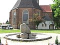 Cathedral
 -
 Municipal Playground


Sons and daughters of the town

- Christian Kunth (1757-1829), educator, educator of Alexander and Wilhelm von Humboldt
- Johann Gottlob Nathusius (1760-1835), entrepreneur
- Johann Georg Lehmann (1765-1811), surveyor and cartographer
- Friedrich zu Solms-Baruth (1795-1879), politician, member of Prussian parliament
- Ewald von Lochow (1855-1942), Prussian general
- Feodora Schenk (1920-2006), German athlete
References
- ^ Landkreis Teltow-Fläming Wahl der Bürgermeisterin / des Bürgermeisters, accessed 4 July 2021.
- ^ "Bevölkerungsentwicklung und Bevölkerungsstandim Land Brandenburg Dezember 2022" (PDF). Amt für Statistik Berlin-Brandenburg (in German). June 2023.
{{cite web}}: CS1 maint: unrecognized language (link) - ^ Main constitution of the town of Baruth/Mark PDF[permanent dead link] (in German)
- ^ Detailed data sources are to be found in the Wikimedia Commons.Population Projection Brandenburg at Wikimedia Commons
- ^ "Baruth Climate Normals 1991–2020". National Oceanic and Atmospheric Administration. Archived from the original on 14 September 2023. Retrieved 15 September 2023.
Towns and municipalities in Teltow-Fläming | ||
|---|---|---|
 | ||
This Brandenburg location article is a stub. You can help Wikipedia by expanding it. |
- CS1 maint: unrecognized language
- All articles with dead external links
- Articles with dead external links from October 2016
- Articles with invalid date parameter in template
- Articles with German-language sources (de)
- Short description with empty Wikidata description
- Coordinates not on Wikidata
- Towns in Brandenburg
- Localities in Teltow-Fläming
- Teltow-Fläming
- Fläming Heath
- Brandenburg geography stubs