Darvoz Range
| Darvoz Range | |
|---|---|
| Darvaz Range | |
| Highest point | |
| Peak | Arnavad Peak |
| Elevation | 6,083 m (19,957 ft) |
| Coordinates | 38°34′00″N 71°31′00″E / 38.5667°N 71.5167°E |
| Dimensions | |
| Length | 200 km (120 mi) NE/SW |
| Width | 50 km (31 mi) NW/SE |
| Naming | |
| Native name | Қаторкӯҳи Дарвоз (Tajik) |
| Geography | |
| Country | Tajikistan |
| Region | Gorno-Badakhshan |
| Parent range | Pamir Mountains |
| Geology | |
| Age of rock | Paleozoic |
| Type of rock | Granite and metamorphic schist |
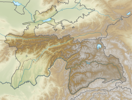
The Darvoz Range or Darvaz Range (Tajik: Қаторкӯҳи Дарвоз, ‹See Tfd›Russian: Дарва́зский хребе́т) is a mountain range in the Western Pamirs, in Gorno-Badakhshan Autonomous Region of Tajikistan. Its name derives from the historical region of Darvaz.[1]
Geography
Starting near the Academy of Sciences Range by Mount Garmo, it stretches roughly southwestwards between the Vanj River and Panj River (following the flows of the two), and the Khingob (Obikhingou), a left tributary of the Vakhsh River. The Vanj River separates it from the Vanj Range. Roughly 750 km2 of the mountain chain are glaciated.[1]
The highest summit of the range is Arnavad Peak (Qullai Arnavad), a 6083 m high ultra-prominent peak.[2][3]

See also
References
Categories:
- Short description with empty Wikidata description
- Coordinates not on Wikidata
- Articles containing Tajik-language text
- Pages using Lang-xx templates
- Articles containing Russian-language text
- Mountain ranges of Tajikistan
- China–Tajikistan border
- Gorno-Badakhshan Autonomous Region
- Pamir Mountains
- Tajikistan geography stubs

