
Farrell Flat
This article needs additional citations for verification. (May 2009) |
| Farrell Flat South Australia | |||||||||||||||
|---|---|---|---|---|---|---|---|---|---|---|---|---|---|---|---|
 Shops in Farrell Flat | |||||||||||||||
 Farrell Flat | |||||||||||||||
| Coordinates | 33°50′0″S 138°48′0″E / 33.83333°S 138.80000°E | ||||||||||||||
| Postcode(s) | 5416 | ||||||||||||||
| Location | |||||||||||||||
| LGA(s) | Regional Council of Goyder | ||||||||||||||
| State electorate(s) | Frome, Stuart | ||||||||||||||
| Federal division(s) | Grey | ||||||||||||||
| Website | Farrell Flat | ||||||||||||||
| |||||||||||||||
Farrell Flat (formerly Hanson)[1] is a town in South Australia. The town is located 20 kilometres (12 mi) east of Clare and 22 kilometres (14 mi) southwest of Burra.

Once the heart of a thriving farming community, Farrell Flat today is largely a satellite town to the larger towns nearby. It has retained its own identity, with a functioning hotel, cafe and meeting house, engineering business and grain silos.
The town was surveyed as Hanson in 1870 and did not officially become Farrell Flat until 19 September 1940.[2] The name Farrell's Flat had been in use for some time, this being the name of the railway station.[3] The nearby town of Davies was officially renamed to Hanson on 19 September 1940.[3]
Farrell Flat was on the Roseworthy-Peterborough railway line. The last train ran through Farrell Flat in 2004.
Farrell Flat was named for Colonial Chaplain and Dean of Adelaide, James Farrell (26 November 1803 – 26 April 1869)
See also
Gallery
-
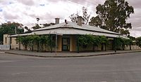 Farrell Flat Hotel in 2013
 -
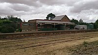 Farrell Flat Railway Station in 2013
 -
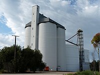 Silos
Silos -
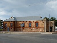 Farrell Flat Institute 1912
 -
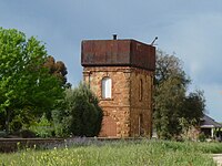 Railway Water Tank
 -
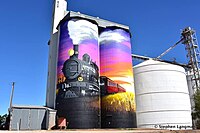 Painted Silos at Farrell Flat
 -
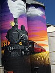 Painted Silos at Farrell Flat


References
- ^ Farrell Flat Archived 1 April 2018 at the Wayback Machine. South Australian History. Retrieved 1 April 2018.
- ^ "NEW TOWN NAMES APPROVED". The Advertiser. South Australia. 26 July 1940. p. 10. Retrieved 5 September 2016 – via National Library of Australia.
- ^ 3.0 3.1 Towns and other places in the District, www.burrahistory.info Retrieved on 8 November 2014
This South Australia geography article is a stub. You can help Wikipedia by expanding it. |
- Webarchive template wayback links
- All articles needing additional references
- Use dmy dates from June 2022
- Articles with invalid date parameter in template
- Use Australian English from March 2013
- All Wikipedia articles written in Australian English
- Short description with empty Wikidata description
- Coordinates not on Wikidata
- Towns in South Australia
- South Australia geography stubs