
File:Distribution of US Rural Population during 1910.pdf
The media handler extension for this file format is missing. Advanced media features may not work unless the file is viewed at Wikimedia Commons.

Size of this preview: 800 × 535 pixels. Other resolutions: 320 × 214 pixels | 640 × 428 pixels | 1,024 × 685 pixels | 1,280 × 857 pixels | 2,468 × 1,652 pixels.
Original file (file size: 64.73 MB, MIME type: application/pdf)
| This is a file from the Wikimedia Commons. Information from its description page there is shown below. Commons is a freely licensed media file repository. You can help. |
Summary
| Description |
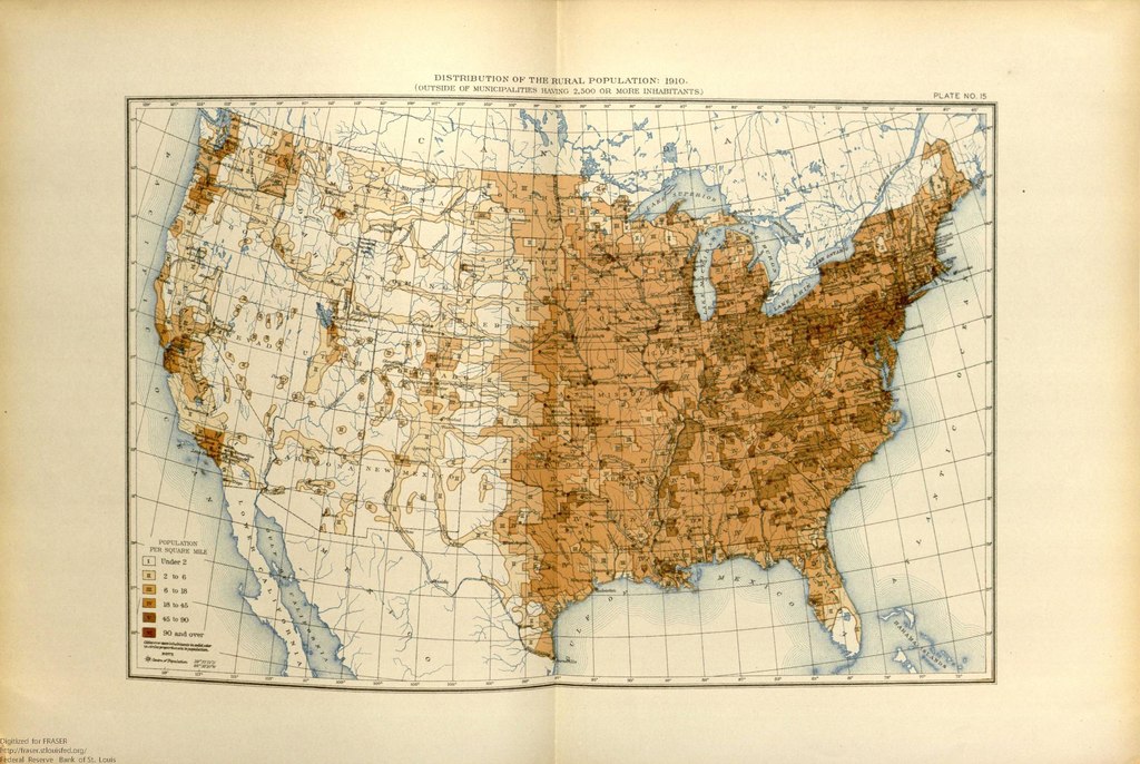
English: This map shows the population distribution of the 46 states and 2 territories of the mainland United States and the remaining extent of the frontier by 1910. |
| Date | |
| Source | United States. Bureau of the Census. "Illustrations: Population" in Statistical Atlas of the United States, 1910 (July 1914). https://fraser.stlouisfed.org/title/74/item/492434, accessed on January 6, 2020. |
| Author | United States Census Bureau |
Licensing
This image or file is a work of a United States Census Bureau employee, taken or made as part of that person's official duties. As a work of the U.S. federal government, the image is in the public domain.
|
 |
File history
Click on a date/time to view the file as it appeared at that time.
| Date/Time | Thumbnail | Dimensions | User | Comment | |
|---|---|---|---|---|---|
| current | 21:05, 6 January 2020 |  | (64.73 MB) | wikimediacommons>Killroy is here | User created page with UploadWizard |
File usage
The following page uses this file: