
File:Fort Sindree after earthquake.tiff
The media handler extension for this file format is missing. Advanced media features may not work unless the file is viewed at Wikimedia Commons.

Size of this preview of this TIF file: 752 × 599 pixels. Other resolutions: 301 × 240 pixels | 602 × 480 pixels | 964 × 768 pixels | 1,280 × 1,020 pixels | 1,419 × 1,131 pixels.
Original file (1,419 × 1,131 pixels, file size: 6.12 MB, MIME type: image/tiff)
| This is a file from the Wikimedia Commons. Information from its description page there is shown below. Commons is a freely licensed media file repository. You can help. |
Summary
| Description |
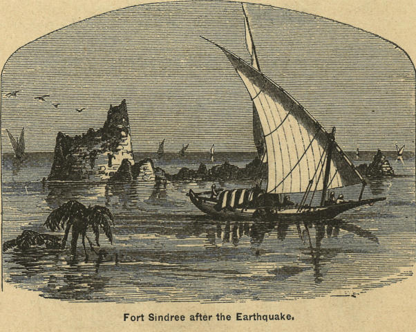
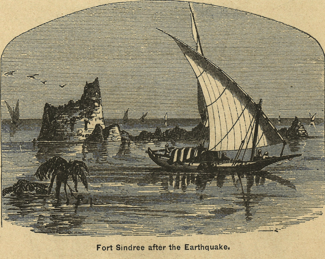
English: The fort and village of Sindree sank so much from the 1819 earthquake only the tops are seen above the water |
| Date | |
| Source | Monteith's Physical and Political Geography |
| Author | James Monteith |
Licensing
This media file is in the public domain in the United States. This applies to U.S. works where the copyright has expired, often because its first publication occurred prior to January 1, 1930, and if not then due to lack of notice or renewal. See this page for further explanation.
|
 | |
 |
File history
Click on a date/time to view the file as it appeared at that time.
| Date/Time | Thumbnail | Dimensions | User | Comment | |
|---|---|---|---|---|---|
| current | 19:11, 9 August 2012 |  | 1,419 × 1,131 (6.12 MB) | wikimediacommons>FAHansson |
File usage
The following page uses this file: