
File:NPS american-samoa-map.pdf
The media handler extension for this file format is missing. Advanced media features may not work unless the file is viewed at Wikimedia Commons.

Size of this preview: 800 × 548 pixels. Other resolutions: 320 × 219 pixels | 640 × 438 pixels | 1,024 × 701 pixels | 1,250 × 856 pixels.
Original file (file size: 290 KB, MIME type: application/pdf)
| This is a file from the Wikimedia Commons. Information from its description page there is shown below. Commons is a freely licensed media file repository. You can help. |
Summary
| Description |
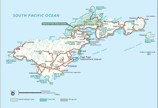
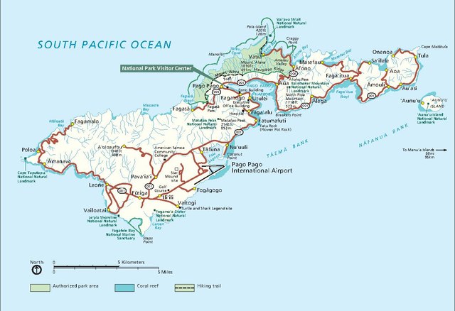
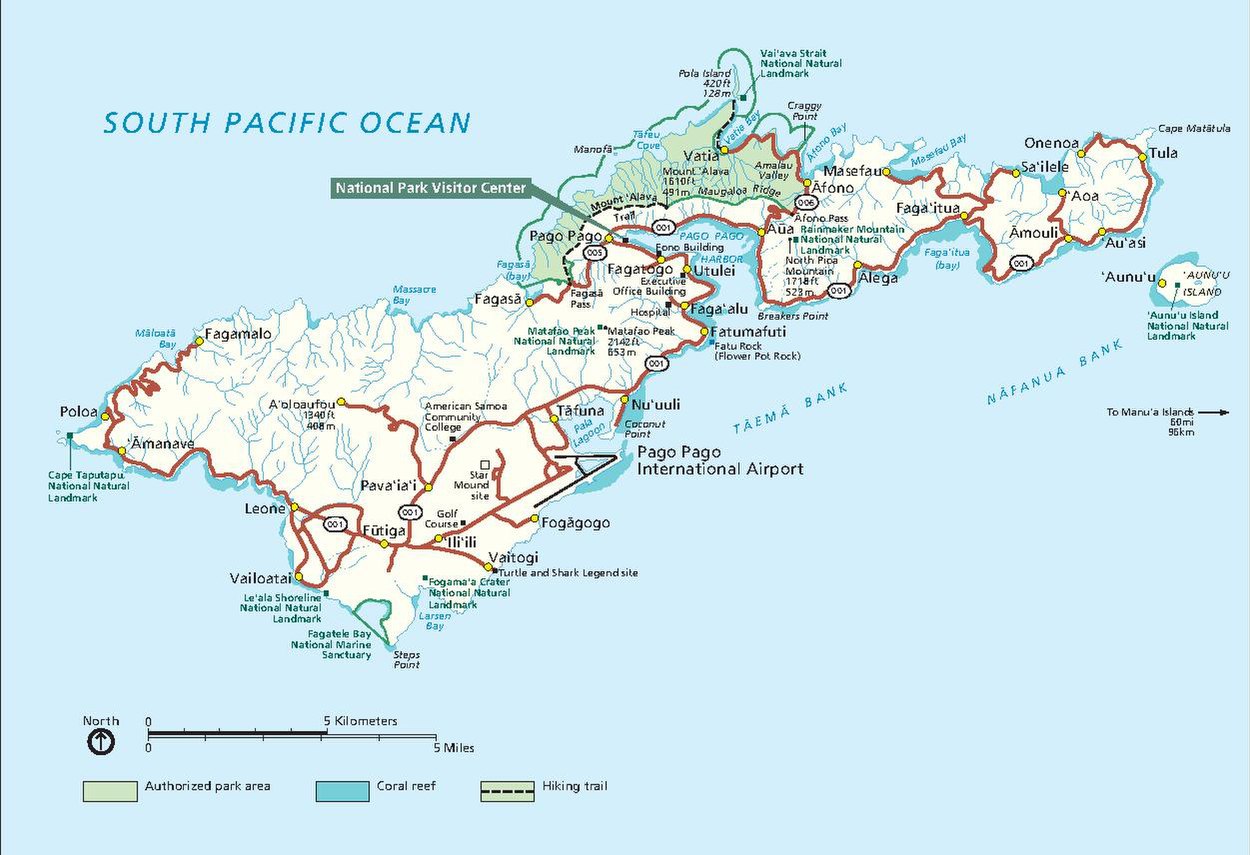
English: Main American Samoa map showing the park lands on Tutuila Island around Pago Pago. |
| Date | |
| Source | American Samoa National Park Maps (https://npmaps.com/american-samoa) |
| Author | U.S. National Park Service, restoration/cleanup by National Park Maps (https://npmaps.com) |
| Other versions |
 |
Licensing
| This image or media file contains material based on a work of a National Park Service employee, created as part of that person's official duties. As a work of the U.S. federal government, such work is in the public domain in the United States. See the NPS website and NPS copyright policy for more information. |
File history
Click on a date/time to view the file as it appeared at that time.
| Date/Time | Thumbnail | Dimensions | User | Comment | |
|---|---|---|---|---|---|
| current | 07:33, 12 May 2017 |  | (290 KB) | wikimediacommons>RKBot | =={{int:filedesc}}== {{Information |description= {{en|1=Main American Samoa map showing the park lands on Tutuila Island around Pago Pago.}} |date= 2016-02-22 |source= U.S. National Park Service (http://npmaps.com/wp-content/uploads/american-samoa-map.... |
File usage
The following page uses this file: