File:Political Map of the Arctic.pdf
The media handler extension for this file format is missing. Advanced media features may not work unless the file is viewed at Wikimedia Commons.
Size of this preview: 786 × 600 pixels. Other resolutions: 315 × 240 pixels | 629 × 480 pixels | 1,007 × 768 pixels | 1,280 × 977 pixels | 2,560 × 1,953 pixels | 4,770 × 3,639 pixels.
Original file (file size: 11.48 MB, MIME type: application/pdf)
| This is a file from the Wikimedia Commons. Information from its description page there is shown below. Commons is a freely licensed media file repository. You can help. |
Summary
| Description |
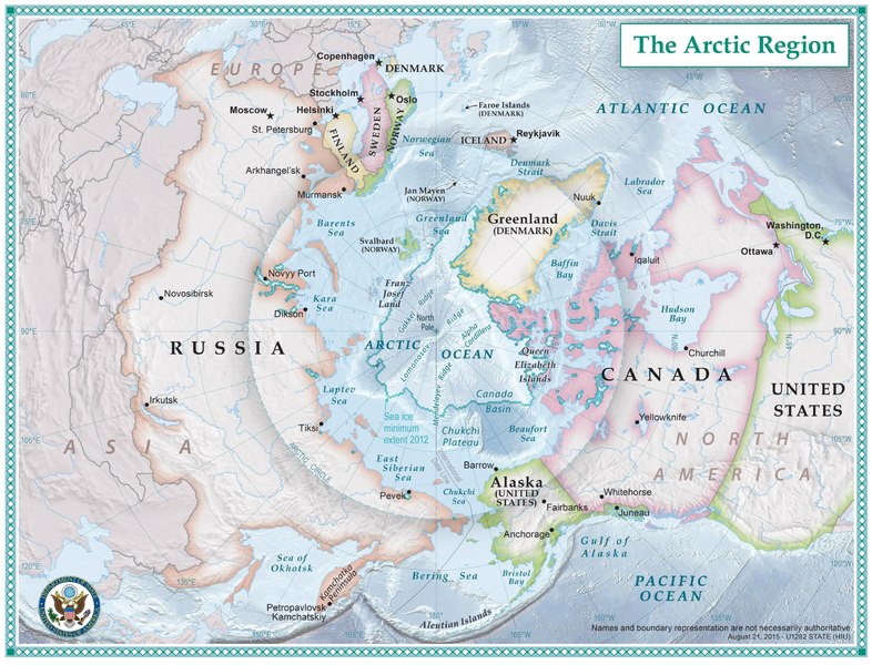
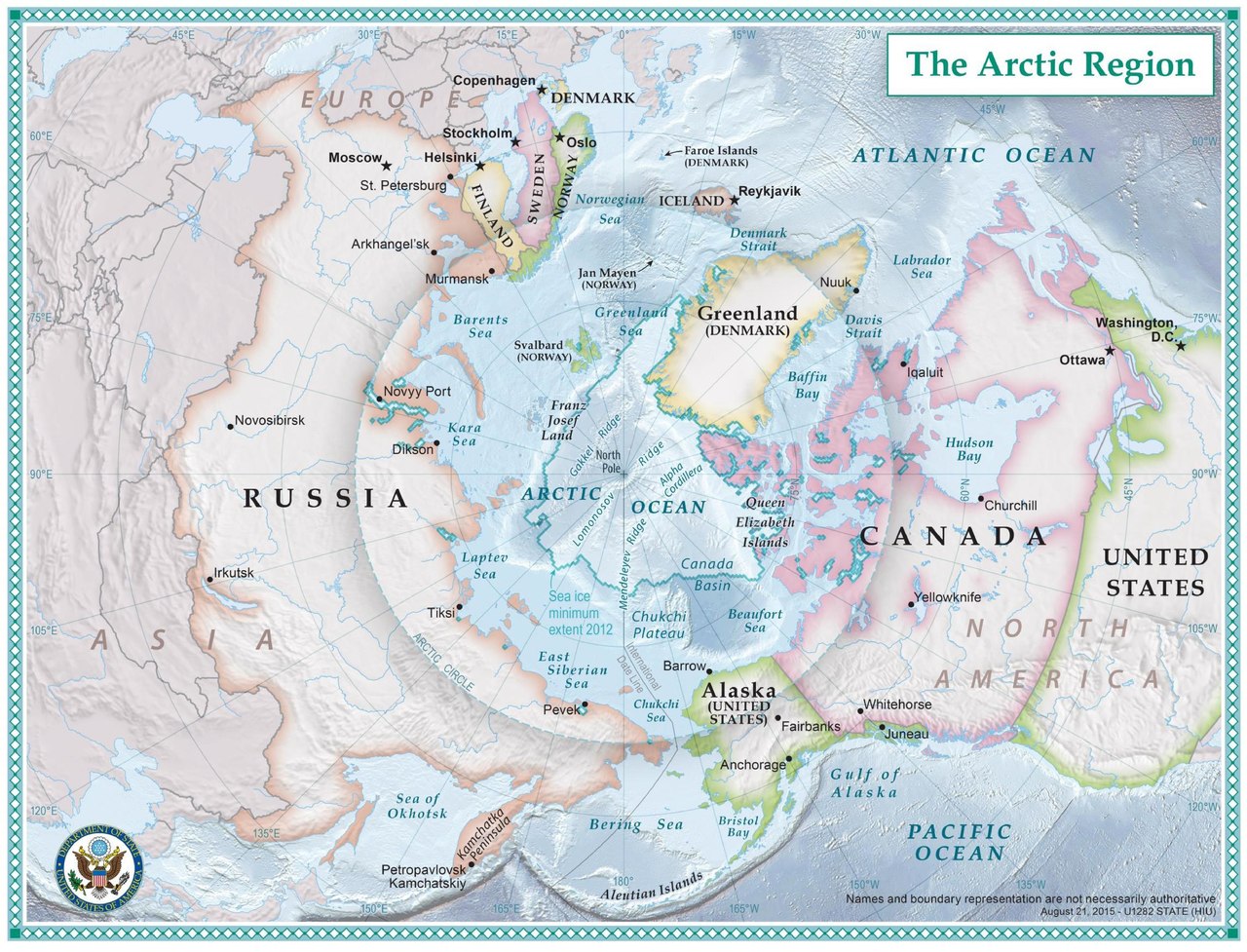
English: The nations which comprise the Arctic region. |
| Date | circa 2014 |
| Source | https://2009-2017.state.gov/e/oes/ocns/opa/arc/uschair/258202.htm . This map of the Arctic was created by State Department geographers as part of the U.S. Chairmanship of the Arctic Council. |
| Author | U.S. State Department |
Licensing
This work is in the public domain in the United States because it is a work prepared by an officer or employee of the United States Government as part of that person’s official duties under the terms of Title 17, Chapter 1, Section 105 of the US Code.
Note: This only applies to original works of the Federal Government and not to the work of any individual U.S. state, territory, commonwealth, county, municipality, or any other subdivision. This template also does not apply to postage stamp designs published by the United States Postal Service since 1978. (See § 313.6(C)(1) of Compendium of U.S. Copyright Office Practices). It also does not apply to certain US coins; see The US Mint Terms of Use.
|
 | |
| This file has been identified as being free of known restrictions under copyright law, including all related and neighboring rights. | ||
File history
Click on a date/time to view the file as it appeared at that time.
| Date/Time | Thumbnail | Dimensions | User | Comment | |
|---|---|---|---|---|---|
| current | 19:16, 24 September 2016 |  | (11.48 MB) | wikimediacommons>Association Chemist | User created page with UploadWizard |
File usage
The following page uses this file: