
Geography of China
 | |
| Continent | Asia |
|---|---|
| Region | East/Southeast Asia |
| Coordinates | 35°0′N 105°0′E / 35.000°N 105.000°E[1] |
| Area | Ranked 3/4 |
| • Total | 9,596,960[1] km2 (3,705,410 sq mi) |
| • Land | 97.2[1]% |
| • Water | 2.8[1]% |
| Coastline | 14,500[1] km (9,000 mi) |
| Borders | Afghanistan, Bhutan, Myanmar, India, North Korea, Kazakhstan, Kyrgyzstan, Pakistan, Laos, Mongolia, Nepal, Russia, Tajikistan, Vietnam |
| Highest point | Mount Everest, 8,848.86 m (29,032 ft)[2] |
| Lowest point | Turpan Pendi, −154 m (−505 ft)[1] |
| Longest river | Yangtze River[3] |
| Largest lake | Qinghai Lake[citation needed] |
| Climate | diverse; ranges from tropical in south to subarctic in north[1] |
| Terrain | mostly mountains, high plateaus, deserts in west and plains, deltas and hills in east[1] |
| Natural resources | coal, iron ore, petroleum, natural gas, mercury, tin, tungsten, antimony, manganese, molybdenum, vanadium, magnetite, aluminum, lead, zinc, rare earth elements, uranium, hydropower potential, arable land[1] |
| Natural hazards | typhoons; damaging floods; tsunamis; earthquakes; droughts; land subsidence[1] |
| Environmental issues | air pollution; water shortages; water pollution; deforestation; soil erosion; desertification; trade in endangered species[1] |


China has great physical diversity. The eastern plains and southern coasts of the country consist of fertile lowlands and foothills. They are the location of most of China's agricultural output and human population. The southern areas of the country (south of the Yangtze River) consist of hilly and mountainous terrain. The west and north of the country are dominated by sunken basins (such as the Gobi and the Taklamakan), rolling plateaus, and towering massifs. It contains part of the highest tableland on earth, the Tibetan Plateau, and has much lower agricultural potential and population.
Traditionally, the Chinese population centred on the Chinese central plain, developing as a country whose center lay in the middle and lower reaches of the Yellow River on the northern plains.[4] More recently, the 18,000 km (11,000 mi) coastline has been used extensively for export-oriented trade, causing the coastal provinces to become the leading economic center.
The People's Republic of China has an area of about 9,600,000 km2 (3,700,000 sq mi). The exact land area is sometimes challenged by border disputes, most notably about Taiwan, Aksai Chin, the Trans-Karakoram Tract, and South Tibet. The area of the People's Republic of China is 9,596,960 km2 (3,705,410 sq mi) according to the CIA's The World Factbook.[1] The People's Republic of China is either the third or fourth-largest country in the world, being either slightly larger or slightly smaller than the United States, depending on how the area of the United States is measured. Both countries are smaller than Russia and Canada and larger than Brazil.


Physical geography
Generalities

The topography of China has been divided by the Chinese government into five homogeneous physical macro-regions, namely Eastern China (subdivided into the northeast plain, north plain, and southern hills), Xinjiang-Mongolia, and the Tibetan highlands.[5] It is diverse with snow-capped mountains, deep river valleys, broad basins, high plateaus, rolling plains, terraced hills, sandy dunes with many other geographic features and other landforms present in myriad variations. In general, the land is high in the west and descends to the east coast. Mountains (33 percent), plateaus (26 percent) and hills (10 percent) account for nearly 70 percent of the country's land surface. Most of the country's arable land and population are based in lowland plains (12 percent) and basins (19 percent), though some of the greatest basins are filled with deserts. The country's rugged terrain presents problems for the construction of overland transportation infrastructure and requires extensive terracing to sustain agriculture, but is conducive to the development of forestry, mineral and hydropower resources, as well as tourism in the country.
Eastern China
- Northeast Plain
Northeast of Shanhaiguan a narrow sliver of flat coastal land opens up into the vast Northeast China Plain. The plains extend north to the crown of the "Chinese rooster", near where the Greater and Lesser Hinggan ranges converge. The Changbai Mountains to the east divide China from the Korean peninsula.
- North plain
The Taihang Mountains form the western side of the triangular North China Plain. The other two sides are the Pacific coast to the east and the Yangtze River to the southwest. The vertices of this triangle are Beijing to the north, Shanghai to the southeast, and Yichang to the southwest. This alluvial plain, fed by the Yellow and Yangtze Rivers, is one of the most heavily populated regions of China. The only mountains in the plain are the Taishan in Shandong and Dabie Mountains of Anhui.
Beijing, at the north tip of the North China Plain, is shielded by the intersection of the Taihang and Yan Mountains. Further north are the drier grasslands of the Inner Mongolian Plateau, traditionally home to pastoralists. To the south are agricultural regions, traditionally home to sedentary populations. The Great Wall of China was built across the mountains that mark the southern edge of the Inner Mongolian Plateau. The Ming-era walls run over 2,000 km (1,200 mi) east to west from Shanhaiguan on the Bohai coast to the Hexi Corridor in Gansu.
- South (hills)


East of the Tibetan Plateau, deeply folded mountains fan out toward the Sichuan Basin, which is ringed by mountains with 1,000–3,000 m elevation. The floor of the basin has an average elevation of 500 m and is home to one of the most densely farmed and populated regions of China. The Sichuan Basin is capped in the north by the eastward continuation of the Kunlun range, the Qinling, and the Dabashan. The Qinling and Dabashan ranges form a major north–south divide across China Proper, the traditional core area of China. Southeast of the Tibetan Plateau and south of the Sichuan Basin is the Yunnan-Guizhou Plateau, which occupies much of southwest China. This plateau, with an average elevation of 2,000 m, is known for its limestone karst landscape.
South of the Yangtze, the landscape is more rugged. Like Shanxi Province to the north, Hunan and Jiangxi each have a provincial core in a river basin that is surrounded by mountains. The Wuling range separates Guizhou from Hunan. The Luoxiao and Jinggang divide Hunan from Jiangxi, which is separated from Fujian by the Wuyi Mountains. The southeast coastal provinces, Zhejiang, Fujian and Guangdong, have rugged coasts, with pockets of lowland and mountainous interior. The Nanling, an east–west mountain range across northern Guangdong, seals off Hunan and Jiangxi from Guangdong.
Xinjiang-Mongolia
Northwest of the Tibetan Plateau, between the northern slope of Kunlun and southern slope of Tian Shan, is the vast Tarim Basin of Xinjiang, which contains the Taklamakan Desert. The Tarim Basin, the largest in China, measures 1,500 km (930 mi) from east to west and 600 km (370 mi) from north to south at its widest parts. Average elevation in the basin is 1,000 m. To the east, the basin descends into the Hami-Turpan Depression of eastern Xinjiang, where the dried lake bed of Lake Ayding, at −154m below sea level, is the lowest surface point in China and the third-lowest in the world. With temperatures that have reached 49.6 C., the lake bed ranks as one of the hottest places in China. North of Tian Shan is Xinjiang's second great basin, the Junggar, which contains the Gurbantünggüt Desert. The Junggar Basin is enclosed to the north by the Altay Mountains, which separate Xinjiang from Russia and Mongolia.
Northeast of the Tibetan Plateau, the Altun Shan-Qilian Mountains range branches off the Kunlun and creates a parallel mountain range running east–west. In between in northern Qinghai is the Qaidam Basin, with elevations of 2,600–3,000 m and numerous brackish and salt lakes. North of the Qilian is Hexi Corridor of Gansu, a natural passage between Xinjiang and China Proper that was part of the ancient Silk Road and traversed by modern highway and rail lines to Xinjiang. Further north, the Inner Mongolian Plateau, between 900 and 1,500 m in elevation, arcs north up the spine of China and becomes the Greater Hinggan Range of Northeast China.
Between the Qinling and the Inner Mongolian Plateau is Loess Plateau, the largest of its kind in the world, covering 650,000 km2 (250,000 sq mi) in Shaanxi, parts of Gansu and Shanxi provinces, and some of Ningxia-Hui Autonomous Region. The plateau is 1,000–1,500m in elevation and is filled with loess, a yellowish, loose soil that travels easily in the wind. Eroded loess silt gives the Yellow River its color and name. The Loess Plateau is bound to the east by the Luliang Mountain of Shanxi, which has a narrow basin running north to south along the Fen River. Further east are the Taihang Mountains of Hebei, the dominant topographical feature of North China.


- Highlands
The world's tallest mountains, the Karakorum, Pamirs and Tian Shan divide China from South and Central Asia. Eleven of the seventeen tallest mountain peaks on Earth are located on China's western borders. They include the world's tallest peak Mount Everest (8848 m) in the Himalayas on the border with Nepal and the world's second tallest peak, K2 (8611 m) on the border with Pakistan. From these towering heights in the west, the land descends in steps like a terrace.
North of the Himalayas and east of the Karakorum/Pamirs is the vast Tibetan Plateau. It is the largest and highest plateau in the world, and for this reason is also informally known as the "Roof of the World". Its average elevation is 4000 meters above sea level. Its area is 2.5 million square kilometers which is just over a quarter of China's total area. In the north, the plateau is hemmed in by the Kunlun Mountains, which extends eastward from the intersection of the Pamirs, Karakorum and Tian Shan.
- Tallest mountain peaks
Besides Mt. Everest and K2, the other 9 of the world's 17 tallest peaks on China's western borders are: Lhotse (8516 m, 4th highest), Makalu (8485 m, 5th), Cho Oyu (8188 m, 6th), Gyachung Kang (7952 m, 15th) of the Himalayas on the border with Nepal and Gasherbrum I (8080 m, 11th), Broad Peak (8051 m, 12th), Gasherbrum II (8035 m, 13th), Gasherbrum III (7946 m, 16th) and Gasherbrum IV (7932 m, 17th) of the Karakorum on the border with Pakistan. The tallest peak entirely within China is Shishapangma (8013 m, 14th) of the Tibetan Himalayas in Nyalam County of Tibet Autonomous Region. In all, 9 of the 14 mountain peaks in the world over 8,000 m are in or on the border of China. Another notable Himalayan peak in China is Namchabarwa (7782 m, 28th), near the great bend of the Yarlungtsanpo (upper Brahmaputra) River in eastern Tibet, and considered to be the eastern anchor of the Himalayas.
Outside the Himalayas and Karakorum, China's tallest peaks are Kongur Tagh (7649 m, 37th) and Muztagh Ata (7546 m, 43rd) in the Pamirs of western Xinjiang, Gongga Shan (7556 m, 41st) in the Great Snowy Mountains of western Sichuan; and Tömür Shan (7439 m, 60th), the highest peak of Tian Shan, on the border with Kyrgyzstan.
Southwestern regions
This section needs expansion. You can help by adding to it. (September 2023) |
Southwestern China is a transition between eastern plains and the high Tibetan plateau; the region is largely mountainous.[6][verification needed]
Rivers

China originally had an estimated number of 50,000 rivers. However, due to statistical discrepancies, water and soil loss, and climate change, there are currently only an estimated 22,000 rivers remaining.[7] The rivers in China have a total length of 420,000 kilometers. 1,500 have a catchment area exceeding 1,000 square kilometers. The majority of rivers flow west to east into the Pacific Ocean. The Yangtze (Chang Jiang) rises in Tibet, flows through Central China and enters the East China Sea near Shanghai. The Yangtze is 6,300 kilometers long and has a catchment area of 1.8 million square kilometers. It is the third longest river in the world, after the Amazon and the Nile. The second longest river in China is the Huang He (Yellow River). It rises in Tibet and travels circuitously for 5,464 kilometers through North China, it empties into the Bo Hai Gulf on the north coast of the Shandong Province. It has a catchment area of 752,000 square kilometers. The Heilongjiang (Heilong or Black Dragon River) flows for 3,101 kilometers in Northeast China and an additional 1,249 kilometers in Russia, where it is known as the Amur. The longest river in South China is the Zhujiang (Pearl River), which is 2,214 kilometers long. Along with its three tributaries, the Xi (West), Dong (East), and Bei (North) rivers, it forms the Pearl River Delta near Guangzhou, Zhuhai, Macau, and Hong Kong. Other major rivers are the Liaohe in the northeast, Haihe in the north, Qiantang in the east, and Lancang in the southwest.

Inland drainage involving upland basins in the north and northeast accounts for 40 percent of the country's total drainage area. Many rivers and streams flow into lakes or diminish in the desert. Some are used for irrigation.
China's territorial waters are principally marginal seas of the western Pacific Ocean. These waters lie on the indented coastline of the mainland and approximately 5,000 islands. The Yellow Sea, East China Sea, and South China Sea are marginal seas of the Pacific Ocean. More than half the coastline, predominantly in the south, is rocky; most of the remainder is sandy. The Bay of Hangzhou roughly divides the two kinds of shoreline.
- Northern plain
There is a steep drop in the river level in the North China Plain, where the river continues across the delta, it transports a heavy load of sand and mud which is deposited on the flat plain. The flow is aided by manmade embankments. As a result, the river flows on a raised ridge fifty meters above the plain. Waterlogging, floods, and course changes have recurred over the centuries. Traditionally, rulers were judged by their concern for or indifference to preservation of the embankments.[citation needed] In the modern era, China has undertaken extensive flood control and conservation measures.
Flowing from its source in the Qingzang highlands, the Yellow River courses toward the sea through the North China Plain, the historic center of Chinese expansion and influence. Han Chinese people have farmed the rich alluvial soils since ancient times, constructing the Grand Canal for north–south transport during the Imperial Era. The plain is a continuation of the Dongbei (Manchurian) Plain to the northeast but is separated from it by the Bohai Gulf, an extension of the Yellow Sea.
Like other densely populated areas of China, the plain is subject to floods and earthquakes. The mining and industrial center of Tangshan, 165 km (103 mi) east of Beijing, was leveled by an earthquake in July 1976, it was believed to be the largest earthquake of the 20th century by death toll.
The Hai River, like the Yangtze River, flows from west to east. Its upper course consists of five rivers that converge near Tianjin, then flow seventy kilometers before emptying into the Bohai Gulf. The Huai River, rises in Henan Province and flows through several lakes before joining the Yangtze River near Yangzhou.
- East and Yangtze
The Qin Mountains, a continuation of the Kunlun Mountains, divides the North China Plain from the Yangtze River Delta and is the major physiographic boundary between the two great parts of China Proper. It is a cultural boundary as it influences the distribution of customs and language. South of the Qinling mountain range divide are the densely populated and highly developed areas of the lower and middle plains of the Yangtze River and, on its upper reaches, the Sichuan Basin, an area encircled by a high barrier of mountain ranges.
The country's longest and most important waterway, the Yangtze River, is navigable for the majority of its length and has a vast hydroelectric potential. Rising on the Qingzang Plateau, the Yangtze River traverses 6,300 km (3,900 mi) through the heart of the country, draining an area of 1,800,000 km2 (690,000 sq mi) before emptying into the East China Sea. Roughly 300 million people live along its middle and lower reaches. The area is a large producer of rice and wheat. The Sichuan Basin, due to its mild, humid climate and long growing season, produces a variety of crops. It is a leading silk-producing area and an important industrial region with substantial mineral resources.
The Nanling Mountains, the southernmost of the east–west mountain ranges, overlook areas in China with a tropical climate. The climate allows two crops of rice to be grown per year. Southeast of the mountains lies a coastal, hilly region of small deltas and narrow valley plains. The drainage area of the Pearl River and its associated network of rivers occupies much of the region to the south. West of the Nanling, the Yunnan-Guizhou Plateau rises in two steps, averaging 1,200 and 1,800 m in elevation, respectively, toward the precipitous mountain regions of the eastern Qingzang Plateau.
Geology and natural resources
China has substantial mineral reserves and is the world's largest producer of antimony, natural graphite, tungsten, and zinc. Other major minerals are aluminum, bauxite, coal, crude petroleum, diamonds, gold, iron ore, lead, magnetite, manganese, mercury, molybdenum, natural gas, phosphate rock, tin, uranium, and vanadium. China's hydropower potential is the largest in the world.
Land use
Based on 2005 estimates, 14.86% (about 1,400,000 km2 (540,000 sq mi)) of China's total land area is arable. About 1.3% (some 116,580 km2) is planted to permanent crops and the rest planted to temporary crops. With comparatively little land planted to permanent crops, intensive agricultural techniques are used to reap harvests that are sufficient to feed the world's largest population and still have surplus for export. An estimated 544,784 km2 of land were irrigated in 2004. 42.9% of total land area was used as pasture, and 17.5% was forest.
Deserts
Nearly 20 percent of China (about 1,900,000 km2) is desert:
- Gobi Desert and Hami Desert - 1,295,000 km2 (with Mongolia)
- Dzungaria - 777,000 km2
- Taklamakan Desert - 337,000 km2
- Ordos Desert - 215,952 km2
- Lop Desert - 50,000 km2
- Gurbantünggüt Desert - 50,000 km2
- Mu Us Desert - 48,288 km2
- Badain Jaran Desert - 49,000 km2
- Tengger Desert - 36,700 km2
- Kubuqi Desert - 18,600 km2
- Shapotou, Zhongwei - 5,380 km2
- Kumtag Desert - 2,600 km2
Wildlife
China lies in two of the world's major ecozones, the Palearctic and the Indomalaya. In the Palearctic zone mammals such as the horse, camel, and jerboa are found. Among the species found in the Indomalaya region are the leopard cat, bamboo rat, treeshrew, and various other species of monkeys and apes. Some overlap exists between the two regions because of natural dispersal and migration, and deer or antelope, bears, wolves, pigs, and rodents are found in all of the diverse climatic and geological environments. The famous giant panda is found only in a limited area along the Yangtze. There is a continuing problem with trade in endangered species, although there are now laws to prohibit such activities.
Human geography
History

Chinese history is often explained in terms of several strategic areas, defined by particular topographic limits. Starting from the Chinese central plain, the former heart of the Han populations, the Han people expanded militarily and then demographically toward the Loess Plateau, the Sichuan Basin, and the Southern Hills (as defined by the map on the left), not without resistance from local populations. Pushed by its comparatively higher demographic growth, the Han continued their expansion by military and demographic waves. The far-south of present-day China, the northern parts of today's Vietnam, and the Tarim Basin were first reached and durably subdued by the Han dynasty's armies. The Northern steppes were always the source of invasions into China, which culminated in the 13th century by Mongolian conquest of the whole China and creation of Mongolian Yuan dynasty. Manchuria, much of today's Northeast China, and Korean Peninsula were usually not under Chinese control, with the exception of some limited periods of occupation. Manchuria became strongly integrated into the Chinese empire during the late Qing dynasty, while the west side of the Changbai Mountains, formerly the home of Korean tribes, thus also entered China.
Demographic geography

The demographic occupation follows the topography and availability of former arable lands. The Heihe–Tengchong Line, running from Heihe, Heilongjiang to Tengchong County, Yunnan divides China into two roughly equal sections–in terms of geographic area, with areas west of the line being sparsely settled and areas east densely populated, in general. Today there are 5 major religions that have been recognized by the state; Buddhism, Taoism, Protestantism, Catholicism, and Islam. Buddhism and folk religions account for roughly 21% of the population while Protestants make up 5% and Islam 1.6% of the population.[8] A substantial number of Buddhists live in the southwestern Tibetan region of the country which borders Nepal, Bangladesh, and Bhutan and most notably India, the birthplace of Buddhism. The Islamic population, consisting mostly of Hui and Uighur Muslims, is concentrated in the northwestern Xinjiang region of the country which shares borders with Mongolia, Kazakhstan, Kyrgyzstan, Tajikistan, Afghanistan, Pakistan, India, and Russia.[9]
Administrative geography
Chinese administrative geography was drawn mainly during the 1949 and 1954 administrative reorganizations. These reorganizations have been the source of much debate within China. In addition, a parcel of land was ceded from Guangdong to Guangxi to grant the latter immediate access to the Gulf of Tonkin, while Hainan was split from Guangdong in 1988 and Chongqing from Sichuan in 1997.
Agriculture
As the country continues to industrialize, the share of agriculture as a part of China's GDP has lowered to 11% in recent years. Of the enormous labor force in China, 27.7% work in agriculture.[10] China's primary agricultural import is wheat from Argentina, Australia, Canada, and France. They import about four to five million metric tons of wheat per year and they are able to buy the wheat for about $700 per ton, making wheat China's most important agricultural import. On the other hand, China's most important agricultural export is rice. China exports about 750,000 metric tons of rice per year for about $1200 per ton.[11] Other significant agricultural exports from China are potatoes, corn, tobacco, peanuts, tea, apples, cotton, pork, mutton, eggs, fish, and shrimp.[10]
According to the World Bank, as of 2015, China's total arable land was estimated at 119,000,000 hectares.[12] Since 2005, arable land in China has been on the decline and the total arable land per citizen has reached .2 acres.[13] As a percentage, agricultural land makes up about 54.7% of land. The climate of the country is difficult to describe because it varies so much depending on the region of China. The southernmost parts of the country are almost tropical, while the northernmost part is subarctic.[14]
<imagemap> Image:China administrative.gif|700px|center poly 238 62 219 74 211 97 181 87 158 114 126 115 126 152 115 166 83 171 61 173 53 181 42 179 42 173 16 177 3 200 17 207 14 230 3 230 39 276 59 277 73 291 98 298 113 294 126 305 165 304 200 300 231 314 246 297 232 277 265 267 281 243 315 220 336 220 338 205 329 178 305 159 270 147 279 120 271 95 254 88 247 65 Xinjiang Uyghur Autonomous Region poly 75 292 90 299 110 296 130 310 167 307 202 305 216 314 210 352 219 372 294 402 294 414 316 418 333 408 344 426 347 467 335 484 318 482 303 478 307 471 301 457 287 461 276 452 248 464 220 474 189 462 172 458 116 440 73 386 59 389 33 352 33 333 35 340 50 340 46 313 56 312 Tibet Autonomous Region poly 238 274 252 302 240 307 243 322 219 318 214 354 224 372 234 369 243 380 275 393 285 391 299 410 315 414 332 386 336 374 350 377 365 399 389 403 395 393 386 377 401 377 407 375 402 366 421 341 416 320 382 300 365 282 355 287 340 276 335 299 300 289 273 270 Qinghai poly 337 212 339 221 322 228 295 245 285 245 282 269 297 279 302 287 331 292 337 275 355 282 365 280 384 294 419 318 426 342 405 367 410 374 403 381 388 375 401 395 410 391 407 384 417 374 426 386 435 389 443 408 454 410 463 404 467 392 474 393 475 378 475 364 487 370 497 368 495 362 509 362 509 341 480 327 476 341 484 344 483 352 473 359 458 352 458 330 449 319 432 311 444 288 441 280 413 287 408 295 378 269 389 253 362 248 353 234 358 230 350 209 339 209 Gansu poly 335 377 333 398 342 404 351 425 349 488 357 477 372 495 388 531 410 527 407 510 420 500 427 486 435 485 435 501 447 497 450 504 468 504 457 492 465 484 452 472 459 455 473 456 481 460 490 445 504 429 482 410 454 411 439 407 436 391 421 387 418 377 412 391 402 397 392 396 392 405 377 411 368 403 348 380 Sichuan poly 347 473 333 492 339 499 335 531 314 549 312 566 337 564 335 584 345 586 334 603 348 607 356 619 369 612 371 625 379 626 379 601 390 603 397 596 405 604 413 597 430 599 457 587 457 575 433 567 438 553 430 545 437 530 422 526 421 515 448 509 448 497 436 501 431 486 411 508 412 528 388 532 373 498 365 498 364 489 359 479 350 487 Yunnan poly 451 320 460 329 461 348 475 360 476 351 481 352 481 343 475 342 478 328 487 327 492 313 477 305 484 292 478 286 470 304 470 313 Ningxia Hui Autonomous Region poly 354 212 360 232 354 236 364 249 390 249 383 266 408 293 410 284 441 280 446 288 432 308 449 317 466 313 469 293 481 284 485 289 482 303 510 316 532 286 560 282 564 268 591 259 586 243 599 230 601 240 628 229 628 221 641 217 652 239 664 239 664 224 667 220 675 231 720 199 707 176 701 182 689 151 702 153 702 133 692 122 718 92 728 47 717 35 712 43 692 45 682 26 676 28 666 21 671 13 667 7 653 23 657 22 663 33 647 74 628 87 617 82 603 114 606 120 627 121 632 116 643 115 665 137 646 139 614 151 616 161 575 181 561 176 551 187 559 200 524 226 493 226 457 241 419 228 414 220 Inner Mongolia Autonomous Region poly 534 286 513 317 495 316 490 331 511 341 508 362 496 363 498 368 485 370 478 365 474 374 479 378 475 394 465 395 464 409 505 420 522 430 523 414 531 412 522 401 547 400 533 372 540 355 535 327 543 318 537 307 548 284 Shaanxi poly 506 422 503 428 506 429 495 449 490 448 484 462 475 462 459 454 461 463 452 469 467 483 467 488 474 490 480 484 486 485 486 478 493 479 493 483 502 481 513 497 517 481 506 467 507 454 520 452 532 443 533 437 Chongqing Municipality poly 459 489 469 504 453 505 450 512 425 513 426 526 435 524 438 528 431 542 440 552 434 562 446 557 457 562 476 553 480 547 487 553 496 553 520 541 520 520 511 521 520 508 517 496 513 499 500 484 490 481 476 492 Guizhou poly 437 565 459 573 462 586 450 592 472 599 470 614 500 626 502 621 525 626 555 601 554 588 566 574 563 564 557 565 549 556 555 543 548 532 536 540 491 556 480 548 477 555 461 565 447 557 Guangxi Zhuang Autonomous Region poly 549 285 538 307 543 317 539 358 534 374 585 357 587 343 583 337 592 316 583 305 588 290 596 286 595 274 587 271 596 266 592 260 566 267 561 280 Shanxi poly 588 341 590 356 538 374 548 396 557 413 590 415 594 428 616 432 626 424 626 413 620 414 614 411 610 403 616 393 620 391 619 383 625 384 628 388 636 384 629 372 617 372 607 365 616 351 613 345 Henan poly 522 401 534 412 524 415 525 431 533 435 532 447 520 453 505 454 506 464 517 476 530 467 541 467 541 462 574 471 578 465 582 472 590 463 594 468 596 477 623 463 632 463 626 446 629 440 621 439 617 431 610 433 594 427 591 416 567 417 553 411 548 401 Hubei poly 520 475 523 511 512 519 522 519 524 539 541 534 553 535 557 543 548 557 564 563 568 556 580 556 588 550 599 551 597 515 591 513 593 502 602 492 601 486 592 477 590 467 582 473 570 471 540 462 541 468 537 470 528 469 Hunan poly 570 557 565 581 556 589 555 599 530 621 523 638 531 652 540 650 535 639 539 630 580 621 595 608 592 601 600 604 629 600 648 595 657 581 650 563 633 558 632 564 626 561 607 566 613 555 611 550 600 552 587 549 583 559 Guangdong poly 518 658 466 657 462 686 505 685 524 694 527 687 531 687 540 682 548 664 545 656 Hainan poly 598 230 590 241 587 251 596 262 589 270 594 272 596 286 588 289 587 295 583 303 586 305 592 315 584 336 608 345 615 344 612 337 635 310 643 309 648 303 643 294 630 291 633 286 631 277 627 279 613 280 609 271 616 265 614 260 625 249 638 254 638 262 644 266 647 276 654 284 667 279 666 272 674 264 670 255 658 250 665 240 650 241 647 233 650 232 641 218 630 221 628 230 616 234 602 242 Hebei poly 668 8 673 14 667 22 676 28 676 25 684 28 690 45 712 41 716 35 730 47 722 66 725 82 718 98 694 122 707 141 716 141 722 154 741 152 750 157 760 155 762 164 768 164 777 173 779 163 793 180 793 176 809 168 821 175 815 149 824 140 840 140 845 94 849 84 847 82 845 73 815 94 803 96 797 89 793 76 778 69 754 68 723 11 707 6 692 1 Heilongjiang poly 706 142 702 152 689 151 695 158 700 181 711 174 721 194 730 197 733 202 737 198 748 216 747 220 756 237 769 218 789 221 785 209 796 207 806 198 806 188 813 190 823 185 821 175 813 173 809 169 796 174 793 181 780 164 777 172 772 173 768 165 763 164 761 156 754 155 748 157 741 152 725 155 715 141 Jilin poly 721 193 721 201 680 224 676 231 665 221 666 237 659 251 669 255 674 264 683 260 691 245 708 250 696 271 703 278 696 283 697 286 708 280 719 267 737 260 756 239 748 222 747 214 738 197 733 203 Liaoning poly 626 248 614 259 618 264 610 271 612 279 625 281 631 276 638 264 639 254 631 253 Beijing Municipality poly 639 264 631 277 633 285 630 291 643 295 649 282 646 280 647 277 643 276 642 267 643 267 Tianjin Municipality poly 664 303 645 304 633 311 612 337 616 353 605 365 613 367 615 371 629 374 631 367 640 366 646 373 656 368 660 373 675 359 695 337 696 327 719 320 721 310 704 311 690 306 678 320 665 318 Shandong poly 639 366 630 372 640 376 650 382 659 386 659 397 664 405 670 404 673 399 679 408 669 408 670 413 666 418 675 426 673 432 693 432 703 438 710 431 714 423 724 419 719 411 706 403 693 372 676 366 674 360 667 367 664 372 657 369 647 373 Jiangsu poly 628 373 636 384 628 389 620 384 620 392 609 403 616 411 625 413 627 425 619 434 630 440 627 446 634 463 645 459 643 467 650 459 668 467 678 456 676 451 685 449 683 445 688 434 675 433 676 427 666 421 669 413 669 410 677 408 678 404 673 400 671 404 665 405 662 398 658 397 659 387 653 386 Anhui poly 713 422 709 432 717 438 725 434 721 426 Shanghai Municipality poly 690 432 684 449 678 449 678 457 666 472 675 489 679 490 683 504 689 504 693 500 697 504 710 507 715 493 720 493 727 483 734 456 717 446 708 450 705 446 711 444 715 439 708 433 702 437 Zhejiang poly 595 480 602 493 593 512 597 513 601 552 611 549 614 555 606 565 627 561 632 566 637 540 643 535 642 531 645 527 643 521 653 512 651 504 660 498 674 490 666 475 668 468 655 465 650 460 642 467 645 459 640 457 630 465 623 463 621 466 Jiangxi poly 679 490 673 492 658 498 651 504 654 512 643 519 646 526 642 534 633 558 650 562 658 582 679 563 702 541 709 507 698 505 694 500 688 505 681 504 Fujian poly 600 605 602 615 669 616 668 604 Hong Kong Special Administrative Region poly 595 609 589 616 589 630 623 630 623 619 602 618 Macau Special Administrative Region poly 738 542 728 547 711 574 710 584 714 594 721 600 723 608 727 596 733 589 742 559 742 553 744 548 Taiwan desc top-right </imagemap>

Territory and boundary disputes
The territory of China has been defined as a homeland for many different ethnic and racial groups in the country. However, the way that the territory has been defined varies between ethnic groups. In relation to the Han Chinese, the homeland has been defined by national borders which are more or less accepted internationally. This is because the Han Chinese are the largest population and have most influence politically than any other ethnic population in China. To the Han Chinese population, the territory of the country is defined by the regions of Tibet, inner Mongolia, Manchuria, and the Xinjiang Province which is the most western land of China. The Chinese territory is the second largest in land area and also has the longest combined land border in the world. However, there are many other ethnic groups in China that have their own definitions of what concerns the territory of China.
One group of people in China are the Tibetans. Tibetans and the land of Tibet are considered by the Han Chinese government to be part of China and that the territory of Tibet is also part of the country. However, many Tibetans disagree and are protesting as well as rallying for freedom in present day. To this ethnic population, the territory of Tibet is not considered part of China and so is not defined as a Chinese territory. However, the Chinese government still consider Tibet as a territory of China which reflects the dispute in definition of Chinese territory between two ethnic groups.
Another group of people which have a dispute in definition of territory are the Taiwanese. The Taiwanese people inhabit the island of Taiwan and are markedly politically different as the people of Taiwan have a free market capitalist based economy while the mainland Chinese government employ a communistic state run economy. There are disputes in the definition of territory between Taiwan and China as the Chinese government claims ownership over Taiwan while some Taiwanese people maintain that they are a sovereign state completely independent from the mainland Chinese government. These disputes have led to international controversy as many countries such as the United States of America have not officially recognized the sovereignty of Taiwan.[15]
Central Asia
China's borders have more than 20,000 km (12,000 mi) of land frontier shared with nearly all the nations of mainland East Asia, and have been disputed at a number of points. In the western sector, China claimed portions of the 41,000 km2 (16,000 sq mi) Pamir Mountains area, a region of soaring mountain peaks and glacier-filled valleys where the borders of Afghanistan, Pakistan, the former Soviet Union, and China meet in Central Asia. North and east of this region, some sections of the border remained undemarcated in 1987. The 6,542 kilometres (4,065 mi) frontier with the Soviet Union has been a source of continual friction. In 1954 China published maps showing substantial portions of Soviet Siberian territory as its own. In the northeast, border friction with the Soviet Union produced a tense situation in remote regions of Inner Mongolia and Heilongjiang along segments of the Argun River, Amur River, and Ussuri River. Each side had massed troops and had exchanged charges of border provocation in this area. In a September 1986 speech in Vladivostok, the Soviet leader Mikhail S. Gorbachev offered the Chinese a more conciliatory position on Sino-Soviet border issues. In 1987 the two sides resumed border talks that had been broken off after the 1979 Soviet invasion of Afghanistan (see Sino-Soviet relations). Although the border issue remained unresolved as of late 1987, China and the Soviet Union agreed to consider the northeastern sector first. In October 2004, China signed an agreement with Russia on the delimitation of their entire 4,300 km (2,700 mi)-long border, which had long been in dispute.
Southern border
Eastward from Bhutan and north of the Brahmaputra River (Yarlung Zangbo Jiang) lies a large area controlled and administered by India but claimed by the Chinese. The area was demarcated by the British McMahon Line, drawn along the Himalayas in 1914 as the Sino-Indian border; India accepts and China rejects this boundary. In June 1980 China made its first move in twenty years to settle the border disputes with India, proposing that India cede the Aksai Chin area in Jammu and Kashmir to China in return for China's recognition of the McMahon Line; India did not accept the offer, however, preferring a sector-by-sector approach to the problem. In July 1986 China and India held their seventh round of border talks, but they made little headway toward resolving the dispute. Each side, but primarily India, continued to make allegations of incursions into its territory by the other. Most of the mountainous and militarized boundary with India is still in dispute, but Beijing and New Delhi have committed to begin resolution with discussions on the least disputed middle sector. India does not recognize Pakistan's ceding lands to China in a 1964 boundary agreement.
The China-Burma border issue was settled 1 October 1960, by the signing of the Sino-Burmese Boundary Treaty. The first joint inspection of the border was completed successfully in June 1986.
India: On 15 May 2015, Mr. Li from China and Mr. Modi from India held talks at the Great Hall of the people during Modi's China tour. The two leaders held talks on border disputes that began in 1914 when the British still controlled India and signed an agreement with Tibet to make the McMahon line the de facto boundary between India and China, even though China had rejected this agreement. Both countries had various claims to disputed territories such as the South Tibetan region of Zangnan which is considered to be part of the Arunachal Pradesh state in India. So far there have been only talks and no solutions and tensions continue to rise as each country continues to increase regional influences.[16]
Seas
China is involved in a complex dispute with Malaysia, Philippines, Vietnam, and possibly Brunei over the Spratly (Nansha) Islands in the South China Sea. The 2002 "Declaration on the Conduct of Parties in the South China Sea" eased tensions but fell short of a legally binding code of conduct desired by several of the disputants. China also controls the Paracel (Xisha) Islands, which are also claimed by Vietnam, and asserts a claim to the Japanese-administered Senkaku (Diaoyu) Islands in the East China Sea.
South China Sea: On 16 June 2011, the Chinese government sent out one of its largest patrol ships known as the Haixun-31 which the Chinese government describe as routine. The ship will pass the Paracel and Spratly Islands and make its way up from the Malaysian to Filipino coast. Vietnam, China, the Philippines, Taiwan, Brunei and Malaysia all have competing claims to the Spratlys Islands while Beijing and Hanoi are in dispute over the Paracel islands. Hanoi has proposed a multilateral solution between the Asian countries but China says that it prefers to negotiate with individual states separately.[17]
Border security
The security and strength of the Chinese borders vary depending on the location of the section of the border in question. This is due to the nature of the borders as well as the physical geography of the country. China has a large territory, about the same size as the United States, but the actual distribution of population is highly disproportionate. Sixty percent of the population live on the east coast of China which is only 22 percent of its territory while the other 78 percent lying inland is sparsely populated with ethnic minorities such as Tibetans, Kazakhs, Uyghurs, and other Chinese Muslim groups. Many of these groups have little to no loyalty to the central government of China further adding to the strained security of China's borders. The regions of Xinjiang and Tibet in particular harbor strong separatist movements.[15]
China signed the Sino-Soviet Treaty of Friendship and Alliance with the Soviet Union in 1950. In the wake of the Sino-Soviet split during the 1960s, the Sino-Soviet border became highly militarized: at one point over 1.5 million nuclear-armed troops were installed along both sides of the border. Relations improved in the mid-1980s due to the decrease in threat to the Chinese government from the USSR.[15] On 13 January 2011, the parliament of Tajikistan voted to ratify a 1999 deal to cede 1,000 km2 (390 sq mi) of land in the remote Pamir Mountain range, which thoroughly resolved a century-long border dispute with China. China is the largest investor in the Tajik economy especially in the energy and infrastructure sectors.[18]
Climate and environment
Climate

Owing to tremendous differences in latitude, longitude, and altitude, the climate of China is extremely diverse, ranging from tropical in the far south to subarctic in the far north and alpine in the higher elevations of the Tibetan Plateau. Monsoon winds, caused by differences in the heat-absorbing capacity of the continent and the ocean, dominate the climate. During the summer, the East Asian Monsoon carries warm and moist air from the south and delivers the vast majority of the annual precipitation in much of the country. Conversely, the Siberian anticyclone dominates during winter, bringing cold and comparatively dry conditions. The advance and retreat of the monsoons account in large degree for the timing of the rainy season throughout the country. Although most of the country lies in the temperate belt, its climatic patterns are complex.
The northern extremities of both Heilongjiang and Inner Mongolia have a subarctic climate; in contrast, most of Hainan Island and parts of the extreme southern fringes of Yunnan have a tropical climate. Temperature differences in winter are considerable, but in summer the variance is considerably less. For example, Mohe County, Heilongjiang has a 24-hour average temperature in January approaching −30 °C (−22 °F), while the corresponding figure in July exceeds 18 °C (64 °F). By contrast, most of Hainan has a January mean in excess of 17 °C (63 °F), while the July mean there is generally above 28 °C (82 °F).
Precipitation is almost invariably concentrated in the warmer months, though annual totals range from less than 20 millimetres (0.8 in) in northwestern Qinghai and the Turpan Depression of Xinjiang to easily exceeding 2,000 millimetres (79 in) in Guangdong, Guangxi, and Hainan. Only in some pockets of the Dzungaria region of Xinjiang is the conspicuous seasonal variation in precipitation that defines Chinese (and, to a large extent, East Asian) climate absent.
Annual sunshine duration ranges from less than 1,100 hours in parts of Sichuan and Chongqing to over 3,400 hours in northwestern Qinghai. Seasonal patterns in sunshine vary considerably by region, but overall, the north and the Tibetan Plateau are sunnier than the south of the country.
-

-

-
 Snow encircling the area around the Bo Hai
 -
 The first day of spring 2010 brought a massive sandstorm blowing from Inner Mongolia
 -
 On November 11, 2010, a wall of sand blew across northern China, covering much of the North China Plain and Shandong Peninsula.
 -
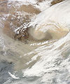
 Smog from Eastern China spread over neighboring areas in February 2004.
 -

-
 Natural color satellite image of a smog event in the heart of northern China
 -
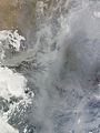 Dense smog settled over the North China Plain on February 20, 2011.
.png)


Environment
Air pollution (sulfur dioxide particulates) from reliance on coal is a major issue, along with water pollution from untreated wastes and use of debated standards of pollutant concentration rather than Total Maximum Daily Load. There are water shortages, particularly in the north. The eastern part of China often experiences smoke and dense fog in the atmosphere as a result of industrial pollution. Heavy deforestation with an estimated loss of one-fifth of agricultural land since 1949 to soil erosion and economic development is occurring with resulting desertification.
China is a party to the Antarctic-Environmental Protocol, the Antarctic Treaty, the Convention on Biological Diversity, the Climate Change treaty, the United Nations Convention to Combat Desertification, the Endangered Species treaty, the Hazardous Wastes treaty, the Law of the Sea, the International Tropical Timber Agreements of 1983 and 1994, the International Convention for the Regulation of Whaling, and agreements on Marine Dumping, Ozone Layer Protection, Ship Pollution, and Wetlands protection. China has signed, but not ratified, the Kyoto Protocol (but is not yet required to reduce its carbon emission under the agreement, as is India) and the Nuclear Test Ban treaty.
See also
Lua error in mw.title.lua at line 346: bad argument #2 to 'title.new' (unrecognized namespace name 'Portal').
Notes and references
- ^ 1.00 1.01 1.02 1.03 1.04 1.05 1.06 1.07 1.08 1.09 1.10 1.11 "China". The World Factbook. CIA. Archived from the original on 12 June 2007. Retrieved 31 December 2015.
- ^ Based on the 2020 survey of elevation of snow cap, not rock head. For more details, see Surveys.
- ^ "Yangtze River". University of Washington. Retrieved 31 December 2015.
- ^ National Geographic https://education.nationalgeographic.org/resource/huang-he-valley/.
{{cite web}}: Missing or empty|title=(help) - ^ CIA (October 1967), Communist China Map Folio, U.S. Central Intelligence Agency
- ^ Atlas of China. Beijing, China: SinoMaps Press. 2006. ISBN 9787503141782.
- ^ Hsu, Angel; Miao, William (29 April 2013). "28,000 Rivers Disappeared in China: What Happened?". The Atlantic. Retrieved 14 September 2018.
- ^ "The State of Religion in China". Council on Foreign Relations. Retrieved 13 October 2018.
- ^ "This fascinating map shows the new religious breakdown in China". Business Insider. Retrieved 13 October 2018.
- ^ 10.0 10.1 "East Asia/Southeast Asia :: China — The World Factbook - Central Intelligence Agency". www.cia.gov. Archived from the original on 12 June 2007. Retrieved 21 November 2018.
- ^ Mah, Feng-Hwa (1971). "Why China Imports Wheat". The China Quarterly. 45 (45): 116–128. doi:10.1017/S0305741000010456. JSTOR 651886. S2CID 153871544.
- ^ "Arable land (hectares) | Data". data.worldbank.org. Retrieved 2 November 2018.
- ^ "Farming the World: China's Epic Race to Avoid a Food Crisis". Bloomberg. 22 May 2017. Retrieved 29 September 2022.
- ^ "East Asia/Southeast Asia :: China — The World Factbook - Central Intelligence Agency". www.cia.gov. Archived from the original on 12 June 2007. Retrieved 17 November 2018.
- ^ 15.0 15.1 15.2 Chung, Jae Ho (21 September 2017). "China Goes Local (Again)". Centrifugal Empire. Vol. 1. Columbia University Press. doi:10.7312/columbia/9780231176200.003.0002. ISBN 9780231176200.
- ^ "India and China 'to resolve dispute'". BBC News. 15 May 2015. Retrieved 26 November 2018.
- ^ "China sends ship to disputed sea". BBC News. 16 June 2011. Retrieved 26 November 2018.
- ^ "Tajikistan cedes land to China". BBC News. 2011. Retrieved 26 November 2018.
- Fitzpatrick, John. 1992. "The Middle Kingdom, the Middle Sea, and the Geographical Pivot of History". Review (fernand Braudel Center) 15 (3). Research Foundation of SUNY: 477–521. https://www.jstor.org/stable/40241233.
External links
- Chinese Academy of Sciences Institute of Geographical Sciences and Natural Resources
- Chinese Ecosystem Research Network (CERN)
- Illustrations of Famous Mountains from 1368 to 1644
Lua error in mw.title.lua at line 346: bad argument #2 to 'title.new' (unrecognized namespace name 'Portal').
- Short description with empty Wikidata description
- Articles with unsourced statements from July 2018
- Articles with invalid date parameter in template
- Articles to be expanded from September 2023
- All pages needing factual verification
- Wikipedia articles needing factual verification from September 2023
- Articles with unsourced statements from January 2013
- Commons category link is defined as the pagename
- Commons link is locally defined
- Coordinates not on Wikidata
- Geography of China