Merchweiler
Merchweiler | |
|---|---|
 Merchweiler | |
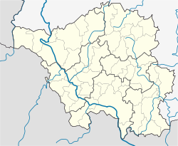
Location of Merchweiler within Neunkirchen district <imagemap>File: Merchweiler in NK.svg | 240x240px poly 1052 410 996 274 953 328 800 318 794 231 591 155 479 225 406 228 303 334 233 341 170 281 44 477 127 590 100 672 173 676 226 915 349 944 362 1077 429 1180 555 1104 644 1124 605 948 611 805 760 679 790 613 857 616 983 440 Eppelborn poly 1052 410 989 440 860 616 797 609 760 669 611 805 608 944 654 1130 760 1127 774 1230 840 1226 1036 1047 1168 1051 1175 948 1102 855 1374 881 1391 812 1324 745 1547 639 1553 533 1424 417 1341 420 1258 470 1082 473 Illingen poly 1102 855 1374 881 1404 1037 1268 1187 1294 1276 1215 1276 1195 1478 1109 1482 1099 1323 1016 1299 973 1200 840 1223 1039 1044 1178 1051 1175 934 Merchweiler poly 1321 742 1543 636 1653 676 1686 762 1775 762 1762 958 1699 1034 1676 1200 1556 1376 1420 1386 1294 1273 1265 1190 1404 1037 1377 875 1397 812 Schiffweiler poly 1344 424 1424 420 1553 523 1547 633 1653 672 1689 755 1772 759 1921 689 1978 769 2061 666 2193 639 2220 702 2289 626 2376 613 2425 503 2538 500 2565 583 2674 536 2764 536 2813 480 2681 281 2558 271 2508 175 2402 238 2193 66 1799 397 1626 361 1570 248 1457 238 1344 420 Ottweiler poly 1500 1561 1477 1661 1706 1847 1785 1847 1818 1820 1888 1873 1945 1800 2011 1790 2074 1830 2057 1624 1974 1538 Spiesen-Elversberg poly 1772 762 1765 964 1696 1044 1679 1200 1497 1439 1503 1555 1978 1535 2061 1628 2077 1827 2041 1943 2067 2012 2502 1774 2525 1681 2585 1654 2644 1522 2618 1459 2551 1485 2459 1435 2419 1253 2455 1163 2399 1067 2283 1047 2283 928 2382 885 2406 742 2508 709 2512 619 2565 586 2542 503 2435 503 2379 609 2286 626 2216 702 2187 639 2074 666 1974 765 1908 689 1779 762 Neunkirchen poly 2469 -1 2515 62 2498 178 2551 261 2687 288 2843 583 2790 676 2870 726 2867 29 2462 3 Rhineland-Palatinate poly 538 -1 601 152 797 235 797 311 946 328 999 274 1082 473 1258 467 1341 420 1450 241 1573 251 1626 361 1799 394 2193 72 2412 238 2505 185 2518 62 2465 -1 Sankt Wendel (district) poly 1 3 545 3 601 155 472 221 396 228 296 328 220 334 177 288 41 470 117 593 91 672 180 672 223 908 163 931 170 1041 91 1034 4 1173 Saarlouis (district) poly 1 1177 4 2032 1328 2039 1304 1926 1391 1813 1560 1730 1474 1654 1490 1439 1550 1379 1407 1392 1301 1279 1218 1279 1198 1475 1105 1478 1102 1326 1003 1293 959 1200 777 1233 764 1127 648 1130 565 1094 432 1180 356 1070 346 948 236 908 157 934 167 1034 100 1037 Saarbrücken (district) poly 1331 2039 1308 1929 1394 1810 1560 1740 1716 1857 1792 1860 1882 1870 1948 1800 2024 1794 2081 1833 2034 1939 2071 2012 2498 1777 2585 1654 2641 1522 2618 1455 2548 1488 2455 1435 2422 1253 2455 1167 2392 1061 2280 1034 2286 938 2382 885 2409 742 2505 709 2505 613 2668 536 2764 536 2813 483 2833 593 2794 676 2867 719 2870 2019 Saarpfalz-Kreis desc bottom-right </imagemap> | |
| Coordinates: 49°21′N 7°2′E / 49.350°N 7.033°E | |
| Country | Germany |
| State | Saarland |
| District | Neunkirchen |
| Subdivisions | 2 |
| Government | |
| • Mayor (2024–34) | Sebastian Maas[1] (CDU) |
| Area | |
| • Total | 12.78 km2 (4.93 sq mi) |
| Highest elevation | 392 m (1,286 ft) |
| Lowest elevation | 271 m (889 ft) |
| Population (2022-12-31)[2] | |
| • Total | 9,843 |
| • Density | 770/km2 (2,000/sq mi) |
| Time zone | UTC+01:00 (CET) |
| • Summer (DST) | UTC+02:00 (CEST) |
| Postal codes | 66584–66589 |
| Dialling codes | 06825 |
| Vehicle registration | NK |
| Website | www.merchweiler.de |
Merchweiler is a municipality in the district of Neunkirchen, in Saarland, Germany. It is situated approximately 10 km west of Neunkirchen, and 15 km northeast of Saarbrücken. The municipality of Merchweiler consists of two parts: Merchweiler (village) and Wemmetsweiler (village).
Twin towns — sister cities
Merchweiler is twinned with:
 Falicon, France (1987)
References
- ^ Gewählte Ober-/Bürgermeister*innen, Landrät*innen und Regionalverbandsdirektor*in im Saarland, Statistisches Amt des Saarlandes, 12 June 2024.
- ^ "Fläche und Bevölkerung - Stand: 31.12.2022 (Basis Zensus 2011)" (PDF) (in German). Statistisches Amt des Saarlandes. June 2023.
{{cite web}}: CS1 maint: unrecognized language (link)


