Mgla
Mgla
Мгла | |
|---|---|
| Coordinates: 66°29′52″N 44°26′58″E / 66.49778°N 44.44944°E | |
| Country | Russia |
| Federal subject | Nenets Autonomous Okrug |
| Population | |
| • Total | 20 |
| Postal code(s)[2] | 166737 |
| Dialing code(s) | +7 81857 |
This article needs additional citations for verification. (February 2024) |
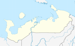
Mgla (‹See Tfd›Russian: Мгла) is a rural locality (a selo) in Zapolyarny District of Nenets Autonomous Okrug, Russia. Mgla had a population of 20 people as of 2010, a decrease from a population of 33 in 2002.
Geography
Mgla is located in the southern portions of the Kanin Peninsula. The village is on the coast of the White Sea.
References
- ^ Russian Federal State Statistics Service (2011). Всероссийская перепись населения 2010 года. Том 1 [2010 All-Russian Population Census, vol. 1]. Всероссийская перепись населения 2010 года [2010 All-Russia Population Census] (in Russian). Federal State Statistics Service.
{{cite web}}: CS1 maint: unrecognized language (link) - ^ Почта России. Информационно-вычислительный центр ОАСУ РПО. (Russian Post). Поиск объектов почтовой связи (Postal Objects Search) (in Russian)
Categories:
- Short description with empty Wikidata description
- Coordinates not on Wikidata
- All articles needing additional references
- Articles containing Russian-language text
- Pages using Lang-xx templates
- Rural localities in Nenets Autonomous Okrug
- Arkhangelsk Oblast geography stubs
- CS1 maint: unrecognized language
- CS1 uses русский-language script (ru)
- Articles with Russian-language sources (ru)

