Moelfre Uchaf
| Moelfre Uchaf | |
|---|---|
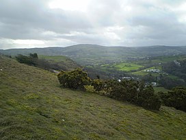
 Moelfre Uchaf from Cefn-yr-Ogof | |
<mapframe zoom="10" frameless="1" align="center" longitude="-3.65233" latitude="53.22997" height="200" width="250">{"type":"Feature","geometry":{"coordinates":[-3.65233,53.22997],"type":"Point"},"properties":{"marker-color":"#5E74F3","title":"Moelfre Uchaf","marker-symbol":"mountain"}}</mapframe> <mapframe zoom="5" frameless="1" align="center" longitude="-3.65233" latitude="53.22997" height="200" width="250">{"type":"Feature","geometry":{"coordinates":[-3.65233,53.22997],"type":"Point"},"properties":{"marker-color":"#5E74F3","title":"Moelfre Uchaf","marker-symbol":"mountain"}}</mapframe> <mapframe zoom="1" frameless="1" align="center" longitude="-3.65233" latitude="53.22997" height="200" width="250">{"type":"Feature","geometry":{"coordinates":[-3.65233,53.22997],"type":"Point"},"properties":{"marker-color":"#5E74F3","title":"Moelfre Uchaf","marker-symbol":"mountain"}}</mapframe> | |
| Highest point | |
| Elevation | 396 m (1,299 ft) |
| Prominence | 144 m (472 ft) |
| Listing | Sub-Marilyn |
| Coordinates | 53°13′48″N 3°39′08″W / 53.22997°N 3.65233°W |
| Naming | |
| English translation | High bare hill |
| Language of name | Welsh |
| Pronunciation | Welsh: [ˈmoilvrɛ ˈɪxav] |
| Geography | |
| Country | Wales |
| County Borough | Conwy |
| Parent range | Denbigh Moors |
| OS grid | SH898716 |
Moelfre Uchaf is a hill in Conwy County Borough, North Wales, 5 miles (8.0 km) south-east of Colwyn Bay and 1.5 mi (2.4 km) south-west of Betws-yn-Rhos. It is 396 m (1,299 ft) above sea level. A trigpoint is on the summit.

External links
Categories:
- Short description with empty Wikidata description
- Use British English from August 2022
- Articles with invalid date parameter in template
- Infobox mapframe without OSM relation ID on Wikidata
- Coordinates not on Wikidata
- Pages with Welsh IPA
- Betws yn Rhos
- Mountains and hills of Conwy County Borough
- Clwyd geography stubs