
Mount Webster
| Mount Webster | |
|---|---|
 The view from Mount Willey along the spine of the Presidential Range, from Jefferson (left background) to Mount Webster (right foreground). | |
<mapframe zoom="10" frameless="1" align="center" longitude="-71.388166666667" latitude="44.194833333333" height="200" width="250">{"type":"Feature","geometry":{"coordinates":[-71.38816666666666,44.194833333333335],"type":"Point"},"properties":{"marker-color":"#5E74F3","title":"Mount Webster","marker-symbol":"mountain"}}</mapframe> <mapframe zoom="5" frameless="1" align="center" longitude="-71.388166666667" latitude="44.194833333333" height="200" width="250">{"type":"Feature","geometry":{"coordinates":[-71.38816666666666,44.194833333333335],"type":"Point"},"properties":{"marker-color":"#5E74F3","title":"Mount Webster","marker-symbol":"mountain"}}</mapframe> <mapframe zoom="1" frameless="1" align="center" longitude="-71.388166666667" latitude="44.194833333333" height="200" width="250">{"type":"Feature","geometry":{"coordinates":[-71.38816666666666,44.194833333333335],"type":"Point"},"properties":{"marker-color":"#5E74F3","title":"Mount Webster","marker-symbol":"mountain"}}</mapframe> | |
| Highest point | |
| Elevation | 1,192 m (3,911 ft) |
| Prominence | 46 m (151 ft) |
| Coordinates | 44°11.69′N 71°23.29′W / 44.19483°N 71.38817°W |
| Geography | |
| Location | Bean's Purchase, Coös County / Hart's Location, Carroll County, New Hampshire, U.S. |
| Parent range | Presidential Range |
| Topo map | USGS Crawford Notch |
Mount Webster is a mountain located on the border between Coos County and Carroll County, New Hampshire. The mountain, formerly called Notch Mountain, is named after Daniel Webster (1782–1852), and is the south-westernmost of the Presidential Range of the White Mountains. Mount Webster is flanked to the northeast by Mount Jackson; to the southwest it faces Mount Willey across Crawford Notch.
The west face of Mount Webster drains directly into the Saco River, thence into the Gulf of Maine at Saco, Maine. The north and southeast faces drain into the Saco via Silver Cascade and Webster Brook respectively.
Mount Webster is on the western boundary of the Presidential Range - Dry River Wilderness. The Appalachian Trail, a 2,170-mile (3,500-km) National Scenic Trail from Georgia to Maine, runs along the ridge of the Presidentials, across the summit of Webster.
Gallery
-
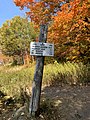 A sign at the start of the Webster-Jackson trail

See also
Lua error in mw.title.lua at line 346: bad argument #2 to 'title.new' (unrecognized namespace name 'Portal').
External links
- U.S. Geological Survey Geographic Names Information System: Mount Webster
- Mount Webster on Topozone
- PeakBagger.com: Mount Webster
- summitpost.org: Mount Webster
This New Hampshire state location article is a stub. You can help Wikipedia by expanding it. |
- Pages with script errors
- Short description with empty Wikidata description
- Infobox mapframe without OSM relation ID on Wikidata
- Coordinates not on Wikidata
- Mountains of New Hampshire
- White Mountains (New Hampshire)
- Mountains of Coös County, New Hampshire
- Mountains of Carroll County, New Hampshire
- Mountains on the Appalachian Trail
- New Hampshire geography stubs