Navini
| <mapframe zoom="7" frameless="1" align="center" longitude="177.38138888889" latitude="-17.118055555556" height="200" width="250">{"type":"Feature","geometry":{"coordinates":[177.3813888888889,-17.118055555555557],"type":"Point"},"properties":{"marker-color":"#a8bdec","title":"Navini","marker-symbol":"island"}}</mapframe> | |
| Geography | |
|---|---|
| Location | South Pacific |
| Coordinates | 17°7′05″S 177°22′53″E / 17.11806°S 177.38139°E |
| Archipelago | Mamanuca Islands[1] |
| Area | 0.09 km2 (0.035 sq mi) |
| Highest elevation | 3 m (10 ft) |
| Administration | |
| Division | Western |
| Province | Nadroga-Navosa Province |
| Demographics | |
| Population | unknown |

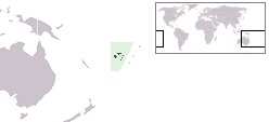
Navini is a small, private island within the Mamanuca Islands of Fiji in the South Pacific.[2] The islands are a part of the Fiji's Western Division.
Geography
Navini is a tiny reef island. There is a small private resort there.[3]
References
- ^ Kumar, Lalit (31 January 2020). Climate Change and Impacts in the Pacific. Springer Nature. p. 68. ISBN 978-3-030-32878-8. Retrieved 15 April 2021.
- ^ Stanley, David (18 August 2004). Moon Handbooks: Fiji. Avalon Travel Publishing. p. 145. ISBN 978-1-56691-497-0. Retrieved 16 April 2021.
- ^ "Navini Island Resort". Mamanuca Islands. Retrieved 16 April 2021.
External links