
Pluzhne
Pluzhne
Плужне | |
|---|---|
 Pluzhne. Administration | |
 Flag  Coat of arms | |
.svg) Pluzhne Location in Khmelnytskyi Oblast | |
| Coordinates: 50°10′49″N 26°33′46″E / 50.18028°N 26.56278°E | |
| Country | |
| Oblast | Khmelnytskyi |
| Raion | Shepetivka |
| First mention date | 1576 |
| Government | |
| • Mayor | Vitaliy Martyniuk |
| Area | |
| • Total | 7,649 km2 (2,953 sq mi) |
| • Land | 83,660 km2 (32,300 sq mi) |
| Elevation | 255 m (837 ft) |
| Population (2001) | |
| • Total | 3,297 |
| • Density | 431,170/km2 (1,116,700/sq mi) |
| Time zone | UTC+2 (EET) |
| • Summer (DST) | UTC+3 (EEST) |
| Postal code | 30320 |
| Area code | +3803852 |
| Website | Page on Official Website of Verkhovna Rada |
Pluzhne (Ukrainian: Плужне, Belarusian: Плужна, Polish: Płuźno, Płuzhno, ‹See Tfd›Russian: Плужное) is a selo in Shepetivka Raion, Khmelnytskyi Oblast (province), Ukraine. The village is located on the river Ustya, 24 km away from the city of Iziaslav, 44 km away from Shepetivka and 127 km away from Khmelnytskyi. Pluzhne hosts the administration of Pluzhne rural hromada, one of the hromadas of Ukraine.[1] Population is 3,297 inhabitants (as of 2001).[2]
Until 18 July 2020, Pluzhne belonged to Iziaslav Raion. The raion was abolished in July 2020 as part of the administrative reform of Ukraine, which reduced the number of raions of Khmelnytskyi Oblast to three. The area of Iziaslav Raion was merged into Shepetivka Raion.[3][4]
Historical demographics of Pluzhne
<timeline> ImageSize = width:500 height:300 PlotArea = left:50 right:20 top:25 bottom:30 TimeAxis = orientation:vertical AlignBars = late Colors =
 id:linegrey2 value:gray(0.8)
 id:linegrey value:gray(0.5)
 id:cobar value:rgb(0.1,0.2,0.9)
 id:cobar2 value:rgb(0.4,0.9,0.4)
DateFormat = yyyy Period = from:0 till:6000 ScaleMajor = unit:year increment:4000 start:0 gridcolor:linegrey ScaleMajor = unit:year increment:2000 start:0 gridcolor:linegrey ScaleMinor = unit:year increment:400 start:0 gridcolor:linegrey2 PlotData =
 color:cobar width:19 align:left
 bar:1885 from:0 till:2009
 bar:1906 from:0 till:2302
 bar:1931 from:0 till:755
 bar:1972 from:0 till:4009
 bar:1978 color:cobar2 from:0 till:5600
 bar:1984 from:0 till:3400
 bar:2001 from:0 till:3287
 bar:2010 from:0 till:2844
 bar:2011 from:0 till:2695
PlotData=
 textcolor:black fontsize:S
 bar:1885 at:2009 text: 2.009 shift:(-14,4)
 bar:1906 at:2302 text: 2.302 shift:(-14,4)
 bar:1931 at:755 text: 755 courtyards shift:(-30,5)
 bar:1972 at:4009 text: 4.009 shift:(-14,4)
 bar:1978 at:5600 text: 5.600 shift:(-14,5)
 bar:1984 at:3400 text: 3.400 shift:(-14,9)
 bar:2001 at:3287 text: 3.287 shift:(-14,7)
 bar:2010 at:2844 text: 2.844 shift:(-14,5)
 bar:2011 at:2695 text: 2.695 shift:(-14,5)
</timeline>
As of 1978, the village's population is 5600 [5]
Gallery
-
 Pluzhne. View on tsenter
 -
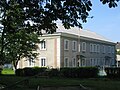
 Grammar School
 -
 Monument to Children
 -
 Boarding School


.jpg)
References
- ^ "Плужненская громада" (in русский). Портал об'єднаних громад України.
- ^ Parliament of Ukraine. Pluzhne. Discount card (in Ukrainian)
- ^ "Про утворення та ліквідацію районів. Постанова Верховної Ради України № 807-ІХ". Голос України (in українська). 2020-07-18. Retrieved 2020-10-03.
- ^ "Нові райони: карти + склад" (in Ukrainian). Міністерство розвитку громад та територій України.
{{cite web}}: CS1 maint: unrecognized language (link) - ^ Map of the General Staff. M-35-XV (1980) Archived 2011-07-24 at the Wayback Machine (in Ukrainian)
External links
- Weather in the village Pluzhne (in Ukrainian)
- Passport Pluzhnenskoyi Village Council Information on 2011-01-01 (in Ukrainian)
- The murder of the Jews of Pluzhne during World War II, at Yad Vashem website.
- CS1 русский-language sources (ru)
- Articles with Ukrainian-language sources (uk)
- CS1 українська-language sources (uk)
- CS1 maint: unrecognized language
- Webarchive template wayback links
- Short description with empty Wikidata description
- Articles containing Ukrainian-language text
- Pages using Lang-xx templates
- Articles containing Belarusian-language text
- Articles containing Polish-language text
- Articles containing Russian-language text
- Commons category link is defined as the pagename
- Coordinates not on Wikidata
- Villages in Sheptivka Raion
- Populated places established in 1576
- Ostrozhsky Uyezd
- Holocaust locations in Ukraine