Slavyanka (river)
| Slavyanka | |
|---|---|
 | |
| Location | |
| Country | Russia |
| Physical characteristics | |
| Mouth | Neva |
• coordinates | 59°49′46″N 30°31′13″E / 59.8295°N 30.5204°E |
| Length | 39 km (24 mi)[1] |
| Basin size | 249 km2 (96 sq mi)[1] |
| Basin features | |
| Progression | Neva→ Gulf of Finland |
The Slavyanka (‹See Tfd›Russian: Славя́нка) is a river in Leningrad Oblast of Russia. It is a left tributary of the Neva. It is 39 kilometres (24 mi) long, with a drainage basin of 249 square kilometres (96 sq mi).[1]
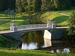
The river begins in swamps 9 kilometres (6 mi) southwest of Pavlovsk, and flows northeast towards Pavlovsk, where it passes through the parks surrounding the large Pavlovsk Palace. It then continues north, and flows into the Neva in the Rybatskoye area of Saint Petersburg. At the mouth the river is about 1.5 metres (4.9 ft) deep. The Slavyanka is a typical slow-moving lowland river.
References
- ^ 1.0 1.1 1.2 «Река СЛАВЯНКА (БАС.Р.НЕВА БАЛТ.М.», Russian State Water Registry
External links
Wikimedia Commons has media related to Slavyanka River.
Categories:
- Short description with empty Wikidata description
- Coordinates not on Wikidata
- Tributaries of the Neva
- Articles containing Russian-language text
- Pages using Lang-xx templates
- Commons category link is locally defined
- Rivers of Leningrad Oblast
- Rivers of Saint Petersburg
- Cultural heritage monuments of federal significance in Saint Petersburg
- Russia river stubs
