Template:Infobox Australian place/Examples
These are some examples of Infobox Australian place.
Region
| Hunter Region New South Wales | |||||||||||||||
|---|---|---|---|---|---|---|---|---|---|---|---|---|---|---|---|
 View across the Hunter Valley | |||||||||||||||
 The mouth of the Hunter River at Newcastle | |||||||||||||||
The location of Newcastle, the major city in the Hunter Region | |||||||||||||||
| Coordinates | 32°55′S 151°45′E / 32.917°S 151.750°E | ||||||||||||||
| Population | 620,530 (2011 census) | ||||||||||||||
| • Density | 21.2911/km2 (55.1438/sq mi) | ||||||||||||||
| Area | 29,145 km2 (11,252.9 sq mi) | ||||||||||||||
| Time zone | AEST (UTC+10) | ||||||||||||||
| • Summer (DST) | AEDT (UTC+11) | ||||||||||||||
| Location | 120 km (75 mi) N of Sydney | ||||||||||||||
| LGA(s) |
| ||||||||||||||
| State electorate(s) | |||||||||||||||
| Federal division(s) | |||||||||||||||
| |||||||||||||||
<syntaxhighlight lang="wikitext" style="overflow:auto">
| Hunter Region New South Wales | |||||||||||||||
|---|---|---|---|---|---|---|---|---|---|---|---|---|---|---|---|
 View across the Hunter Valley | |||||||||||||||
 The mouth of the Hunter River at Newcastle | |||||||||||||||
The location of Newcastle, the major city in the Hunter Region | |||||||||||||||
| Coordinates | 32°55′S 151°45′E / 32.917°S 151.750°E | ||||||||||||||
| Population | 620,530 (2011 census) | ||||||||||||||
| • Density | 21.2911/km2 (55.1438/sq mi) | ||||||||||||||
| Area | 29,145 km2 (11,252.9 sq mi) | ||||||||||||||
| Time zone | AEST (UTC+10) | ||||||||||||||
| • Summer (DST) | AEDT (UTC+11) | ||||||||||||||
| Location | 120 km (75 mi) N of Sydney | ||||||||||||||
| LGA(s) |
| ||||||||||||||
| State electorate(s) | |||||||||||||||
| Federal division(s) | |||||||||||||||
| |||||||||||||||
</syntaxhighlight>
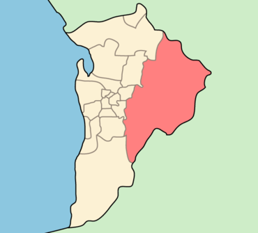
Local Government Area
| Adelaide Hills Council South Australia | |
|---|---|
 | |
| Population | 36,629 |
| • Density | 46/km2 (120/sq mi) |
| Established | 1997 |
| Area | 795.08 km2 (307.0 sq mi) |
| Mayor | Bill Cooksley |
| Council seat | Woodside |
| Region | Adelaide Hills, Metropolitan Adelaide |
| State electorate(s) | Morialta, Kavel, Schubert |
| Federal division(s) | Mayo, Sturt, Wakefield |
| Website | Adelaide Hills Council |
<syntaxhighlight lang="wikitext" style="overflow:auto">
| Adelaide Hills Council South Australia | |
|---|---|
 | |
| Population | 36,629 |
| • Density | 46/km2 (120/sq mi) |
| Established | 1997 |
| Area | 795.08 km2 (307.0 sq mi) |
| Mayor | Bill Cooksley |
| Council seat | Woodside |
| Region | Adelaide Hills, Metropolitan Adelaide |
| State electorate(s) | Morialta, Kavel, Schubert |
| Federal division(s) | Mayo, Sturt, Wakefield |
 | |
| Website | Adelaide Hills Council |
</syntaxhighlight>
City
| Adelaide South Australia | |||||||||
|---|---|---|---|---|---|---|---|---|---|
 Looking south-east over Adelaide city centre c. 2005 | |||||||||
| Coordinates | 34°55′44.4″S 138°36′3.6″E / 34.929000°S 138.601000°E | ||||||||
| Population | 1,225,235 (2011)[1] (5th) | ||||||||
| • Density | 659/km2 (1,710/sq mi) (2006)[2] | ||||||||
| Established | 28 December 1836 | ||||||||
| Area | 1,826.9 km2 (705.4 sq mi) | ||||||||
| Time zone | ACST (UTC+9:30) | ||||||||
| • Summer (DST) | ACDT (UTC+10:30) | ||||||||
| Location | |||||||||
| LGA(s) | 18 | ||||||||
| |||||||||
<syntaxhighlight lang="wikitext" style="overflow:auto">
| Adelaide South Australia | |||||||||
|---|---|---|---|---|---|---|---|---|---|
 Looking south-east over Adelaide city centre c. 2005 | |||||||||
| Coordinates | 34°55′44.4″S 138°36′3.6″E / 34.929000°S 138.601000°E | ||||||||
| Population | 1,225,235 (2011)[1] (5th) | ||||||||
| • Density | 659/km2 (1,710/sq mi) (2006)[3] | ||||||||
| Established | 28 December 1836 | ||||||||
| Area | 1,826.9 km2 (705.4 sq mi) | ||||||||
| Time zone | ACST (UTC+9:30) | ||||||||
| • Summer (DST) | ACDT (UTC+10:30) | ||||||||
| Location | |||||||||
| LGA(s) | 18 | ||||||||
| |||||||||
</syntaxhighlight>
Suburb
| Elizabeth Adelaide, South Australia | |||||||||||||||
|---|---|---|---|---|---|---|---|---|---|---|---|---|---|---|---|
| Population | 811(2001)[4] | ||||||||||||||
| Established | 1955 | ||||||||||||||
| Postcode(s) | 5112 | ||||||||||||||
| LGA(s) | City of Playford | ||||||||||||||
| |||||||||||||||
<syntaxhighlight lang="wikitext" style="overflow:auto">
| Elizabeth Adelaide, South Australia | |||||||||||||||
|---|---|---|---|---|---|---|---|---|---|---|---|---|---|---|---|
| Population | 811 (2001)[5] | ||||||||||||||
| Established | 1955 | ||||||||||||||
| Postcode(s) | 5112 | ||||||||||||||
| LGA(s) | City of Playford | ||||||||||||||
| |||||||||||||||
</syntaxhighlight>
Town
| Raymond Terrace New South Wales | |||||||||||||||
|---|---|---|---|---|---|---|---|---|---|---|---|---|---|---|---|
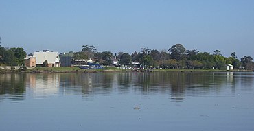
 Raymond Terrace foreshore from the Fitzgerald bridge | |||||||||||||||
| Coordinates | 32°45′41.3″S 151°44′38.6″E / 32.761472°S 151.744056°E | ||||||||||||||
| Population | 12,600 (2011) | ||||||||||||||
| • Density | 1,186.8/km2 (3,074/sq mi) | ||||||||||||||
| Established | 1837 | ||||||||||||||
| Postcode(s) | 2324 | ||||||||||||||
| Elevation | 6 m (20 ft) | ||||||||||||||
| Area | 39.7 km2 (15.3 sq mi) | ||||||||||||||
| Time zone | AEST (UTC+10) | ||||||||||||||
| • Summer (DST) | AEDT (UTC+11) | ||||||||||||||
| Location | |||||||||||||||
| LGA(s) | Port Stephens Council | ||||||||||||||
| Region | Hunter, Mid North Coast | ||||||||||||||
| County | Gloucester | ||||||||||||||
| Parish | Eldon | ||||||||||||||
| State electorate(s) | |||||||||||||||
| Federal division(s) | |||||||||||||||
| |||||||||||||||
<syntaxhighlight lang="wikitext" style="overflow:auto">
| Raymond Terrace New South Wales | |||||||||||||||
|---|---|---|---|---|---|---|---|---|---|---|---|---|---|---|---|
 Raymond Terrace foreshore from the Fitzgerald bridge | |||||||||||||||
| Coordinates | 32°45′41.3″S 151°44′38.6″E / 32.761472°S 151.744056°E | ||||||||||||||
| Population | 12,600 (2011) | ||||||||||||||
| • Density | 1,186.8/km2 (3,074/sq mi) | ||||||||||||||
| Established | 1837 | ||||||||||||||
| Postcode(s) | 2324 | ||||||||||||||
| Elevation | 6 m (20 ft) | ||||||||||||||
| Area | 39.7 km2 (15.3 sq mi) | ||||||||||||||
| Time zone | AEST (UTC+10) | ||||||||||||||
| • Summer (DST) | AEDT (UTC+11) | ||||||||||||||
| Location | |||||||||||||||
| LGA(s) | Port Stephens Council | ||||||||||||||
| Region | Hunter, Mid North Coast | ||||||||||||||
| County | Gloucester | ||||||||||||||
| Parish | Eldon | ||||||||||||||
| State electorate(s) | |||||||||||||||
| Federal division(s) | |||||||||||||||
| |||||||||||||||
</syntaxhighlight>
Cadastral
| Cook County New South Wales | |||||||||||||||
|---|---|---|---|---|---|---|---|---|---|---|---|---|---|---|---|
Location in New South Wales | |||||||||||||||
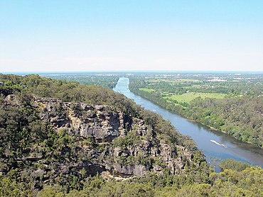
 Looking north on the Nepean River near Penrith; Cook County is on the left of the river; Cumberland is on the right | |||||||||||||||
| |||||||||||||||
<syntaxhighlight lang="wikitext" style="overflow:auto">
| Cook County New South Wales | |||||||||||||||
|---|---|---|---|---|---|---|---|---|---|---|---|---|---|---|---|
Location in New South Wales | |||||||||||||||
 Looking north on the Nepean River near Penrith; Cook County is on the left of the river; Cumberland is on the right | |||||||||||||||
| |||||||||||||||
</syntaxhighlight>
Protected area
With map only
| Ku-ring-gai Chase National Park New South Wales | |
|---|---|
| Nearest town or city | Sydney |
| Coordinates | 33°39′3.6″S 151°12′3.6″E / 33.651000°S 151.201000°E |
| Established | 1 October 1967 |
| Area | 154 km2 (59.5 sq mi) |
| Visitation | 2,000,000 (in 2001) |
| Managing authorities | NSW National Parks & Wildlife Service |
| See also | Protected areas of New South Wales |
<syntaxhighlight lang="wikitext" style="overflow:auto;">
| Ku-ring-gai Chase National Park New South Wales | |
|---|---|
| Nearest town or city | Sydney |
| Coordinates | 33°39′3.6″S 151°12′3.6″E / 33.651000°S 151.201000°E |
| Established | 1 October 1967 |
| Area | 154 km2 (59.5 sq mi) |
| Visitation | 2,000,000 (in 2001) |
| Managing authorities | NSW National Parks & Wildlife Service |
| See also | Protected areas of New South Wales |
</syntaxhighlight>
With photograph and map
| Dorrigo National Park New South Wales | |
|---|---|
 View from the Skywalk, Dorrigo National Park | |
| Nearest town or city | Dorrigo |
| Coordinates | 30°20′53″S 152°49′19″E / 30.34806°S 152.82194°E |
| Established | 1 October 1967 |
| Area | 119 km2 (45.9 sq mi) |
| Managing authorities | NSW National Parks & Wildlife Service |
| Website | Dorrigo National Park |
| See also | Protected areas of New South Wales |
<syntaxhighlight lang="wikitext" style="overflow:auto;">
| Dorrigo National Park New South Wales | |
|---|---|
 View from the Skywalk, Dorrigo National Park | |
| Nearest town or city | Dorrigo |
| Coordinates | 30°20′53″S 152°49′19″E / 30.34806°S 152.82194°E |
| Established | 1 October 1967 |
| Area | 119 km2 (45.9 sq mi) |
| Managing authorities | NSW National Parks & Wildlife Service |
| Website | Dorrigo National Park |
| See also | Protected areas of New South Wales |
</syntaxhighlight>
| Walls of Jerusalem National Park Tasmania | |
|---|---|
 Looking north west from Solomon's Throne. The prominent peak on the left is King Davids Peak. The Temple is on the left with Mount Jerusalem behind. | |
| Nearest town or city | Mole Creek |
| Coordinates | 41°52′08″S 146°15′31″E / 41.86889°S 146.25861°E |
| Established | 13 December 1978[6] |
| Area | 518 km2 (200.0 sq mi)[6] |
| Managing authorities | Tasmania Parks and Wildlife Service |
| Website | Walls of Jerusalem National Park |
| See also | Protected areas of Tasmania |
<syntaxhighlight lang="wikitext" style="overflow:auto;">
| Walls of Jerusalem National Park Tasmania | |
|---|---|
 Looking north west from Solomon's Throne. The prominent peak on the left is King Davids Peak. The Temple is on the left with Mount Jerusalem behind. | |
| Nearest town or city | Mole Creek |
| Coordinates | 41°52′08″S 146°15′31″E / 41.86889°S 146.25861°E |
| Established | 13 December 1978[6] |
| Area | 518 km2 (200.0 sq mi)[6] |
| Managing authorities | Tasmania Parks and Wildlife Service |
| Website | Walls of Jerusalem National Park |
| See also | Protected areas of Tasmania |
</syntaxhighlight>
With multiple nearest towns and/or cities
| Dandenong Ranges National Park Victoria | |
|---|---|
| Nearest town or city |
|
| Area | 32.15 km2 (12.4 sq mi) |
| See also | Protected areas of Victoria |
<syntaxhighlight lang="wikitext" style="overflow:auto;">
| Dandenong Ranges National Park Victoria | |
|---|---|
| Nearest town or city |
|
| Area | 32.15 km2 (12.4 sq mi) |
| See also | Protected areas of Victoria |
</syntaxhighlight>
References
- ^ 1.0 1.1 Australian Bureau of Statistics (2011). "Adelaide revealed as 2011 Census data is released". Retrieved 25 July 2012.
- ^ Australian Bureau of Statistics (17 March 2008). "Explore Your City Through the 2006 Census Social Atlas Series". Retrieved 19 May 2008.
- ^ Australian Bureau of Statistics (17 March 2008). "Explore Your City Through the 2006 Census Social Atlas Series". Retrieved 19 May 2008.
- ^ 2001 Census, Australian Bureau of Statistics
- ^ 2001 Census, Australian Bureau of Statistics
- ^ 6.0 6.1 6.2 6.3 "Reserve Listing - National Parks". Tasmanian Parks and Wildlife Service Website. Tasmania Parks & Wildlife Service. 17 November 2008. Retrieved 1 May 2010. Cite error: Invalid
<ref>tag; name "tpws1" defined multiple times with different content


