
Tuineje
Tuineje | |
|---|---|
Municipality | |
 Flag .svg) Coat of arms | |
 Municipal location in Fuerteventura | |
 Tuineje Location in the province of Las Palmas  Tuineje Tuineje (Canary Islands)  Tuineje Tuineje (Spain, Canary Islands) | |
| Coordinates: 28°19′30″N 14°2′55″W / 28.32500°N 14.04861°W | |
| Country | |
| Autonomous Community | |
| Province | Las Palmas |
| Island | Fuerteventura |
| Government | |
| • Mayor | Salvador Delgado (CC) |
| Area | |
| • Total | 275.94 km2 (106.54 sq mi) |
| Elevation (AMSL) | 205 m (673 ft) |
| Population ()[2] | |
| Time zone | UTC+0 (CET) |
| • Summer (DST) | UTC+1 (CEST (GMT +1)) |
| Postal code | 35629 |
| Area code | +34 (Spain) + 928 (Las Palmas) |
| Website | www.tuineje.es |
Tuineje is a town and a municipality in the southern part of the island of Fuerteventura in the Province of Las Palmas, Canary Islands, Spain. The population is 13,946 (2013),[3] and the area is 275.94 km2.[1] The largest town in the municipality is Gran Tarajal, on the south coast.
History
Tuineje was the site of the two battles between the locals and English privateers in 1740.[citation needed]
Notable people
- Aridane Hernández (born 1989), professional footballer
Gallery
-
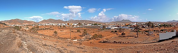 Tuineje village
 -
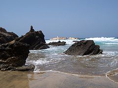 Tuineje
 -
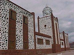 Lighthouse of La Entallada, Tuineje


See also
Wikimedia Commons has media related to Tuineje.
References
- ^ 1.0 1.1 Instituto Canario de Estadística, area
- ^
{{citation}}: Empty citation (help) - ^ Instituto Canario de Estadística Archived 2014-04-19 at the Wayback Machine, population
Places adjacent to Tuineje | ||||||||||||||||
|---|---|---|---|---|---|---|---|---|---|---|---|---|---|---|---|---|
| ||||||||||||||||
This Canary Islands location article is a stub. You can help Wikipedia by expanding it. |
Categories:
- Pages with non-numeric formatnum arguments
- Webarchive template wayback links
- Short description with empty Wikidata description
- Coordinates not on Wikidata
- Articles with unsourced statements from April 2013
- Commons category link is defined as the pagename
- Municipalities in Fuerteventura
- Canary Islands geography stubs